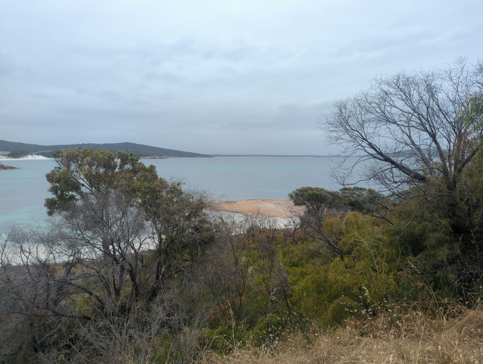
Nestled on the eastern side of the Vancouver Peninsula within Torndirrup National Park, Whalers Cove (also called Fisheries Beach) is a sheltered, north-facing beach with clean white sand, granite outcrops, and crystal-clear waters overlooking King George Sound. Protected from the prevailing swell and wind by the peninsula hills, this 300-metre-long beach features a rocky eastern end and offshore seaweed banks that create excellent conditions for snorkelling. The calm, shallow waters, colourful granite rocks, and tranquil setting make it a favourite local escape — a true snorkeller's dream just 20 minutes from Albany.
Whalers Cove (Fisheries Beach)
BeginnerGO
GO
It's a go.
Showing last known conditions
Wave Height 0.2 mSwell Period 11 sWind Speed 4.3 knPrecipitation 14 mmTidal Phase ebb
Last evaluated
The spot
Community-maintained
Community contribution: submitted by Daniel
Know before you go
Logged by the community, confirmed by mods
Low risk: Slippery granite rocks
Granite outcrops at the eastern end of the beach can be slippery when wet, particularly near the water's edge.
Low risk: Cold water temperatures
Southern Ocean waters remain cold outside summer months; water temperatures are most comfortable between December and April.
Low risk: Offshore seaweed banks
A seaweed bank sits some distance offshore and may obscure submerged rocks and affect entry/exit in some tide conditions.
Low risk: Winter storm swell
Stormy westerly winds in winter can bring occasional surge around the point, reducing water clarity and safety.
Low risk: Summer sea breeze chop
Afternoon sea breezes can create surface chop in the Sound, though the cove remains relatively sheltered.
Low risk: Rocky granite outcrops
Granite boulders at the eastern end of the beach can be slippery underfoot; care needed when entering or exiting the water near rocks.
Low risk: Seaweed banks
A seaweed bank is often present some distance offshore, which can be off-putting for swimmers and may obscure underwater obstacles.
Wildlife Guide
No wildlife notes for this spot yet.
Gallery
2 photos from the community
Getting in
Shore entry
Entry
From Albany, drive along Frenchman Bay Road towards Torndirrup National Park. Turn left onto Quaranup Road and continue for approximately 6 km. The sealed car park for Whalers Cove is on the right. Two concrete paths lead from the car park down to the beach.
Parking & facilities
Sealed car park on Quaranup Road, approximately 67 metres from the beach. Easy access suitable for standard vehicles.
toiletsparking
No fees. Located within Torndirrup National Park but no entry fee is required for this specific beach area.
Spot Map
Community
Gallery ┬╖ 2 photos
Trust
Is this spot real, accurate, still loved?
Spots near Western Australia

No nearby spots yet.
Needs verification
Quick verify
One tap helps the community keep this spot honest.
About this data
- Conditions last evaluated
- Spot data last updated
- Data sources
- Open-Meteo (marine & weather conditions), tide predictions via UTide, community contributors (descriptions, hazards, marine life).
- License
- Spot content licensed under CC BY-SA 4.0. How's the Spot is open source.
Weather & swell ┬╖ Open-Meteo marine & weather APIs Tides ┬╖ UTide harmonic analysis Sea & safety ┬╖ community reports