Tucked into the sheltered eastern side of Vancouver Peninsula, Whalers Cove (also known as Whaling Cove) offers pristine white sands and crystal-clear turquoise waters that earned it the title of Australia's Best Beach in 2022. Facing north-east across King George Sound, the calm, protected waters make it a snorkeller's dream, with easy shore access, granite boulders dotted with orange lichen, and panoramic views of the Albany coastline. Located within Torndirrup National Park, this spot combines scenic beauty with excellent swimming and snorkeling conditions in a quintessential Western Australian coastal setting.
Whalers Cove
BeginnerGO
GO
It's a go.
Showing last known conditions
Wave Height 0.2 mSwell Period 11 sWind Speed 6.6 knPrecipitation 14 mmTidal Phase ebb
Last evaluated
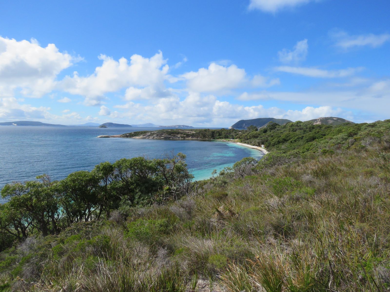 © Calistemon
The spot
Community-maintained
Community contribution: submitted by Daniel
Know before you go
Logged by the community, confirmed by mods
Low risk: Offshore seaweed bank
A bank of seaweed/kelp grows some distance offshore and may entangle swimmers or reduce visibility.
Low risk: Slippery rocks
Granite rocks at the beach margins can be slippery underfoot when wet.
Low risk: Swell during winter storms
Winter storms from the south-west can produce swells that wrap around the headland, creating choppy conditions and stronger shore break.
Low risk: Summer sea breezes
Afternoon sea breezes in summer can stir up surface chop and reduce visibility — best to snorkel in the morning.
Wildlife Guide
No wildlife notes for this spot yet.
Gallery
4 photos from the community
Getting in
Shore entry
Entry
From Albany town centre, drive south-west on Frenchman Bay Road towards Torndirrup National Park (approx 20 min). Before reaching the main park attractions, turn left onto Quaranup Road. Follow the sealed road for a few kilometres — the signed car park for Whalers/Whaling Cove is on the right. Two short paths lead from the car park down to the beaches.
Parking & facilities
Sealed car park with several spaces. Easy access suitable for standard vehicles.
toiletsparking
Torndirrup National Park entry fee applies (per vehicle park pass; can be paid at the park or via Parks WA app).
Spot Map
Community
Gallery ┬╖ 4 photos
Trust
Is this spot real, accurate, still loved?
Spots near Western Australia

No nearby spots yet.
Needs verification
Quick verify
One tap helps the community keep this spot honest.
About this data
- Conditions last evaluated
- Spot data last updated
- Data sources
- Open-Meteo (marine & weather conditions), tide predictions via UTide, community contributors (descriptions, hazards, marine life).
- License
- Spot content licensed under CC BY-SA 4.0. How's the Spot is open source.
Weather & swell ┬╖ Open-Meteo marine & weather APIs Tides ┬╖ UTide harmonic analysis Sea & safety ┬╖ community reports