Waterloo Bay is a remote, pristine white-sand beach on the eastern side of Wilsons Promontory National Park in southern Victoria. Accessible only by a challenging multi-day hike (around 20 km from the nearest trailhead), this secluded cove offers crystal-clear turquoise waters perfect for shore-based snorkelling. The bay sits within the protected Wilsons Promontory Marine National Park, ensuring abundant marine life and unspoiled underwater terrain. Its isolation rewards those who make the trek with a truly wild and tranquil snorkelling experience away from crowds.
Waterloo Bay
IntermediateSKIP
SKIP
Poor conditions. Stay out today.
Showing last known conditions
Wave Height 1.4 mSwell Period 12 sWind Speed 5.4 knPrecipitation 8.7 mmTidal Phase flood
Last evaluated
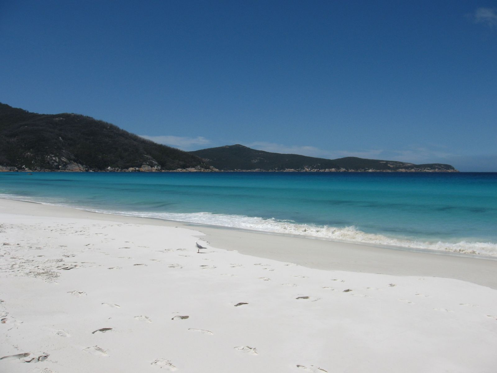 © Papphase
The spot
Community-maintained
Community contribution: submitted by Daniel
Know before you go
Logged by the community, confirmed by mods
Moderate risk: Remote location
Waterloo Bay is a 20+ km hike from the nearest car park at Telegraph Saddle. No road access means self-reliant hiking and snorkelling; emergency evacuation is extremely difficult.
Moderate risk: Strong currents and rips
The bay is exposed to Southern Ocean swells and can experience strong rip currents, especially on rougher days.
Moderate risk: Changeable weather
Victoria's coastal weather can shift rapidly to rain, high winds, and rough seas, making conditions dangerous for snorkellers.
Moderate risk: Rough Ocean Swell
Exposed to Southern Ocean swell; conditions can turn rough quickly with strong waves and surge, especially outside the protected pocket beaches.
Moderate risk: Rip Currents
Rip currents can form between the granite boulder headlands, posing a risk to swimmers and snorkelers.
Low risk: Cold water temperatures
Southern Ocean waters remain cold year-round (10-16°C). Prolonged exposure risks hypothermia even in summer.
Low risk: Limited facilities
No toilets, fresh water, or amenities at Waterloo Bay itself. The remote camping area has basic tables and creek water only (treat before drinking).
Low risk: Sharp Rocks
Granite boulders and reef edges are sharp and slippery; entry and exit require care.
Wildlife Guide
No wildlife notes for this spot yet.
Gallery
2 photos from the community
Getting in
Shore entry
Entry
Access is by foot only via the Wilsons Promontory Lighthouse Walk. From the Telegraph Saddle car park (end of Mount Oberon Carpark Road, just south of Tidal River), follow the walking trail south for approximately 20.6 km to Waterloo Bay. The trail is a Grade 4 hike through coastal scrub and forest. An alternative is the Little Waterloo Bay Circuit (43 km, 2-3 days).
Parking & facilities
Park at the Telegraph Saddle car park at the end of Mount Oberon Carpark Road, near Tidal River in Wilsons Promontory National Park. Space is limited; arrive early.
toiletspicnic_tables
Wilsons Promontory National Park entry fee applies (vehicle entry fee as of current Parks Victoria pricing).
Spot Map
Community
Gallery ┬╖ 2 photos
Trust
Is this spot real, accurate, still loved?
Spots near Victoria

No nearby spots yet.
Needs verification
Quick verify
One tap helps the community keep this spot honest.
About this data
- Conditions last evaluated
- Spot data last updated
- Data sources
- Open-Meteo (marine & weather conditions), tide predictions via UTide, community contributors (descriptions, hazards, marine life).
- License
- Spot content licensed under CC BY-SA 4.0. How's the Spot is open source.
Weather & swell ┬╖ Open-Meteo marine & weather APIs Tides ┬╖ UTide harmonic analysis Sea & safety ┬╖ community reports