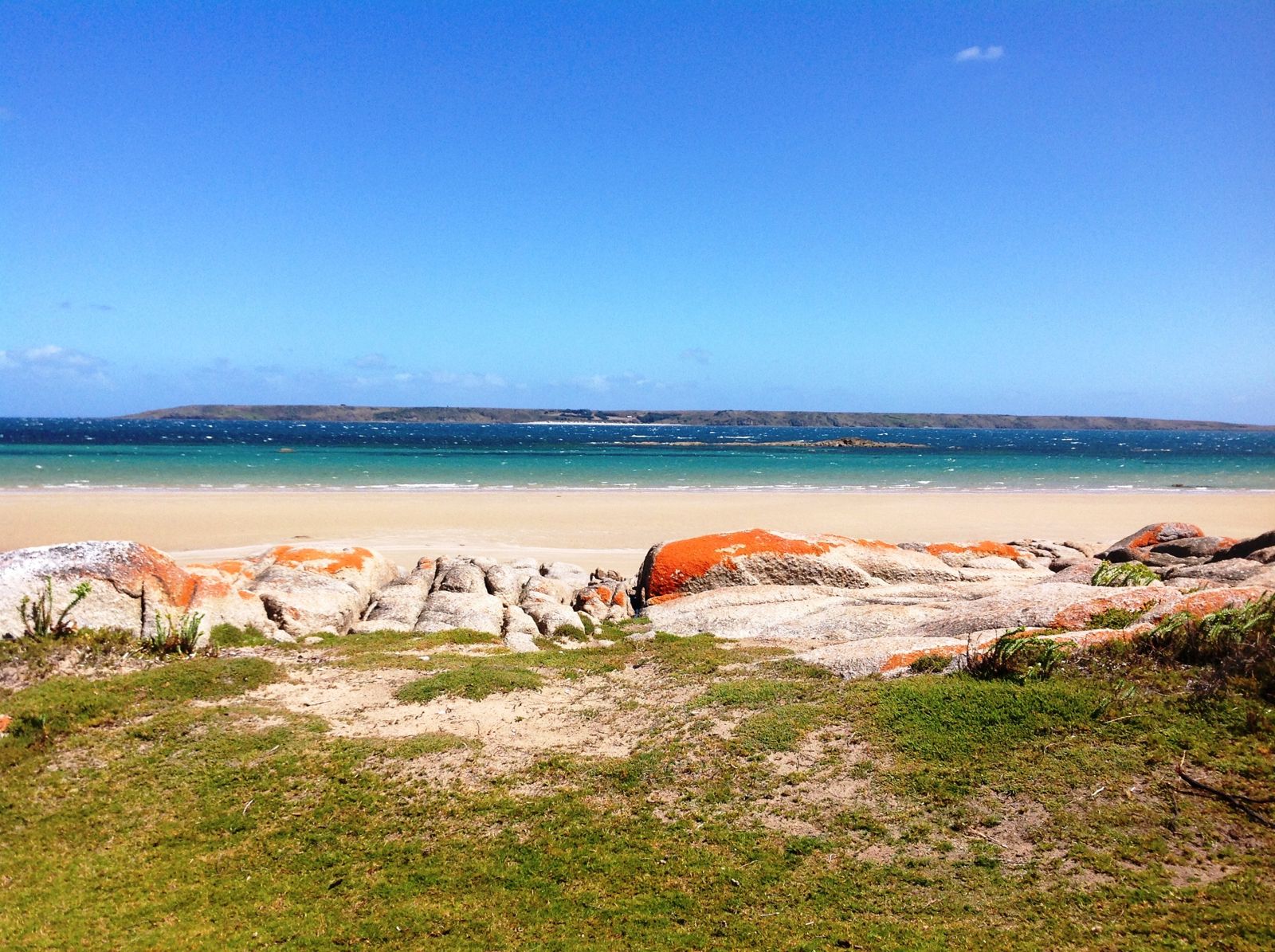
Stretching over 25 km along Tasmania's remote north-east coast, Waterhouse Conservation Area encompasses a wild sweep of sandy beaches, dunes, and coastal scrub. The four main snorkeling access points — Blackmans Lagoon beach, South Croppies, Waterhouse Point, and Ranson Beach — each open onto clear, cool Tasman Sea waters where granite boulders and kelp beds meet sandy shallows. Protected by offshore reefs in places, these beaches offer excellent shore-entry snorkeling in a pristine, low-traffic environment. The area is also a haven for birdlife and the threatened green and golden frog at Blackmans Lagoon, adding conservation significance to the stunning coastal scenery.
Waterhouse Conservation Area (beaches at Blackmans Lagoon, South Croppies, Waterhouse Point, Ranson Beach)
IntermediateGO
GO
It's a go.
Showing last known conditions
Wave Height 0.2 mSwell Period 5.4 sWind Speed 7.9 knPrecipitation 8.1 mmTidal Phase flood
Last evaluated
 © ElPhantomero
DANGER: Explicit Risks Present
Waterhouse Conservation Area (beaches at Blackmans Lagoon, South Croppies, Waterhouse Point, Ranson Beach) has hazards marked as danger. Entering the water here means you may face serious risks to your personal safety.
- Remote location danger
No lifeguards, no phone reception across much of the beach, and emergency services are 30+ minutes away. Self-reliance essential.
The spot
Community-maintained
Community contribution: submitted by Daniel
Know before you go
Logged by the community, confirmed by mods
High risk: Remote location
No lifeguards, no phone reception across much of the beach, and emergency services are 30+ minutes away. Self-reliance essential.
Moderate risk: Exposed wind and swell
The coast is exposed to prevailing winds from the Bass Strait and Tasman Sea. Strong southerly or easterly winds can create hazardous surf conditions and rip currents, especially at the more exposed beaches like South Croppies and Waterhouse Point.
Moderate risk: Cold water temperatures
Cold water temperatures year-round (10–16°C) can cause rapid fatigue and hypothermia. A thick wetsuit (5–7 mm) is essential.
Moderate risk: Swell and surf conditions
Exposed north-east coast receives significant ocean swell. Snorkeling only safe in calm conditions (low swell, light winds). Dangerous rips form near rocky headlands.
Moderate risk: Strong surf and swell
Exposed north-east coast can experience large swells from Bass Strait, making entry hazardous.
Moderate risk: Changing Coastal Conditions
Weather and sea conditions can change rapidly along this exposed coastline, with strong onshore winds whipping up surf and reducing visibility.
Moderate risk: 4WD Beach Traffic
The beach is designated as a dangerous 4WD beach with vehicles permitted; snorkelers must be alert for approaching vehicles, especially near access points.
Moderate risk: Rip Currents
Beach breaks and shifting sandbars can create strong rip currents along the 25 km stretch of coastline.
Moderate risk: Sudden weather changes / swell
Exposed coastline subject to rapid weather and sea state changes. Southerly swells can produce hazardous shore breaks and surge along rock platforms.
Moderate risk: Cold Water Temperature
Tasmanian coastal waters are cold year-round; a thick wetsuit (5mm+) is essential for comfort and safety.
Moderate risk: Duck Hunting Season
The area is popular with duck shooters during hunting season; avoid snorkeling during this time for safety.
Low risk: Remote location — limited emergency access
The area is remote with limited mobile phone reception. Emergency assistance may be difficult to obtain. Snorkelers should carry a personal locator beacon and never snorkel alone.
Low risk: Rough gravel road access
Unsealed gravel roads can become boggy or impassable after heavy rain, making beach access difficult or risky in standard vehicles.
Low risk: Variable water clarity
Lagoon water clarity can vary with rainfall, wind, and seasonal algae blooms, reducing visibility for snorkeling.
Low risk: Shallow submerged logs and vegetation
Dense submerged aquatic plants and occasional fallen timber present entanglement risks in shallow areas.
Low risk: Changing tides
At high tide the beach narrows significantly, limiting exit points. Incoming tides can cut off sections of beach against dune cliffs.
Low risk: Shark presence
North-east Tasmanian waters are frequented by bronze whalers and other shark species. Snorkeling near river mouths after rain increases risk.
Low risk: Unpredictable currents
Tidal flows around rocky headlands and creek mouths can create sudden rips.
Low risk: Limited emergency access
Remote area with no phone reception and long distances to medical facilities.
Low risk: Outgoing tide current
Strong tidal flows across the shallow sand flats, especially during outgoing tide, can pull snorkellers away from their entry point.
Low risk: Changing beach conditions
At high tide the beach narrows significantly against the dunes, reducing safe exit points. At low tide extensive sand flats require long walks to deeper water.
Low risk: Snakes
Tiger snakes and other venomous snakes are common in the coastal dunes and campground areas during warmer months.
Low risk: 4WD traffic on beach
Vehicles are permitted on the beach for boat launching and fishing access. Snorkellers should remain alert for vehicles, especially near access tracks.
Low risk: Remote location — limited services
No fuel, food, or drinking water available on-site. Bring all supplies and first aid equipment.
Low risk: Variable weather conditions
Strong coastal winds and rapid weather changes can occur year-round, affecting water visibility and safety.
Low risk: Shallow lagoon entrances
Lagoons have shallow, narrow connections to the sea; water levels and currents can shift with tides.
Low risk: Tidal currents
Strong tidal flows can develop around reef points and headlands, especially during outgoing tides, posing a risk to snorkelers unfamiliar with the area.
Low risk: Sharp reef and urchins
Rocky reefs and platforms with sharp edges and sea urchins; care needed when entering and exiting the water.
Low risk: Strong Ocean Swells
Bass Strait swells can produce strong surf and surge conditions, especially in exposed areas along the beach.
Low risk: Changing Tides & Currents
Tidal flows around the point can create unexpected currents. Snorkelers should monitor tide times and conditions closely.
Low risk: Wind Chill and Exposure
The lagoon is exposed to coastal winds which can cause rapid chilling when exiting the water.
Low risk: Isolated Location
Remote spot with no lifeguards, phone reception may be limited, and emergency services are far away.
Wildlife Guide
No wildlife notes for this spot yet.
Gallery
4 photos from the community
Getting in
Shore entry
Entry
Approximately 40 km east of Bridport via the B82 road, then turn onto Blackmans Lagoon Road or Homestead Road. Unsealed gravel roads lead to the various beach access points. A 4WD vehicle is recommended as roads can be rough and tricky after wet weather.
Parking & facilities
Unsealed roadside parking and designated parking areas near each campground (Blackmans Lagoon, South Croppies, Waterhouse Point, Ranson Beach). Suitable for caravans and camper trailers at most sites.
parkingtoilets
Free — no booking required.
Spot Map
Community
Gallery ┬╖ 4 photos
Trust
Is this spot real, accurate, still loved?
Spots near Tasmania

No nearby spots yet.
Needs verification
Quick verify
One tap helps the community keep this spot honest.
About this data
- Conditions last evaluated
- Spot data last updated
- Data sources
- Open-Meteo (marine & weather conditions), tide predictions via UTide, community contributors (descriptions, hazards, marine life).
- License
- Spot content licensed under CC BY-SA 4.0. How's the Spot is open source.
Weather & swell ┬╖ Open-Meteo marine & weather APIs Tides ┬╖ UTide harmonic analysis Sea & safety ┬╖ community reports