Eight historic shipwrecks lie scattered in the clear, shallow waters surrounding Wardang Island (Waralti) in Spencer Gulf, just off Port Victoria on South Australia's Yorke Peninsula. This underwater museum traces the region's grain-trade heyday, when square-riggers and coastal steamers crowded the anchorage. Snorkelers can explore wrecks like the iron barque Aagot (1882–1907) in as little as 2–4 m of water, or the Songvaar upright in 10 m, weaving through collapsed hull plates, boilers, and anchor chains encrusted with marine growth. Six land-based interpretive signs at Port Victoria tell the story before you get in the water.
Wardang Island Maritime Heritage Trail
IntermediateMAYBE
MAYBE
Fair. Experienced snorkellers only.
Showing last known conditions
Wave Height 0.3 mSwell Period 12 sWind Speed 1.5 knPrecipitation 6.8 mmTidal Phase unknown
Last evaluated
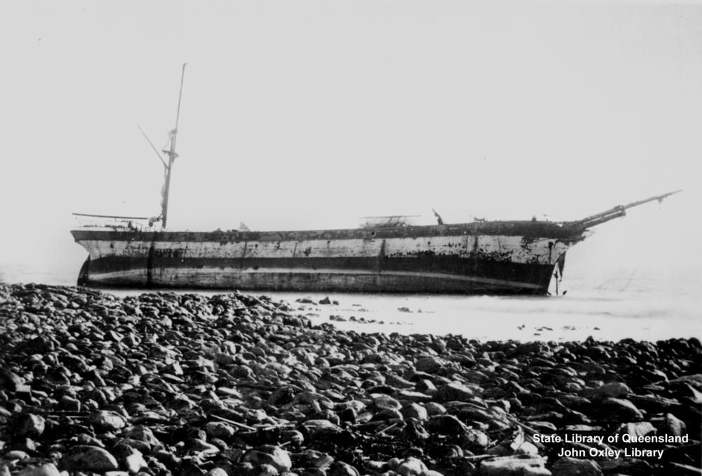 © Dobie & Co of Govan
The spot
Community-maintained
Community contribution: submitted by Daniel
Know before you go
Logged by the community, confirmed by mods
Moderate risk: Outgoing tide current
Strong tidal flows run through the channels between Wardang Island and the mainland, particularly around the southern and western points where several wrecks lie. Snorkelers should time visits to slack tide.
Moderate risk: Surf and surge on western wrecks
Wrecks on the exposed western side of the island (e.g. Aagot at Carpenters Rocks) are affected by ocean swell, surf, and surge that can disorient snorkelers.
Low risk: Sharp wreckage
Collapsed iron hull plates, protruding bolts, and scattered debris pose cutting hazards. Wear exposure protection and fins with sturdy soles.
Low risk: Boat traffic
The anchorage between Port Victoria and Wardang Island is used by fishing and charter vessels. Snorkelers near the outer wrecks should stay vigilant.
Wildlife Guide
No wildlife notes for this spot yet.
Gallery
1 photo from the community
Getting in
Boat
Entry
From Adelaide, take the Princes Highway north to Port Wakefield, then follow the Yorke Highway to the B86 turnoff for Port Victoria (approx. 180 km / 2 hr 15 min). Wardang Island itself is a 3 km boat crossing from the Port Victoria jetty. No public ferry service; you must arrange a private vessel or join a charter. Permission from the Point Pearce Community Council is required to set foot on Wardang Island itself, but snorkeling around the wrecks from a boat does not require landing.
Parking & facilities
Parking is available at the Port Victoria foreshore and boat ramp area on Esplanade, near the jetty. No dedicated fee, but observe local signage.
parkingtoiletspicnic_tablesboat_ramp
No entry fee for the trail itself. Charter/dive boat fees vary. Landing on Wardang Island requires prior permission from Point Pearce Community Council.
Spot Map
Community
Gallery ┬╖ 1 photos
Trust
Is this spot real, accurate, still loved?
Spots near South Australia

No nearby spots yet.
Needs verification
Quick verify
One tap helps the community keep this spot honest.
About this data
- Conditions last evaluated
- Spot data last updated
- Data sources
- Open-Meteo (marine & weather conditions), tide predictions via UTide, community contributors (descriptions, hazards, marine life).
- License
- Spot content licensed under CC BY-SA 4.0. How's the Spot is open source.
Weather & swell ┬╖ Open-Meteo marine & weather APIs Tides ┬╖ UTide harmonic analysis Sea & safety ┬╖ community reports