Wamberal Beach is a sweeping stretch of coastline on the Central Coast of NSW, known for its consistent waves and striking natural beauty. The prime snorkelling area lies at the northern end near Spoon Bay, where a rocky lagoon shoreline creates a sheltered, sandy-bottomed habitat teeming with marine life. Patrolled by Surf Life Saving volunteers on weekends and public holidays, the beach is flanked by the Wamberal Lagoon Nature Reserve, offering a peaceful setting for underwater exploration just north of bustling Terrigal.
Wamberal Beach
IntermediateGO
GO
It's a go.
Showing last known conditions
Wave Height 0.5 mSwell Period 6.5 sWind Speed 5.0 knPrecipitation 0.0 mmTidal Phase ebb
Last evaluated
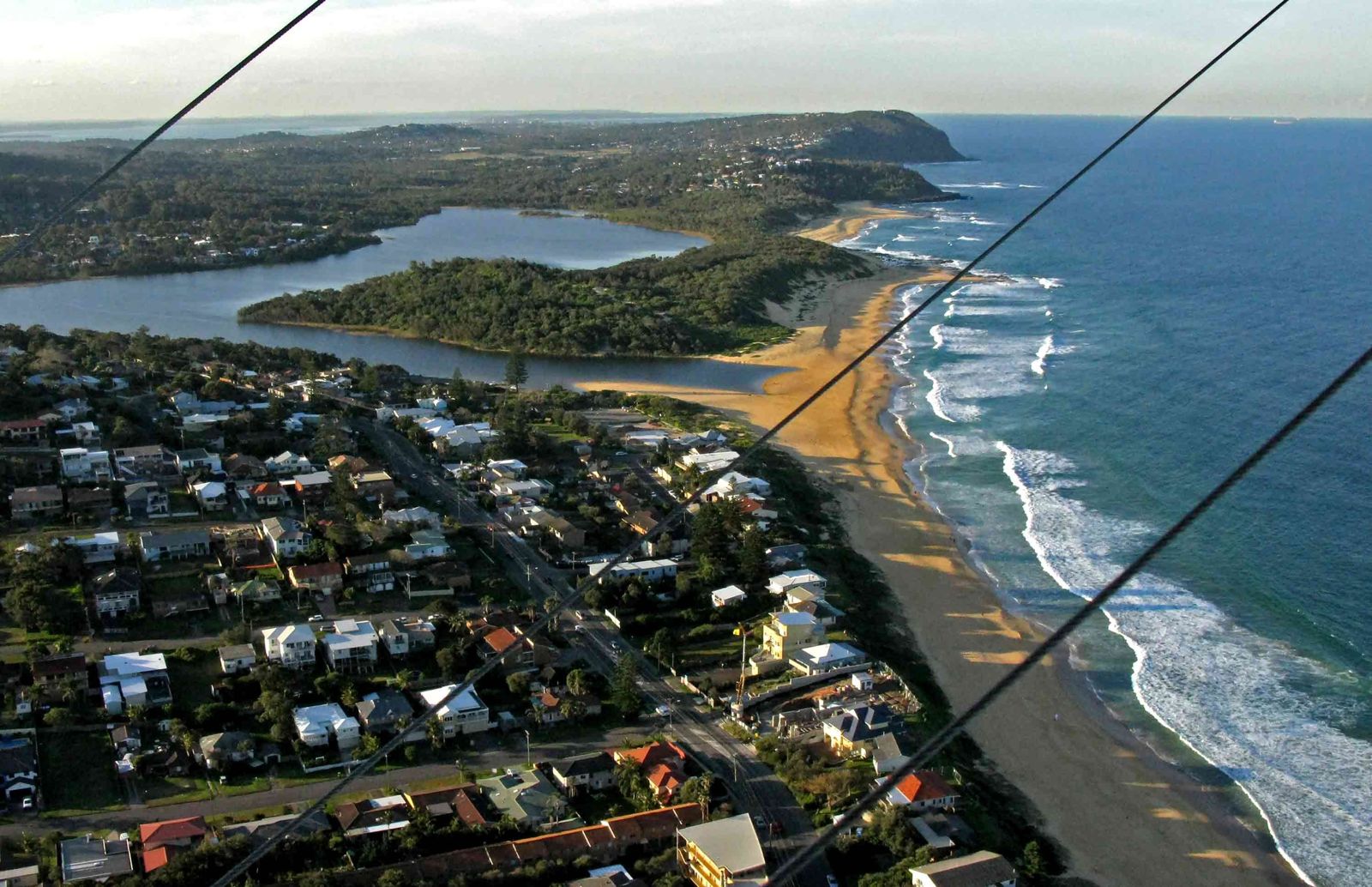 © Ray Hayward
The spot
Community-maintained
Community contribution: submitted by Daniel
Know before you go
Logged by the community, confirmed by mods
Moderate risk: Coastal erosion and unstable shoreline
Wamberal Beach experiences some of the worst coastal erosion in NSW, which can result in unstable sandbanks and debris in the water, particularly after storms.
Moderate risk: Strong surf and rip currents
The beach is open to ocean swells and can develop strong rip currents, especially on larger swell days. Snorkellers should stick to the calmer northern lagoon area.
Low risk: Rocky reef at north end
The north point has a rocky lagoon shoreline with submerged rocks. Care is needed when entering and exiting the water, especially at low tide.
Wildlife Guide
No wildlife notes for this spot yet.
Gallery
2 photos from the community
Getting in
Shore entry
Entry
Wamberal Beach is located off the Central Coast Highway between Terrigal and Forresters Beach. The main beach access is via Dover Road, near the Wamberal Surf Life Saving Club. For the best snorkelling spot (Spoon Bay / north point), take Spoon Bay Road and walk down the track to the northern end of the beach.
Parking & facilities
Medium-sized car park beside the beach near the Surf Life Saving Club at 1 Dover Road, Wamberal. Additional street parking available along Wiles Avenue. Accessible parking bays are provided.
toiletsparkingshowerspicnic_tables
Free entry. Paid and free parking options available.
Spot Map
Community
Gallery ┬╖ 2 photos
Trust
Is this spot real, accurate, still loved?
Spots near New South Wales

No nearby spots yet.
Needs verification
Quick verify
One tap helps the community keep this spot honest.
About this data
- Conditions last evaluated
- Spot data last updated
- Data sources
- Open-Meteo (marine & weather conditions), tide predictions via UTide, community contributors (descriptions, hazards, marine life).
- License
- Spot content licensed under CC BY-SA 4.0. How's the Spot is open source.
Weather & swell ┬╖ Open-Meteo marine & weather APIs Tides ┬╖ UTide harmonic analysis Sea & safety ┬╖ community reports