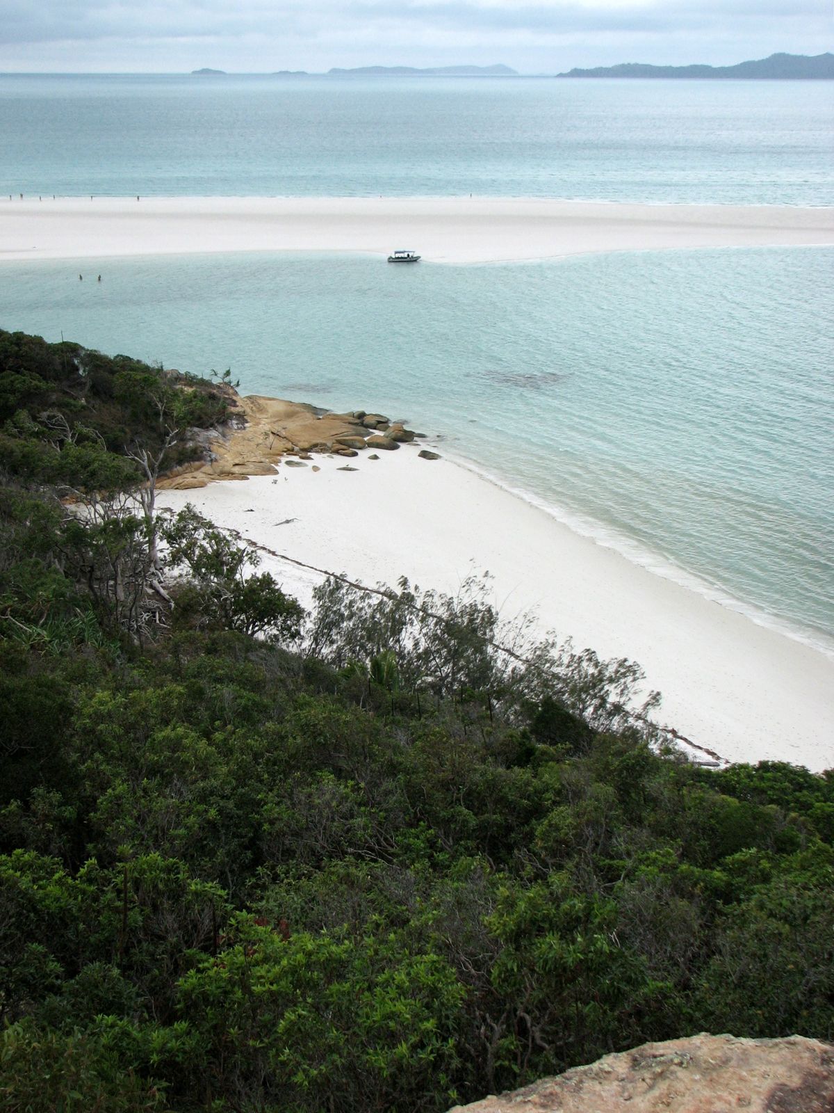
Tucked between Haslewood and Lupton Islands, Waite Bay shelters an extensive fringing reef that offers some of the Whitsundays' most accessible snorkelling. The shallow coral gardens lie just off powdery white silica sand beaches, delivering vibrant hard and soft coral formations in clear, turquoise waters. This highly protected green zone serves as a crucial coral larval nursery, nourishing the surrounding Great Barrier Reef. Its remote location — reachable only by boat — keeps crowds to a minimum, rewarding visitors with a pristine, serene underwater experience. The calm bay conditions and shallow reef make it easy to explore, while the adjacent Chalkies Beach boasts the same dazzling white sand as world-famous Whitehaven Beach.
Waite Bay (Haslewood Island)
IntermediateMAYBE
MAYBE
Fair. Experienced snorkellers only.
Showing last known conditions
Wave Height 0.1 mSwell Period 2.5 sWind Speed 16 knPrecipitation 3.4 mmTidal Phase flood
Last evaluated
The spot
Community-maintained
Community contribution: submitted by Daniel
Know before you go
Logged by the community, confirmed by mods
Moderate risk: Protected Green Zone Restrictions
Waite Bay is a no-go zone for bareboat operators and has strict 'green zone' marine park restrictions. Fines apply for improper anchoring or fishing.
Moderate risk: Marine Stingers (Jellyfish)
Box jellyfish and Irukandji may be present in warmer months.
Moderate risk: Marine stingers
Marine stingers (jellyfish) are present in Whitsunday waters, particularly during the warmer months.
Low risk: Shallow Coral
Coral is very shallow in places, making it easy to accidentally stand on or kick fragile formations. Snorkelers must take care to float above the reef.
Low risk: Variable Visibility
Visibility ranges from 3 to 15 metres depending on tides, weather, and currents. Can be poor after wind or rain.
Low risk: Remote Location
Accessible only by private boat, charter, or tour. No on-site facilities, drinking water, or medical aid - requires full self-sufficiency.
Low risk: Steep reef drop-off
The fringing reef drops off steeply into deeper water. Swimmers and divers should stay aware of their depth and distance from the reef edge.
Low risk: Boat traffic
Boat traffic from tour operators and private charters accessing the bay and moorings. Be vigilant when surfacing.
Low risk: Southeasterly wind swell
White Bay is not a good anchorage in prevailing southeasterly winds, and the bay can become unsafe for boats and swimmers when strong SE winds blow.
Low risk: Sharp coral
Sharp coral formations and shallow reef areas require care to avoid cuts and damage to the reef.
Low risk: Strong tidal currents
Tidal flow through Whitsunday passages can create strong currents around the fringing reef, especially on outgoing tides.
Wildlife Guide
No wildlife notes for this spot yet.
Gallery
1 photo from the community
Getting in
Boat
Entry
Waite Bay is located between Haslewood Island and Lupton Island in the Whitsundays. Access is by private boat, chartered yacht, or commercial tour from Airlie Beach or Hamilton Island. The bay offers anchorage, but bareboat visitors are prohibited from entering — only commercially operated vessels may visit. Chalkies Beach on the island's eastern side provides a landing point.
Parking & facilities
No vehicle parking available. All visitors arrive by boat. Parking is available at marinas in Airlie Beach (Port of Airlie, Abel Point Marina) or Shute Harbour for those self-driving to their vessel.
toilets
No entry fee. Access requires a boat charter, sailing tour, or private vessel. Commercial tours from Airlie Beach range from $180-$280 AUD per person for day trips that include snorkelling stops.
Spot Map
Community
Gallery ┬╖ 1 photos
Trust
Is this spot real, accurate, still loved?
Spots near Queensland

No nearby spots yet.
Needs verification
Quick verify
One tap helps the community keep this spot honest.
About this data
- Conditions last evaluated
- Spot data last updated
- Data sources
- Open-Meteo (marine & weather conditions), tide predictions via UTide, community contributors (descriptions, hazards, marine life).
- License
- Spot content licensed under CC BY-SA 4.0. How's the Spot is open source.
Weather & swell ┬╖ Open-Meteo marine & weather APIs Tides ┬╖ UTide harmonic analysis Sea & safety ┬╖ community reports