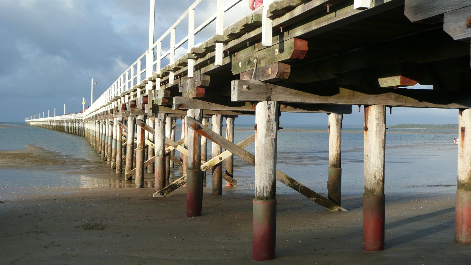
Stretching nearly one kilometre into the calm, protected waters of Hervey Bay, Urangan Pier is one of Australia's longest and oldest piers. Originally built as a deep-water port for exporting coal and timber, its weathered timber pylons now create an artificial reef teeming with marine life. Snorkellers can swim alongside the pylons in clear, shallow waters to spot schools of bream, trevally, and flathead, with stingrays and occasionally dolphins gliding past. The pier offers spectacular views of K'gari (Fraser Island) on the horizon and a serene, sheltered snorkeling experience away from waves.
Urangan Pier
BeginnerGO
GO
It's a go.
Showing last known conditions
Wave Height 0.1 mSwell Period 3.1 sWind Speed 4.0 knPrecipitation 0.1 mmTidal Phase ebb
Last evaluated
 © Kgbo
The spot
Community-maintained
Community contribution: submitted by Daniel
Know before you go
Logged by the community, confirmed by mods
Moderate risk: Marine stingers (box jellyfish)
Box jellyfish and Irukandji may be present in the warmer months, particularly November to May. Stinger suits are recommended.
Low risk: Tidal currents
Moderate tidal flow through the pier pylons can develop during outgoing tides. Swim with caution near the structure.
Low risk: Fishing lines and hooks
Urangan Pier is a popular fishing spot. Snorkellers should watch for discarded fishing line, hooks, and sinkers near the pylons.
Low risk: Boat traffic near pier
Fishing and recreational boats use the area around Urangan Pier. Snorkelers should stay aware and avoid the active fishing zones.
Low risk: Stingrays
Stingrays are common in the shallows around the pier. Shuffle your feet when entering the water to avoid startling them.
Wildlife Guide
No wildlife notes for this spot yet.
Gallery
5 photos from the community
Getting in
Shore entry
Entry
Urangan Pier is located at the end of Pier Street, Urangan, about 5 km south of Hervey Bay's town centre. Follow the Bruce Highway to Maryborough, then take the Hervey Bay exit and follow signs to Urangan.
Parking & facilities
Free parking is available at the Pier Street carpark, adjacent to the pier entrance.
parkingtoiletspicnic_tables
Free entry to the pier and shore access.
Spot Map
Community
Gallery ┬╖ 5 photos
Trust
Is this spot real, accurate, still loved?
Spots near Queensland

No nearby spots yet.
Needs verification
Quick verify
One tap helps the community keep this spot honest.
About this data
- Conditions last evaluated
- Spot data last updated
- Data sources
- Open-Meteo (marine & weather conditions), tide predictions via UTide, community contributors (descriptions, hazards, marine life).
- License
- Spot content licensed under CC BY-SA 4.0. How's the Spot is open source.
Weather & swell ┬╖ Open-Meteo marine & weather APIs Tides ┬╖ UTide harmonic analysis Sea & safety ┬╖ community reports