Jack Evans Boat Harbour sits in the protected tidal inlet of the lower Tweed River, where a long rock wall creates a calm, shallow snorkeling corridor rich with nooks and crannies. The wall and nearby concrete pylons are cloaked in sponges and algae, drawing crayfish, moray eels, nudibranchs, shrimps, and filefish into the open. The harbour is a unique mix of natural habitat and man-made structure — including a submerged shopping trolley — that rewards close-up exploration. Best dived around high tide for clearer water and slack currents, this is an easy-access shore entry for snorkelers wanting a safe, macro-rich urban adventure in northern NSW.
Tweed River (Jack Evans Boat Harbour / rock wall)
BeginnerGO
GO
It's a go.
Showing last known conditions
Wave Height 0.8 mSwell Period 7.6 sWind Speed 7.7 knPrecipitation 0.0 mmTidal Phase ebb
Last evaluated
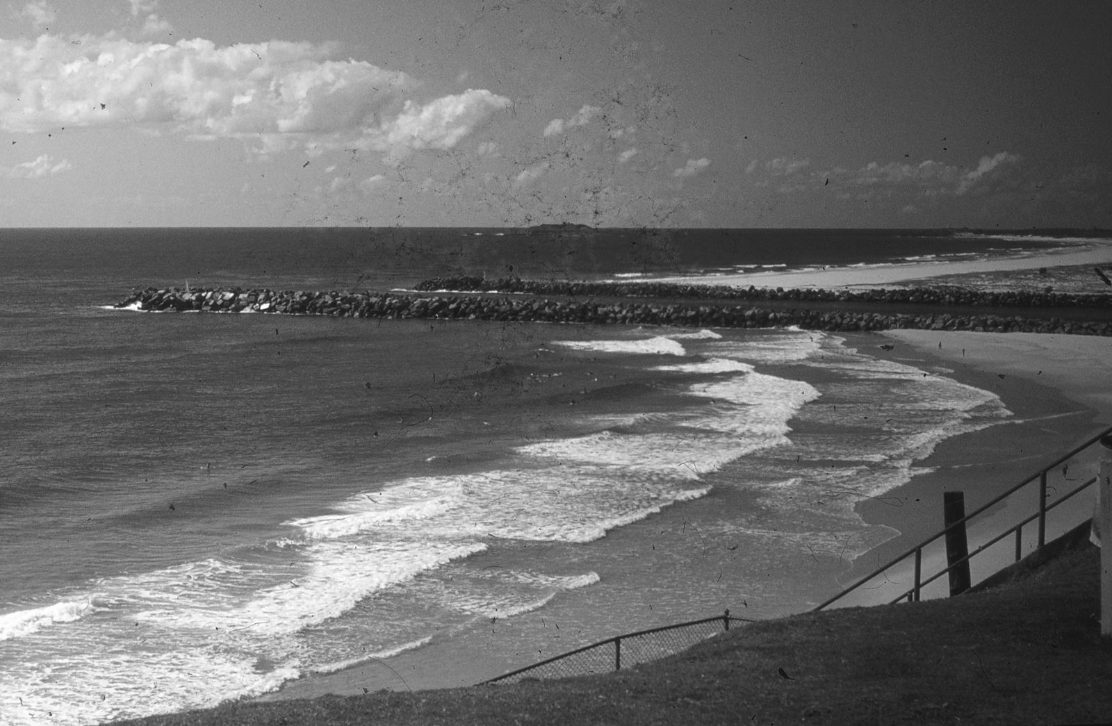 © John Robert McPherson
The spot
Community-maintained
Community contribution: submitted by Daniel
Know before you go
Logged by the community, confirmed by mods
Moderate risk: Boat traffic
The harbour is a working boat channel; boats frequently pass through. Stay close to the wall and avoid surfacing mid-channel.
Moderate risk: Surf break and rip currents
Duranbah is a renowned surf beach with consistent waves and can develop strong rip currents, especially near the headland.
Moderate risk: River mouth currents
Flowing tidal currents at the Brunswick River mouth can be strong, especially during outgoing tides.
Low risk: Tidal current
Tidal movement causes significant current along the rock wall; best dived at high-tide slack water.
Low risk: Slippery steps
Slippery entry steps at Coral Street can be hazardous, especially when wet.
Low risk: Stinging hydroids / irritant algae
Stinging hydroids and certain algae grow on the rocks; prolonged contact can cause skin irritation.
Low risk: Abandoned fishing line and hooks
Fishing line and hooks are common along the wall from shore fishing activity.
Low risk: Rocky headland at southern end
Sharp volcanic rocks extend from the headland at Point Danger; care needed when entering or exiting near this area.
Low risk: 4WD vehicle traffic on beach
Vehicles are permitted in a restricted zone for boat launching and parking; swimmers and snorkelers should be aware of vehicle movement.
Low risk: Surf zone at New Brighton Beach
Adjacent open beach may have waves and sweep currents; stay close to the sheltered river mouth area.
Low risk: Marine stingers
Bluebottles and jellyfish can appear during warmer months along this stretch of coast.
Low risk: Limited parking on weekends
The North Head carpark can fill up quickly on weekends and during peak holiday periods.
Wildlife Guide
No wildlife notes for this spot yet.
Gallery
4 photos from the community
Getting in
Shore entry
Entry
From Tweed Heads, drive to Coral Street and park near the small jetty at the end of Jack Evans Boat Harbour. Enter via the steps at Coral Street or via the beach/rock entry near the Marine Rescue building.
Parking & facilities
Car parking available along Coral Street and near Chris Cunningham Park. Can be limited in summer peak periods; overflow parking available at nearby streets.
parkingtoiletspicnic_tables
Free public access. No entry fee.
Spot Map
Community
Gallery ┬╖ 4 photos
Trust
Is this spot real, accurate, still loved?
Spots near New South Wales

No nearby spots yet.
Needs verification
Quick verify
One tap helps the community keep this spot honest.
About this data
- Conditions last evaluated
- Spot data last updated
- Data sources
- Open-Meteo (marine & weather conditions), tide predictions via UTide, community contributors (descriptions, hazards, marine life).
- License
- Spot content licensed under CC BY-SA 4.0. How's the Spot is open source.
Weather & swell ┬╖ Open-Meteo marine & weather APIs Tides ┬╖ UTide harmonic analysis Sea & safety ┬╖ community reports