Tuncurry Beach (also known as Nine Mile Beach) stretches along the NSW Mid North Coast between the Wallamba River mouth and Black Head. This wide, patrolled beach offers snorkelling around the rocky headland at the southern end and the Tuncurry breakwall, where juvenile fish and the occasional stingray can be spotted. The beach meets the calm Wallamba River estuary — a safer alternative for beginners. Backed by dunes and coastal scrub, it's a less-crowded alternative to nearby Forster Beach with good facilities including a playground, picnic shelters, and public toilets.
Tuncurry Beach
IntermediateGO
GO
It's a go.
Showing last known conditions
Wave Height 1.0 mSwell Period 6.7 sWind Speed 8.7 knPrecipitation 0.0 mmTidal Phase ebb
Last evaluated
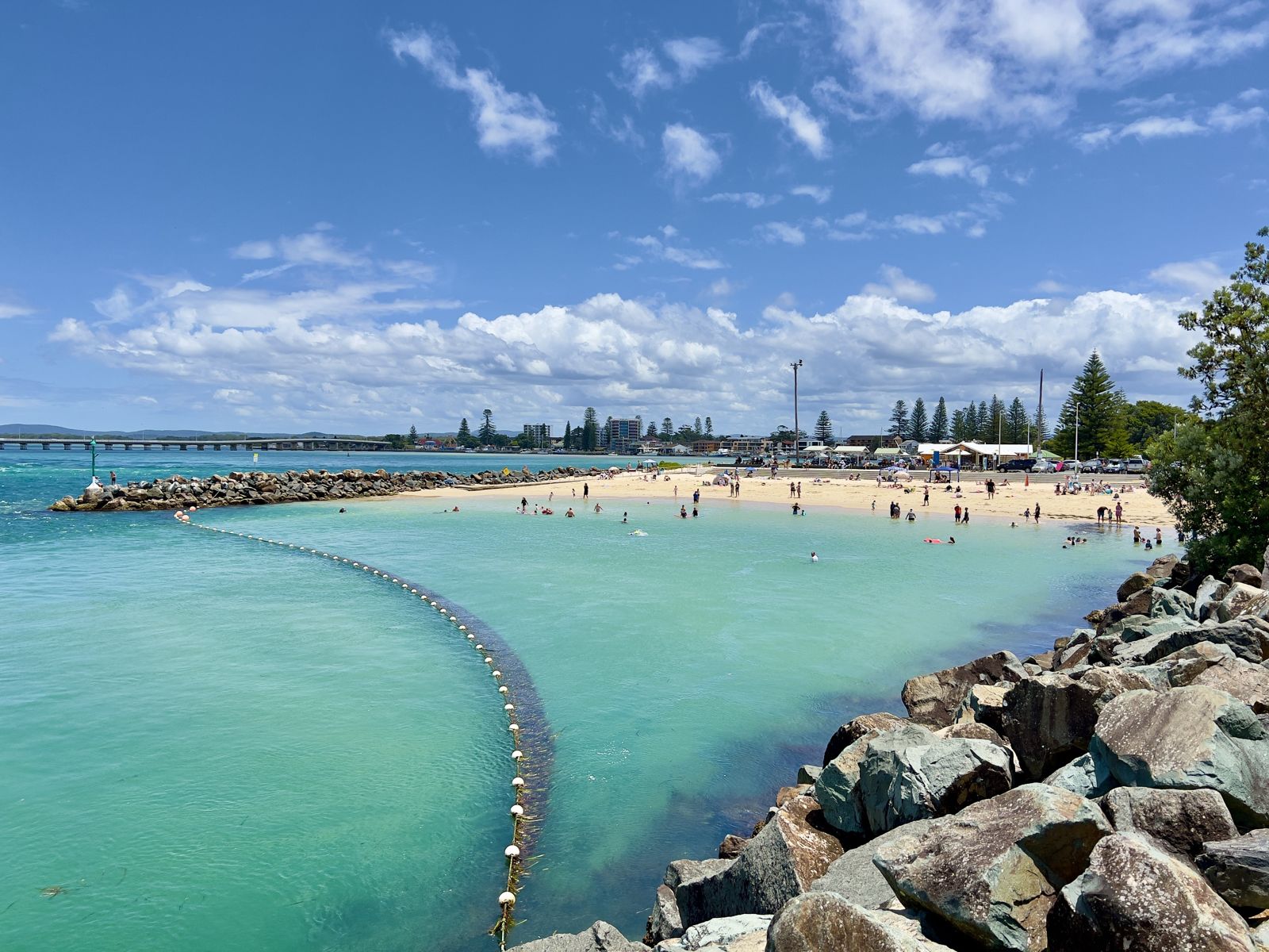 © Chris Olszewski
The spot
Community-maintained
Community contribution: submitted by Daniel
Know before you go
Logged by the community, confirmed by mods
Moderate risk: Rip currents
Strong rips can develop along the open beach, especially near the southern rocks and breakwall. Swim between the flags when patrols are active.
Moderate risk: Boat traffic near breakwall
The Tuncurry breakwall and river mouth are frequented by fishing and recreational boats entering/exiting the Wallamba River.
Low risk: Surf conditions
Southerly swells can produce dumpers and shore break, making shore entry challenging for inexperienced snorkellers.
Low risk: Marine stingers (Bluebottles)
Bluebottles (Physalia physalis) occasionally wash in with northeasterly winds, particularly in summer.
Wildlife Guide
No wildlife notes for this spot yet.
Gallery
3 photos from the community
Getting in
Shore entry
Entry
From the Pacific Highway (A1), take the Forster/Tuncurry exit onto The Lakes Way. Continue into Tuncurry, turn onto Beach Street and follow it to the beachfront carpark. The beach runs parallel to Beach Street / Lakes Way.
Parking & facilities
Large unparked carpark off Beach Street directly behind the beach, plus additional street parking along Beach Street and Manning Street. Free of charge.
toiletspicnic_tablesparking
No entry or parking fees.
Spot Map
Community
Gallery ┬╖ 3 photos
Trust
Is this spot real, accurate, still loved?
Spots near New South Wales

No nearby spots yet.
Needs verification
Quick verify
One tap helps the community keep this spot honest.
About this data
- Conditions last evaluated
- Spot data last updated
- Data sources
- Open-Meteo (marine & weather conditions), tide predictions via UTide, community contributors (descriptions, hazards, marine life).
- License
- Spot content licensed under CC BY-SA 4.0. How's the Spot is open source.
Weather & swell ┬╖ Open-Meteo marine & weather APIs Tides ┬╖ UTide harmonic analysis Sea & safety ┬╖ community reports