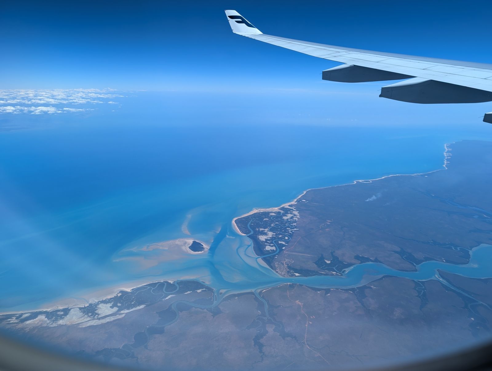
The Tiwi Islands (Bathurst and Melville) offer a rare snorkeling experience in the remote, pristine waters of the Timor Sea, 80 km north of Darwin. The offshore reefs and coastal waters surrounding the islands feature fringing coral reefs, rocky headlands, and white-sand bays with excellent visibility. This is a wild, undeveloped marine environment where you can explore untouched reef systems teeming with tropical fish, turtles, and rays. Snorkeling here is typically accessed via guided fishing or snorkeling tours from Darwin, as the islands are Aboriginal-owned land requiring a permit. The surrounding waters are famed for their bluewater, reef, and estuary ecosystems, offering a truly off-the-beaten-path adventure into one of Australia's most remote snorkeling destinations.
Tiwi Islands (offshore reefs and waters)
It's a go.
Showing last known conditions
Last evaluated
DANGER: Explicit Risks Present
Tiwi Islands (offshore reefs and waters) has hazards marked as danger. Entering the water here means you may face serious risks to your personal safety.
- Saltwater Crocodile Presence danger
Crocodile sightings are possible in nearshore and estuarine waters around the Tiwi Islands, particularly during the wet season. Always follow local guide instructions.
- Box Jellyfish / Stingers danger
Box jellyfish (Chironex fleckeri) and other stingers are prevalent in the waters north of Darwin from October to May.
- Saltwater crocodiles danger
Saltwater crocodiles inhabit coastal waters of the Northern Territory, including the Tiwi Islands region. Always heed local advice.
- Tropical cyclones danger
Tropical cyclones can impact the region from November to April, bringing dangerous seas, heavy rain, and poor visibility.
The spot
Community-maintained
Community contribution: submitted by Daniel
Know before you go
Logged by the community, confirmed by mods
High risk: Saltwater Crocodile Presence
Crocodile sightings are possible in nearshore and estuarine waters around the Tiwi Islands, particularly during the wet season. Always follow local guide instructions.
High risk: Box Jellyfish / Stingers
Box jellyfish (Chironex fleckeri) and other stingers are prevalent in the waters north of Darwin from October to May.
High risk: Saltwater crocodiles
Saltwater crocodiles inhabit coastal waters of the Northern Territory, including the Tiwi Islands region. Always heed local advice.
High risk: Tropical cyclones
Tropical cyclones can impact the region from November to April, bringing dangerous seas, heavy rain, and poor visibility.
Moderate risk: Strong Tidal Currents
Strong tidal flows move through the channels between Bathurst and Melville Islands and around reef systems, which can sweep snorkelers away from their entry point.
Moderate risk: Remote Location / Limited Medical Facilities
The remote nature of the islands means medical facilities are very limited. The nearest hyperbaric chamber is in Darwin.
Moderate risk: Box jellyfish (stinger season)
Box jellyfish (stingers) are present in tropical NT waters during the wet season. Stinger suits are strongly recommended.
Moderate risk: Box Jellyfish
Box jellyfish (Chironex fleckeri) are present in the coastal waters of the Northern Territory, typically swarming in shallow waters during the wet season. Their sting is extremely painful and can be life-threatening.
Low risk: Remote Location
Remote location with limited emergency services. The nearest medical facilities are in Darwin, 80 km away. Snorkeling is best done as part of a guided tour with proper safety equipment.
Wildlife Guide
No wildlife notes for this spot yet.
Gallery
1 photo from the community
Getting in
The Tiwi Islands (Bathurst and Melville) are located 80 km north of Darwin, NT. Access is via a 2.5-hour ferry or a 20-minute light aircraft flight from Darwin. All visitors require a permit from the Tiwi Land Council, which is typically arranged by tour operators. Day tours operate Monday to Friday, April to November.
Parking available at Darwin departure points (ferry terminal and Darwin airport). No public vehicle access on the islands themselves — tours provide transport on the islands via bus or boat.
Spot Map
Community
Trust
Is this spot real, accurate, still loved?
Spots near Northern Territory

No nearby spots yet.
Quick verify
One tap helps the community keep this spot honest.
About this data
- Conditions last evaluated
- Spot data last updated
- Data sources
- Open-Meteo (marine & weather conditions), tide predictions via UTide, community contributors (descriptions, hazards, marine life).
- License
- Spot content licensed under CC BY-SA 4.0. How's the Spot is open source.