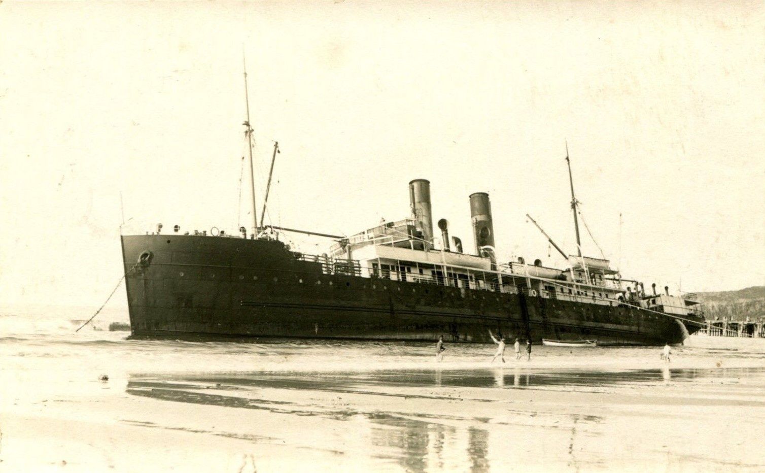
The Wreck is named for the remains of the SS Wollongbar, a North Coast Steam Navigation vessel that ran aground during a storm in 1921 and sank at its moorings in 1922. The corroded steel hull sits roughly 100 metres offshore, forming an artificial reef that draws fish, rays, and occasionally turtles. On calm days this is one of the most accessible snorkel sites in Byron Bay — wade in from the eastern end of Main Beach and swim straight out. The wreckage is partially visible at low tide and creates a fascinating underwater structure to explore.
The Wreck — Byron Bay snorkel site (offshore wreck)
IntermediateGO
GO
It's a go.
Showing last known conditions
Wave Height 0.6 mSwell Period 7.7 sWind Speed 6.1 knPrecipitation 0.0 mmTidal Phase ebb
Last evaluated
DANGER: Explicit Risks Present
The Wreck — Byron Bay snorkel site (offshore wreck) has hazards marked as danger. Entering the water here means you may face serious risks to your personal safety.
- Low tide exposed wreckage danger
At very low tide the wreck breaks the surface with sharp, jagged metal — hazardous for swimmers and snorkellers who don't keep clear.
The spot
Community-maintained
Community contribution: submitted by Daniel
Know before you go
Logged by the community, confirmed by mods
High risk: Low tide exposed wreckage
At very low tide the wreck breaks the surface with sharp, jagged metal — hazardous for swimmers and snorkellers who don't keep clear.
Moderate risk: Strong rip currents
Main Beach can develop rip currents, especially on larger swell days, which can pull swimmers away from the wreck zone.
Moderate risk: Sharp barnacle-covered metal
The wreck structure is old, corroded steel heavily encrusted with barnacles that can cause deep cuts on contact.
Moderate risk: Rip current
Main Beach can develop strong lateral currents that sweep swimmers sideways along the beach unexpectedly.
Low risk: Boat traffic
The wreck lies close to shore but is also near the main swimming zone and boat channel; be alert for jet skis and small craft.
Low risk: Exposed metal wreckage
The rusted steel beams and rudder can cause cuts if swimmers bump into them; fins and booties recommended.
Low risk: Changing tide and current
Tidal flow around the wreck structure can pick up during outgoing tide, making it harder to hold position while snorkeling.
Low risk: Poor visibility after swell
Recent surf stirs up sediment, dropping visibility to murky brown — best to wait 48 hours after heavy swell for the water to clear.
Wildlife Guide
No wildlife notes for this spot yet.
Gallery
1 photo from the community
Getting in
Shore entry
Entry
From Lawson Street in Byron Bay town centre, walk east along Main Beach toward Cape Byron. The wreck site is roughly 100 metres offshore at the eastern end of Main Beach, near where the rock shelf begins. At low tide, parts of the wreck are visible from the beach.
Parking & facilities
Apex Park car park on Lawson Street ($4/hour, 4-hour limit). Smaller car parks also available on Border Street, Don Street and Childe Street.
toiletsparkingshowers
No fee for snorkelling. Parking is $4/hour at the Main Beach car park.
Spot Map
Community
Gallery ┬╖ 1 photos
Trust
Is this spot real, accurate, still loved?
Spots near New South Wales

No nearby spots yet.
Needs verification
Quick verify
One tap helps the community keep this spot honest.
About this data
- Conditions last evaluated
- Spot data last updated
- Data sources
- Open-Meteo (marine & weather conditions), tide predictions via UTide, community contributors (descriptions, hazards, marine life).
- License
- Spot content licensed under CC BY-SA 4.0. How's the Spot is open source.
Weather & swell ┬╖ Open-Meteo marine & weather APIs Tides ┬╖ UTide harmonic analysis Sea & safety ┬╖ community reports