The Spit (also known as Southport Spit) is the northernmost point of the Gold Coast beach strip, where the Nerang River meets the Pacific Ocean through the man-made Seaway. This Gold Coast shore-diving hotspot offers easy stair-entry into clear, calm waters along the South Wall and the famous Sand Pipe — an exposed underwater pipeline teeming with fish. Built in the late 1980s to stabilise the river mouth, the Seaway has become a biodiversity magnet with over 400 species recorded, from schooling trevally and bream to Queensland groupers, rays and nudibranchs. The adjacent Doug Jennings Park provides barbecue facilities, toilets, showers, and a popular kiosk, making this a relaxed day out for snorkellers and divers alike.
The Spit (Southport Spit)
IntermediateGO
GO
It's a go.
Showing last known conditions
Wave Height 0.8 mSwell Period 7.3 sWind Speed 8.1 knPrecipitation 0.2 mmTidal Phase ebb
Last evaluated
 © Sheba_Also 43,000 photos
DANGER: Explicit Risks Present
The Spit (Southport Spit) has hazards marked as danger. Entering the water here means you may face serious risks to your personal safety.
- Boat traffic danger
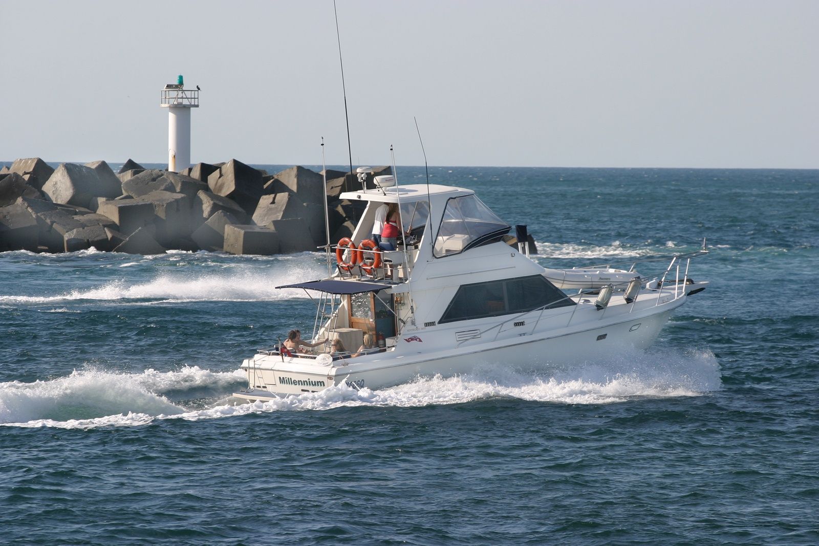
Boats transit the seaway channel to reach open water. Snorkellers must not swim in the central passage and should stay close to the wall.
- Stonefish danger
Well-camouflaged stonefish hide among objects on the sand under the pipe. Never grab anything without looking closely.
- Strong tidal current danger
The Seaway channel experiences fast-moving tidal flows, especially during mid-tide. Snorkel only during slack tide to avoid being swept out to sea.
The spot
Community-maintained
Community contribution: submitted by Daniel
Know before you go
Logged by the community, confirmed by mods
High risk: Boat traffic
Boats transit the seaway channel to reach open water. Snorkellers must not swim in the central passage and should stay close to the wall.
High risk: Stonefish
Well-camouflaged stonefish hide among objects on the sand under the pipe. Never grab anything without looking closely.
High risk: Strong tidal current
The Seaway channel experiences fast-moving tidal flows, especially during mid-tide. Snorkel only during slack tide to avoid being swept out to sea.
Moderate risk: Strong tidal currents
The channel experiences powerful currents, especially on outgoing tides. Snorkellers must stay to the south wall and avoid the middle of the channel.
Moderate risk: Fishing lines and hooks
Fishing lines and tackle litter the rock walls and sandy bottom, posing entanglement risks. Carry a dive knife and watch where you swim.
Moderate risk: Stinger season (marine stingers)
Box jellyfish and other marine stingers are present in Gold Coast waters during the warmer months (November to May).
Moderate risk: Boat Traffic (Seaway Channel)
Boats transit the channel to reach open ocean. Snorkellers must stay close to the South Wall and never swim in the middle of the channel.
Moderate risk: Outgoing Tide Current
Strong currents form during outgoing tide, especially through the Sand Pipe area. Wastewater release occurs on outgoing tide, reducing visibility. Snorkel at slack high tide for best conditions.
Low risk: Treated wastewater outflow
On the outgoing tide, treated wastewater from sewage treatment plants is released into the channel, degrading visibility. Time your visit for the incoming high tide.
Low risk: Fishing Lines & Hooks
Fishing lines and hooks are common on the bottom. Entanglement risk — a dive knife is recommended for safety.
Low risk: Variable Visibility
Visibility ranges from 3–15 metres depending on tide, wind (avoid northerly winds), and recent rainfall. Check conditions before entering.
Wildlife Guide
No wildlife notes for this spot yet.
Gallery
4 photos from the community
Getting in
Shore entry
Entry
Located at 40-44 Seaworld Drive, Main Beach, Gold Coast. From the Pacific Motorway (M1), take the Southport exit and follow signs to Seaworld / The Spit. Drive to the end of Seaworld Drive.
Parking & facilities
Two main car parks: Doug Jennings Park (Broadwater side) and Philip Park (ocean side). No overnight parking permitted. Pay attention to signed parking restrictions.
toiletsparkingshowerspicnic_tablesdrinking_water
Free access. No entry fee for the beach or park.
Spot Map
Community
Gallery ┬╖ 4 photos
Trust
Is this spot real, accurate, still loved?
Spots near Queensland

No nearby spots yet.
Needs verification
Quick verify
One tap helps the community keep this spot honest.
About this data
- Conditions last evaluated
- Spot data last updated
- Data sources
- Open-Meteo (marine & weather conditions), tide predictions via UTide, community contributors (descriptions, hazards, marine life).
- License
- Spot content licensed under CC BY-SA 4.0. How's the Spot is open source.
Weather & swell ┬╖ Open-Meteo marine & weather APIs Tides ┬╖ UTide harmonic analysis Sea & safety ┬╖ community reports