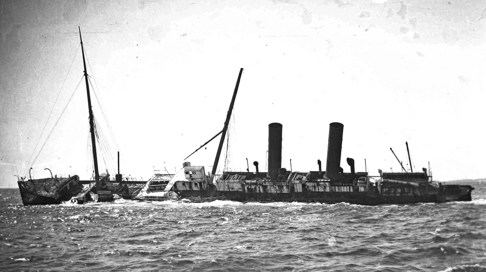
The RMS Orizaba is a 140-metre, 6,077-ton steel steamship that ran aground on the Five Fathom Bank off Point Peron on 16 February 1905 and now rests in just 6–10 metres of water — one of Australia's largest accessible shipwrecks. The shallow depth makes it a remarkable snorkel and dive site where the collapsed bow, massive triple-expansion crank shaft, steering gear, and exposed boilers are encrusted with colourful marine growth. Located about 20 minutes by boat from Rockingham, the wreck sprawls over 130 metres across a sandy reef bed, and on calm days with low swell (under 1 m), snorkellers can glide above the historic steamer's remains, watching schools of reef fish weave through the iron skeleton.
The Orizaba (wreck dive)
IntermediateMAYBE
MAYBE
Fair. Experienced snorkellers only.
Showing last known conditions
Wave Height 0.9 mSwell Period 9.9 sWind Speed 3.4 knPrecipitation 7.2 mmTidal Phase ebb
Last evaluated
The spot
Community-maintained
Community contribution: submitted by Daniel
Know before you go
Logged by the community, confirmed by mods
Moderate risk: Strong surge
The wreck sits on the exposed Five Fathom Bank and can experience powerful ocean surge. Best dived in swell under 1 metre.
Low risk: Poor visibility in weather
Visibility ranges 5–15 m and can drop dramatically after storms or windy conditions, especially in winter.
Low risk: Sharp wreckage
Collapsed steel hull plates, exposed engine parts and boilers with sharp, rusted edges require careful finning and buoyancy control.
Low risk: Boat traffic
Access is by boat only (20-min ride from Point Peron); snorkellers must be aware of dive boat activity in the area.
Wildlife Guide
No wildlife notes for this spot yet.
Gallery
5 photos from the community
Getting in
Boat
Entry
The wreck lies on Five Fathom Bank, approximately 2 nautical miles west of Point Peron, Rockingham. GPS: bow at S 32° 16.914' E 115° 37.691', stern at S 32° 16.945' E 115° 37.769'. Boat access via Carlisle Street boat ramp, Donald Drive boat ramp, or Port Kennedy boat launching facility. The site is about a 20-minute boat ride from Point Peron.
Parking & facilities
Parking available at Carlisle Street boat ramp and Donald Drive boat ramp in Rockingham.
parkingboat_ramp
No site-specific fees. Standard boat ramp fees may apply at some facilities.
Spot Map
Community
Gallery ┬╖ 5 photos
Trust
Is this spot real, accurate, still loved?
Spots near Western Australia

No nearby spots yet.
Needs verification
Quick verify
One tap helps the community keep this spot honest.
About this data
- Conditions last evaluated
- Spot data last updated
- Data sources
- Open-Meteo (marine & weather conditions), tide predictions via UTide, community contributors (descriptions, hazards, marine life).
- License
- Spot content licensed under CC BY-SA 4.0. How's the Spot is open source.
Weather & swell ┬╖ Open-Meteo marine & weather APIs Tides ┬╖ UTide harmonic analysis Sea & safety ┬╖ community reports