The Gravel Loader is the remains of a former jetty at Bass Point Reserve, just south of Shellharbour on the NSW South Coast. This shallow, sheltered site features a 150-metre-long rock shelf scattered with steel-reinforced concrete pylons, steel girders, giant truck tyres, and a submerged anchor. It is famed for its large populations of Australian giant cuttlefish, blue groper, bigscale bullseye, and old wife, and has become a regular nursery for grey nurse sharks since 2016. Protected from southerly winds, it offers reliable conditions year-round and is an excellent night dive.
The Gravel Loader
BeginnerGO
GO
It's a go.
Showing last known conditions
Wave Height 0.4 mSwell Period 6.4 sWind Speed 2.9 knPrecipitation 0.0 mmTidal Phase ebb
Last evaluated
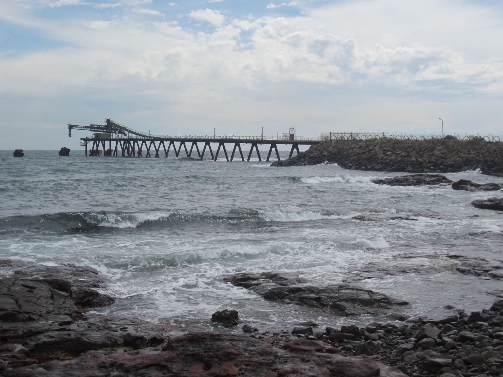 © TrimmerinWiki
The spot
Community-maintained
Community contribution: submitted by Daniel
Know before you go
Logged by the community, confirmed by mods
Moderate risk: Gate closure during fire bans
The reserve gate at the loader may be locked during Total Fire Bans (summer), requiring a longer walk from outside parking.
Low risk: Boat traffic
Fishing and recreational boats operate near the loader; swim with a buoy and stay vigilant.
Low risk: Metal debris and submerged structure
Twisted steel girders, steel-reinforced pylons, anchor chains, and truck tyres litter the bottom close to shore.
Low risk: Grey nurse shark presence
Grey nurse sharks (females and juvenile males) congregate at the end of the loader year-round; they are generally docile but should be treated with respect.
Wildlife Guide
No wildlife notes for this spot yet.
Gallery
1 photo from the community
Getting in
Shore entry
Entry
From Sydney, take the M1 south past Wollongong to Shellharbour. Take the Shellharbour exit onto Shellharbour Road, follow it to the Shellharbour Club intersection, then turn hard right onto Bass Point Tourist Road and follow it to Bass Point Reserve. The Gravel Loader is on the left just before the reserve gate.
Parking & facilities
Park at the old boat ramp area on the eastern side of the loader (the grassy area near the boat ramp). If the reserve gate is locked during fire bans, park outside the gate and walk in.
parkingpicnic_tables
Free
Spot Map
Community
Gallery ┬╖ 1 photos
Trust
Is this spot real, accurate, still loved?
Spots near New South Wales

No nearby spots yet.
Needs verification
Quick verify
One tap helps the community keep this spot honest.
About this data
- Conditions last evaluated
- Spot data last updated
- Data sources
- Open-Meteo (marine & weather conditions), tide predictions via UTide, community contributors (descriptions, hazards, marine life).
- License
- Spot content licensed under CC BY-SA 4.0. How's the Spot is open source.
Weather & swell ┬╖ Open-Meteo marine & weather APIs Tides ┬╖ UTide harmonic analysis Sea & safety ┬╖ community reports