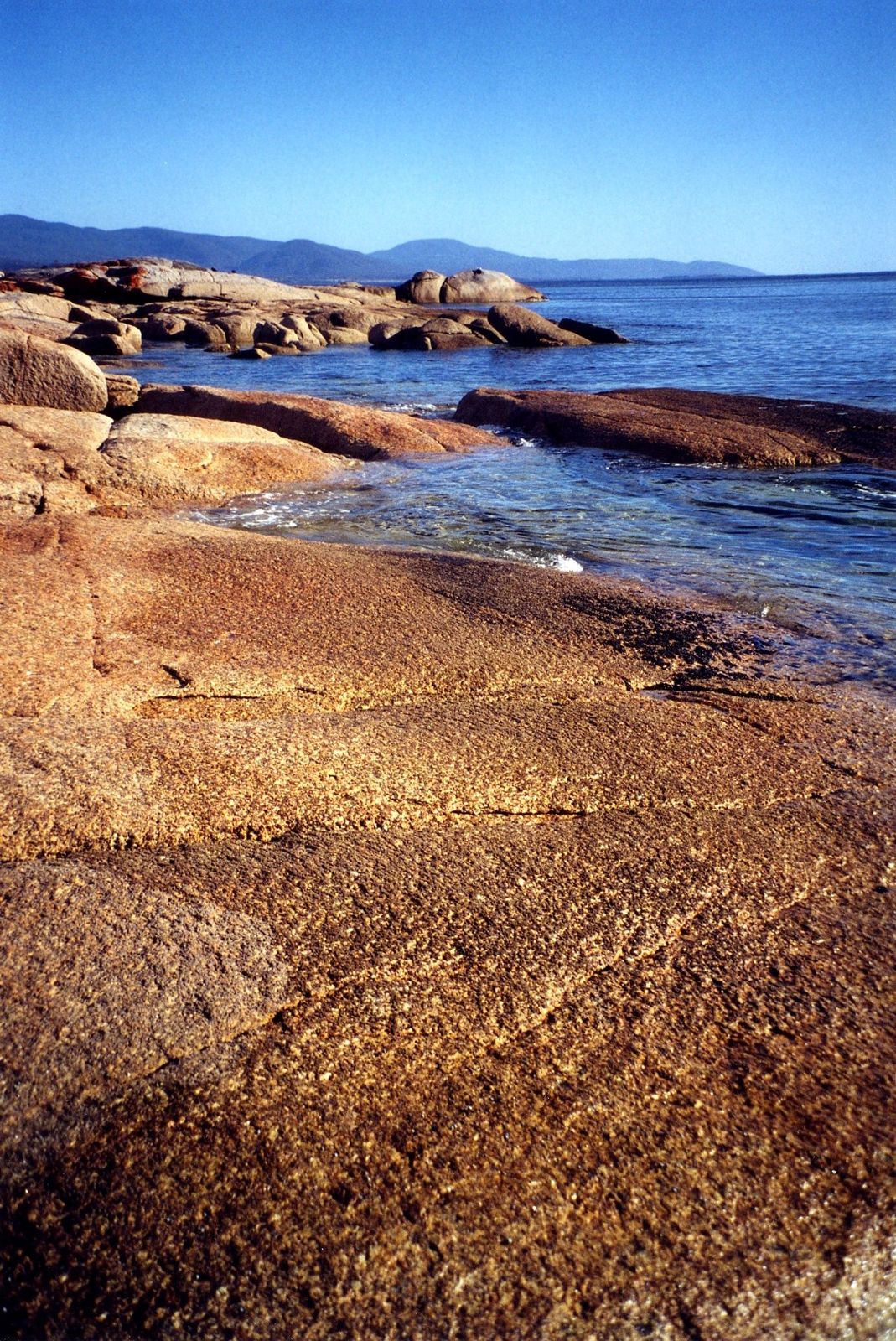
Taylors Beach is a spectacular 3 km sweep of pure white sand and aquamarine water on Tasmania's Bay of Fires coast, north of St Helens. Situated between The Gardens and Sloop Reef, this east-facing beach catches Tasman Sea swells, creating gentle surf and excellent conditions for snorkeling along the rocky reef margins where temperate marine life thrives. The lagoon behind the beach adds ecological diversity, while the crystal-clear waters and striking orange-hued granite boulders typical of the Bay of Fires make this a visually stunning spot for an underwater adventure.
Taylors Beach
IntermediateGO
GO
It's a go.
Showing last known conditions
Wave Height 0.3 mSwell Period 7.8 sWind Speed 9.6 knPrecipitation 3.0 mmTidal Phase slack
Last evaluated
The spot
Community-maintained
Community contribution: submitted by Daniel
Know before you go
Logged by the community, confirmed by mods
Moderate risk: Rip Currents
Multiple rip currents are common along this exposed 3 km beach, especially with east swell.
Moderate risk: Criss-Cross Waves at Sloop Reef Cove
The southern end near Sloop Reef Cove has intersecting wave patterns that make swimming and snorkeling particularly hazardous.
Low risk: Surf Swells
The beach is exposed to east-facing Tasman Sea waves and usually has some surf that can be challenging.
Low risk: Exposed Open Ocean
Open ocean exposure with no reef shelter along the main beach stretch; conditions can change quickly.
Low risk: Surf Conditions
The beach is exposed to easterly swells from the Tasman Sea and usually has some surf, creating unsettled conditions and dumping waves.
Low risk: Rocky Shoreline
Large granite boulders and submerged rocks at the southern end and around Sloop Point present hazards for entry and exit, especially in surf.
Wildlife Guide
No wildlife notes for this spot yet.
Gallery
3 photos from the community
Getting in
Shore entry
Entry
Taylors Beach is located north of St Helens on the Bay of Fires coast. Access via the Tasman Highway (A3) with 7 main road turnouts along the beach, each offering limited parking and a short walk to the sand.
Parking & facilities
Limited parking at 7 road turnouts along the beach; parking is rated as 'fair'.
No fees required.
Spot Map
Community
Gallery ┬╖ 3 photos
Trust
Is this spot real, accurate, still loved?
Spots near Tasmania

No nearby spots yet.
Needs verification
Quick verify
One tap helps the community keep this spot honest.
About this data
- Conditions last evaluated
- Spot data last updated
- Data sources
- Open-Meteo (marine & weather conditions), tide predictions via UTide, community contributors (descriptions, hazards, marine life).
- License
- Spot content licensed under CC BY-SA 4.0. How's the Spot is open source.
Weather & swell ┬╖ Open-Meteo marine & weather APIs Tides ┬╖ UTide harmonic analysis Sea & safety ┬╖ community reports