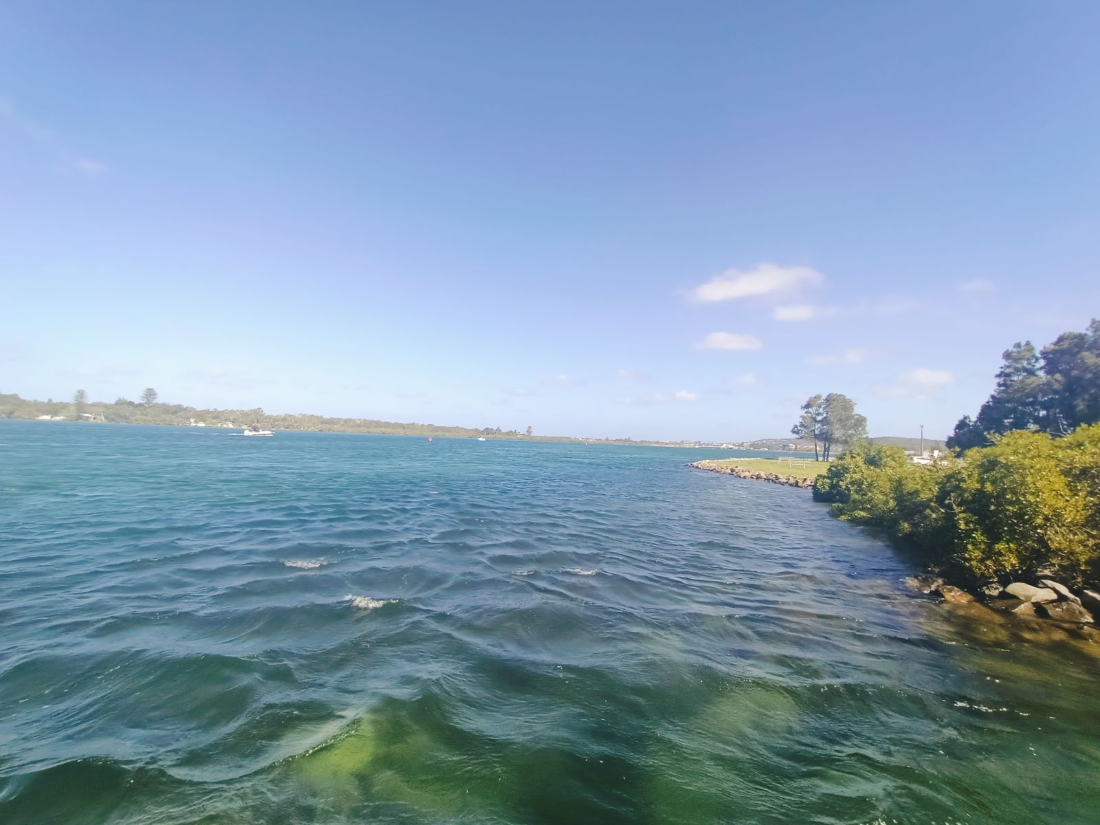
Swansea Channel is the dynamic tidal passage connecting Lake Macquarie to the Pacific Ocean at Swansea, NSW. This unique snorkeling site offers underwater explorers the chance to drift along the channel beneath the historic Swansea Bridge, where abandoned shopping trolleys and pushbikes on the sandy bottom have become artificial reef structures teeming with life. The bridge pylons host colonies of decorator crabs, pineapple fish, large blue eels, fan-bellied leatherjackets, and dazzling nudibranchs. Drift diving on an incoming tide carries snorkelers under the bridge spans from the RSL side into the lake — a thrilling ride past encrusted pillars and curious marine life.
Swansea Channel
AdvancedGO
GO
It's a go.
Showing last known conditions
Wave Height 0.4 mSwell Period 6.4 sWind Speed 7.5 knPrecipitation 1.7 mmTidal Phase flood
Last evaluated
DANGER: Explicit Risks Present
Swansea Channel has hazards marked as danger. Entering the water here means you may face serious risks to your personal safety.
- Strong tidal currents danger
Swansea Channel experiences powerful tidal flows as Lake Macquarie drains and fills. Drift dives are best on incoming tides, but currents can be hazardous for inexperienced snorkelers.
The spot
Community-maintained
Community contribution: submitted by Daniel
Know before you go
Logged by the community, confirmed by mods
High risk: Strong tidal currents
Swansea Channel experiences powerful tidal flows as Lake Macquarie drains and fills. Drift dives are best on incoming tides, but currents can be hazardous for inexperienced snorkelers.
Moderate risk: Boat traffic
The channel is a busy navigation route for boats entering and leaving Lake Macquarie. Snorkelers must be vigilant and stay aware of vessel movements.
Moderate risk: Tidal timing risk
Slack water is essential for safe snorkeling; misjudging the tide can result in being swept out to sea or into the lake. Only snorkel during calm, slack conditions.
Moderate risk: Disorientation under bridge
Navigating between the bridge pylons can be disorienting. Snorkelers must keep track of their position relative to the exit point to avoid surfacing in traffic.
Low risk: Poor visibility after rain
Heavy rainfall in the days prior can reduce visibility to 1–2 m. Ideal conditions see 10 m vis.
Low risk: Sharp debris & underwater obstacles
Shopping trolleys, old pylons, pipes, and dumped gravel on the seabed present entanglement and injury hazards.
Wildlife Guide
No wildlife notes for this spot yet.
Gallery
3 photos from the community
Getting in
Shore entry
Entry
From Sydney, drive 1hr 45min north on the M1 Pacific Motorway to the Swansea exit. Cross the Swansea Bridge and park near the Swansea RSL Club or along Pacific Highway. Enter the water from the shore near the RSL club or the western boat ramp on the channel.
Parking & facilities
Free parking available near Swansea RSL Club and along the Pacific Highway adjacent to the channel.
parkingtoilets
Free public access.
Spot Map
Community
Gallery ┬╖ 3 photos
Trust
Is this spot real, accurate, still loved?
Spots near New South Wales

No nearby spots yet.
Needs verification
Quick verify
One tap helps the community keep this spot honest.
About this data
- Conditions last evaluated
- Spot data last updated
- Data sources
- Open-Meteo (marine & weather conditions), tide predictions via UTide, community contributors (descriptions, hazards, marine life).
- License
- Spot content licensed under CC BY-SA 4.0. How's the Spot is open source.
Weather & swell ┬╖ Open-Meteo marine & weather APIs Tides ┬╖ UTide harmonic analysis Sea & safety ┬╖ community reports