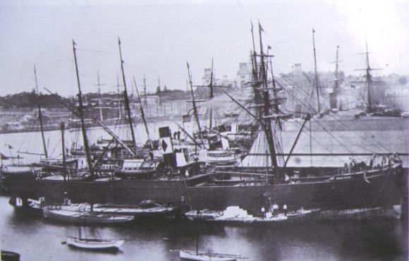
The SS Conside rests on the seabed of Port Phillip Bay off the Mornington Peninsula, a historic iron shipwreck lying in relatively shallow water that advanced snorkelers and divers can explore on calm days. This 19th-century steamship met its fate in the bay, and its broken remains now form an artificial reef encrusted with colourful sponges and soft corals. Located within reach of Melbourne, the wreck offers a rare glimpse into Victoria's maritime history while supporting a surprising array of fish life among the twisted metal and timber.
SS Conside (shipwreck)
AdvancedMAYBE
MAYBE
Fair. Experienced snorkellers only.
Showing last known conditions
Wave Height 0.2 mSwell Period 11 sWind Speed 10 knPrecipitation 39 mmTidal Phase flood
Last evaluated
DANGER: Explicit Risks Present
SS Conside (shipwreck) has hazards marked as danger. Entering the water here means you may face serious risks to your personal safety.
- Boat traffic danger
Located in a busy shipping channel; surface marker buoy essential for safety.
The spot
Community-maintained
Community contribution: submitted by Daniel
Know before you go
Logged by the community, confirmed by mods
High risk: Boat traffic
Located in a busy shipping channel; surface marker buoy essential for safety.
Moderate risk: Strong tidal currents
Tidal flows through Port Phillip Bay can create strong unexpected currents around submerged wreck structures.
Moderate risk: Limited visibility
Sediment stirred by wind and tide can reduce visibility rapidly, making navigation around the wreck challenging.
Moderate risk: Sharp metal debris
Exposed rusted metal plates, cables, and wreckage can cause cuts and entanglement.
Moderate risk: Cold water temperatures
Port Phillip Bay water temperatures range from 11°C in winter to 21°C in summer, requiring a thick wetsuit (7mm+), hood and gloves.
Low risk: Cold water temperature
Victorian waters are cold year-round; significant hypothermia risk without adequate wetsuit protection.
Low risk: Strong currents
Tidal currents in Port Phillip Bay can be strong around wreck structures, especially during tidal changes.
Wildlife Guide
No wildlife notes for this spot yet.
Gallery
1 photo from the community
Getting in
Boat
Entry
The wreck lies offshore in Port Phillip Bay off the Mornington Peninsula coast. Boat access only — launch from Mornington, Dromana, or Sorrento boat ramps. GPS coordinates approximately -38.2288, 145.0600. Best accessed via a guided charter from operators in Melbourne or the Mornington Peninsula.
Parking & facilities
Parking available at public boat ramps in Mornington (Schnapper Point) or Dromana.
parkingboat_ramp
No fee for the site itself; charter tours range from $80–$150 per person.
Spot Map
Community
Gallery ┬╖ 1 photos
Trust
Is this spot real, accurate, still loved?
Spots near Victoria

No nearby spots yet.
Needs verification
Quick verify
One tap helps the community keep this spot honest.
About this data
- Conditions last evaluated
- Spot data last updated
- Data sources
- Open-Meteo (marine & weather conditions), tide predictions via UTide, community contributors (descriptions, hazards, marine life).
- License
- Spot content licensed under CC BY-SA 4.0. How's the Spot is open source.
Weather & swell ┬╖ Open-Meteo marine & weather APIs Tides ┬╖ UTide harmonic analysis Sea & safety ┬╖ community reports