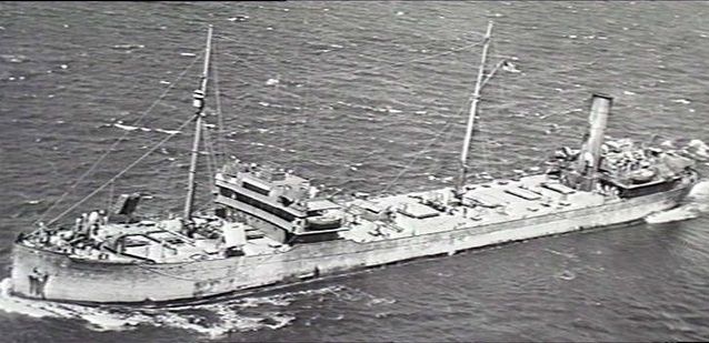
The SS Cities Service Boston (often called the SS Cities Service wreck) is a WWII oil tanker that sank off Bass Point on 16 May 1943 after being battered by massive seas during a violent storm. Today the wreck lies in approximately 25–30 metres of water just off the rocky headland, attracting divers and snorkelers to its scattered, reef-encrusted remains. The site offers a unique blend of maritime history and underwater exploration, with twisted metal plating, engine components, and winch gear now serving as artificial reef habitat. Located within the Bass Point Aquatic Reserve, the calm conditions on the sheltered side can make for good snorkeling over the shallower sections near shore, though the deeper wreckage is best suited to divers. Steel beams and hull fragments rise from a sandy seabed, draped in colourful sponges and soft corals.
SS Cities Service wreck
It's a go.
Showing last known conditions
Last evaluated
The spot
Community-maintained
Community contribution: submitted by Daniel
Know before you go
Logged by the community, confirmed by mods
Moderate risk: Strong swell exposure
The wreck lies off Bass Point, which is exposed to southerly and easterly swells. Rough seas can develop rapidly, especially during storm events.
Moderate risk: Deep water beyond shore snorkeling zone
The main wreckage sits in 25-30m depth — snorkelers should stay in shallower inshore areas near the rocks and avoid venturing over the deeper sections without proper training.
Low risk: Cold water temperatures
South Coast waters can be cold, especially in winter, requiring a thick wetsuit for comfort and safety.
Low risk: Unpredictable currents around Bass Point
Tidal currents and ocean surges can sweep around the point, making conditions challenging for weaker swimmers.
Wildlife Guide
No wildlife notes for this spot yet.
Gallery
1 photo from the community
Getting in
The wreck is located off Bass Point Reserve, Shell Cove, about 15 km south of Wollongong. From the M1 Princes Motorway, take the Shellharbour exit and follow signs to Bass Point Reserve. Park at the reserve carpark and walk down to the rocky shoreline. The shallower sections near the point can be accessed from the shore on calm days; the deeper wreckage requires a boat or a guided dive tour.
Available at Bass Point Reserve car park (gravel/bitumen area, free).
No fee for shore access. Boat-based tours may charge.
Spot Map
Community
Trust
Is this spot real, accurate, still loved?
Spots near New South Wales

No nearby spots yet.
Quick verify
One tap helps the community keep this spot honest.
About this data
- Conditions last evaluated
- Spot data last updated
- Data sources
- Open-Meteo (marine & weather conditions), tide predictions via UTide, community contributors (descriptions, hazards, marine life).
- License
- Spot content licensed under CC BY-SA 4.0. How's the Spot is open source.