South Broulee Cave is the most iconic snorkelling shore entry along the Eurobodalla coast, sitting inside Batemans Marine Park about 20 minutes south of Batemans Bay. The headline attraction is a spectacular 90-metre cave plus a maze of coral-encrusted swim-throughs and holes, all in a shallow, relatively sheltered setting. Look for wobbegongs, Port Jackson sharks, nudibranchs and tropical strays like Moorish idols in summer. Follow the arrows chiselled into the rock from the car park — they guide you straight to the cave entrance. Best explored slowly, with a torch, for the brilliant macro life and twilight ambience.
South Broulee Cave
IntermediateGO
GO
It's a go.
Showing last known conditions
Wave Height 0.4 mSwell Period 6.7 sWind Speed 1.4 knPrecipitation 16 mmTidal Phase flood
Last evaluated
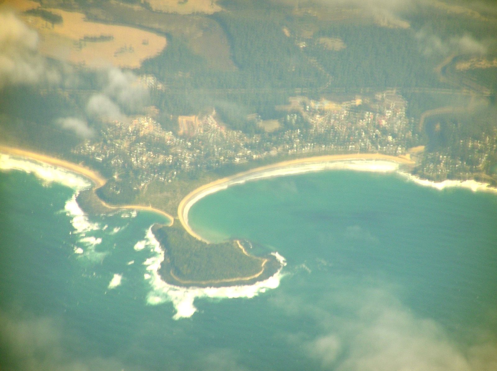 © Graeme Bartlett
The spot
Community-maintained
Community contribution: submitted by Daniel
Know before you go
Logged by the community, confirmed by mods
Moderate risk: Sand spit tidal cut-off
The sand spit connecting Broulee Island to the mainland can be submerged at high tide, stranding snorkellers on the island.
Moderate risk: Cave disorientation risk
The cave is narrow and dark; inexperienced snorkellers can become disoriented. A torch is essential.
Low risk: Ocean swell
Southerly and easterly swells can create surf and strong surge around the island's exposed southern side.
Low risk: Wind chop
Afternoon sea breezes can create choppy conditions on the exposed sides of the island, reducing visibility.
Low risk: Rocky entry
Some entry points have uneven, barnacle-covered rocks; reef shoes recommended to avoid cuts.
Low risk: Marine stingers
Bluebottles and occasional box jellyfish may appear during warmer months after northeasterly winds.
Low risk: Easterly swell and wind
Swell and wind from the east can create choppy conditions and surge around the cave entrance, making entry and exit tricky.
Low risk: Variable visibility
Low visibility (down to 5 m) can occur after rough weather or rainfall, making it easy to lose orientation near the cave.
Low risk: Rocky shoreline entry
Entry/exit over rocks and gravel can be slippery and sharp. Dive boots or reef shoes strongly recommended.
Low risk: Cool water temperatures
Water temps drop to 13-14°C in winter. A 5mm wetsuit with hood is recommended year-round.
Low risk: Swell and surf break
Broulee Beach can experience shore break and easterly swells that create turbulent conditions near the entry point.
Low risk: Rocky reef and urchins
Submerged rocky ridges and crevices are home to sea urchins with sharp spines; wear booties or fins when entering over rocks.
Low risk: Wind chop on easterly breeze
Easterly and north-easterly winds can quickly chop the surface and reduce visibility, especially in the afternoon.
Wildlife Guide
No wildlife notes for this spot yet.
Gallery
4 photos from the community
Getting in
Shore entry
Entry
From Batemans Bay, drive 20 minutes south on George Bass Drive to Broulee. Turn onto Heath Street and follow to the end where the Surf Club car park is located. Chiselled arrows on the rocks from the steps point the way toward the cave.
Parking & facilities
Surf Club car park at the end of Heath Street, Broulee. Free parking available.
parking
Free
Spot Map
Community
Gallery ┬╖ 4 photos
Trust
Is this spot real, accurate, still loved?
Spots near Victoria

No nearby spots yet.
Needs verification
Quick verify
One tap helps the community keep this spot honest.
About this data
- Conditions last evaluated
- Spot data last updated
- Data sources
- Open-Meteo (marine & weather conditions), tide predictions via UTide, community contributors (descriptions, hazards, marine life).
- License
- Spot content licensed under CC BY-SA 4.0. How's the Spot is open source.
Weather & swell ┬╖ Open-Meteo marine & weather APIs Tides ┬╖ UTide harmonic analysis Sea & safety ┬╖ community reports