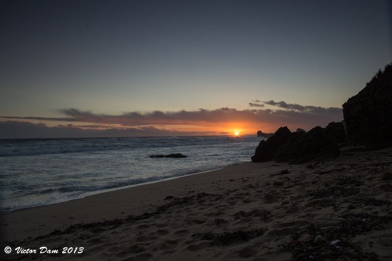
Sorrento Back Beach (also known as Cheviot Beach) sits on the wild ocean side of the Mornington Peninsula within Mornington Peninsula National Park, about 1.5 km south of Sorrento. Backed by low coastal heath and dramatic cliffs, this exposed surf beach offers superb snorkelling around its rocky reef platforms and caves, with abundant kelp forests and rock pools that shelter colourful marine life. At low tide the caves off St Pauls Road become accessible and the water clears beautifully, making it a favourite among those who know where to look. The beach is reached via a staircase or ramp and has plenty of parking, though it can get busy during peak periods.
Sorrento Back Beach (Cheviot Beach)
IntermediateMAYBE
MAYBE
Fair. Experienced snorkellers only.
Showing last known conditions
Wave Height 0.7 mSwell Period 12 sWind Speed 2.1 knPrecipitation 35 mmTidal Phase flood
Last evaluated
DANGER: Explicit Risks Present
Sorrento Back Beach (Cheviot Beach) has hazards marked as danger. Entering the water here means you may face serious risks to your personal safety.
- Rip Currents danger
Powerful and unpredictable rip currents are common along this open ocean beach, especially during summer. Swim only between the flags when lifeguards are present.
- Unpredictable Rips danger
Strong, unpredictable rip currents are common. Swim only between the flags when lifeguards are present.
- Unpredictable rip currents danger
Strong, unpredictable rips are common along this exposed ocean beach and can quickly pull swimmers and snorkellers offshore.
The spot
Community-maintained
Community contribution: submitted by Daniel
Know before you go
Logged by the community, confirmed by mods
High risk: Rip Currents
Powerful and unpredictable rip currents are common along this open ocean beach, especially during summer. Swim only between the flags when lifeguards are present.
High risk: Unpredictable Rips
Strong, unpredictable rip currents are common. Swim only between the flags when lifeguards are present.
High risk: Unpredictable rip currents
Strong, unpredictable rips are common along this exposed ocean beach and can quickly pull swimmers and snorkellers offshore.
Moderate risk: Large Waves
Southerly swells from Bass Strait produce strong surf and large waves that can knock snorkelers into rocks.
Moderate risk: Changing Tide Conditions
Rock pools and ledges change rapidly with the tide. Snorkelers can become trapped or disoriented as incoming tide covers exit points.
Moderate risk: Ocean swell and waves
Waves average 1.6 m over the outer reefs and can surge suddenly. Conditions change rapidly with wind shifts.
Moderate risk: Strong winds
South-westerly winds can pick up quickly. Only safe with light northerly to north-easterly winds. Northerly winds for 3-4 days prior are ideal.
Moderate risk: Large Waves & Dumping Surf
Powerful Southern Ocean swell with large, dumping waves that can disorient snorkellers and push swimmers into rocks.
Moderate risk: Rocky Reef & Caves
Submerged rocky reef platforms and sea caves, especially off St Pauls Road, pose collision and entrapment hazards.
Moderate risk: Rapidly changing conditions
Weather and sea conditions at this exposed back beach can change suddenly, especially with southerly or south-westerly winds.
Moderate risk: Large Waves & Surf
Back Beach receives powerful Bass Strait swells, creating large breaking waves that can knock swimmers over and create turbulent conditions.
Moderate risk: Changing Tides
Tidal movements can rapidly cut off access to rock pools and ledges, stranding unwary explorers as the tide rises.
Low risk: Rocky Entry
Access to water is over uneven, slippery rock platforms and boulders. Sharp edges and barnacles present a cutting hazard.
Low risk: Rock ledges and uneven terrain
Sharp rock platforms and uneven surfaces below the waterline require careful footing, especially at low tide when exploring rock pools.
Low risk: Slippery Rock Ledges
The rock platforms and ledges explored at low tide become extremely slippery when wet, posing a slip-and-fall hazard.
Wildlife Guide
No wildlife notes for this spot yet.
Gallery
3 photos from the community
Getting in
Shore entry
Entry
Located 1.5 km south of Sorrento town centre on the Mornington Peninsula. From Melbourne, take the M3 and then the Mornington Peninsula Freeway (M11) south to Sorrento. Follow St Pauls Road to the end, then take the short walking track and staircase/ramp down to the beach.
Parking & facilities
Plenty of car parking available at the end of St Pauls Road, though it can fill up quickly during summer peak periods and weekends.
parkingtoilets
No entry fee. Part of Mornington Peninsula National Park (Parks Victoria).
Spot Map
Community
Gallery ┬╖ 3 photos
Trust
Is this spot real, accurate, still loved?
Spots near Victoria

No nearby spots yet.
Needs verification
Quick verify
One tap helps the community keep this spot honest.
About this data
- Conditions last evaluated
- Spot data last updated
- Data sources
- Open-Meteo (marine & weather conditions), tide predictions via UTide, community contributors (descriptions, hazards, marine life).
- License
- Spot content licensed under CC BY-SA 4.0. How's the Spot is open source.
Weather & swell ┬╖ Open-Meteo marine & weather APIs Tides ┬╖ UTide harmonic analysis Sea & safety ┬╖ community reports