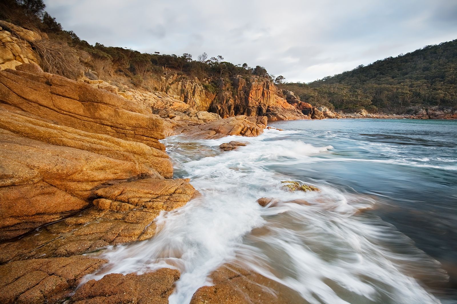
Tucked within Freycinet National Park on Tasmania's east coast, Sleepy Bay is a sheltered rocky bay famed for its turquoise waters and striking orange lichen-encrusted granite boulders. A short 10-minute walk from Cape Tourville Road leads you to a wooden-fenced lookout and down to the water's edge, where calm, protected waters create ideal conditions for snorkelling and diving. At low tide, spectacular rockpools emerge, trapping small fish and other marine life for close-up exploration. The vibrant contrast of aquamarine sea against the pink-hued Hazards mountain range makes this one of Tasmania's most photogenic snorkelling spots.
Sleepy Bay
BeginnerGO
GO
It's a go.
Showing last known conditions
Wave Height 0.0 mSwell Period 5.3 sWind Speed 0.8 knPrecipitation 1.8 mmTidal Phase slack
Last evaluated
The spot
Community-maintained
Community contribution: submitted by Daniel
Know before you go
Logged by the community, confirmed by mods
Moderate risk: Slippery granite rocks
Granite boulders and rocks can be extremely slippery, especially when wet, making entry and exit treacherous.
Low risk: Low tide rock platform hazards
Sharp barnacles and uneven rock platform terrain exposed at low tide can cause cuts and falls.
Low risk: Swell and surge
Occasional southerly swells can create unexpected surges in the bay, pushing swimmers against rocks.
Wildlife Guide
No wildlife notes for this spot yet.
Gallery
1 photo from the community
Getting in
Shore entry
Entry
From Coles Bay township, drive east along Freycinet Drive, then turn onto Cape Tourville Road. Follow Cape Tourville Road for approximately 4 km to reach the small carpark and signed track entrance for Sleepy Bay on the left.
Parking & facilities
Small gravel carpark on Cape Tourville Road with limited spaces. Arrive early in peak season (summer) to secure a spot.
parking
Freycinet National Park entry fee applies. A valid Parks Pass (per vehicle or per person) is required — available at the park entrance booth or online.
Spot Map
Community
Gallery ┬╖ 1 photos
Trust
Is this spot real, accurate, still loved?
Spots near Tasmania

No nearby spots yet.
Needs verification
Quick verify
One tap helps the community keep this spot honest.
About this data
- Conditions last evaluated
- Spot data last updated
- Data sources
- Open-Meteo (marine & weather conditions), tide predictions via UTide, community contributors (descriptions, hazards, marine life).
- License
- Spot content licensed under CC BY-SA 4.0. How's the Spot is open source.
Weather & swell ┬╖ Open-Meteo marine & weather APIs Tides ┬╖ UTide harmonic analysis Sea & safety ┬╖ community reports