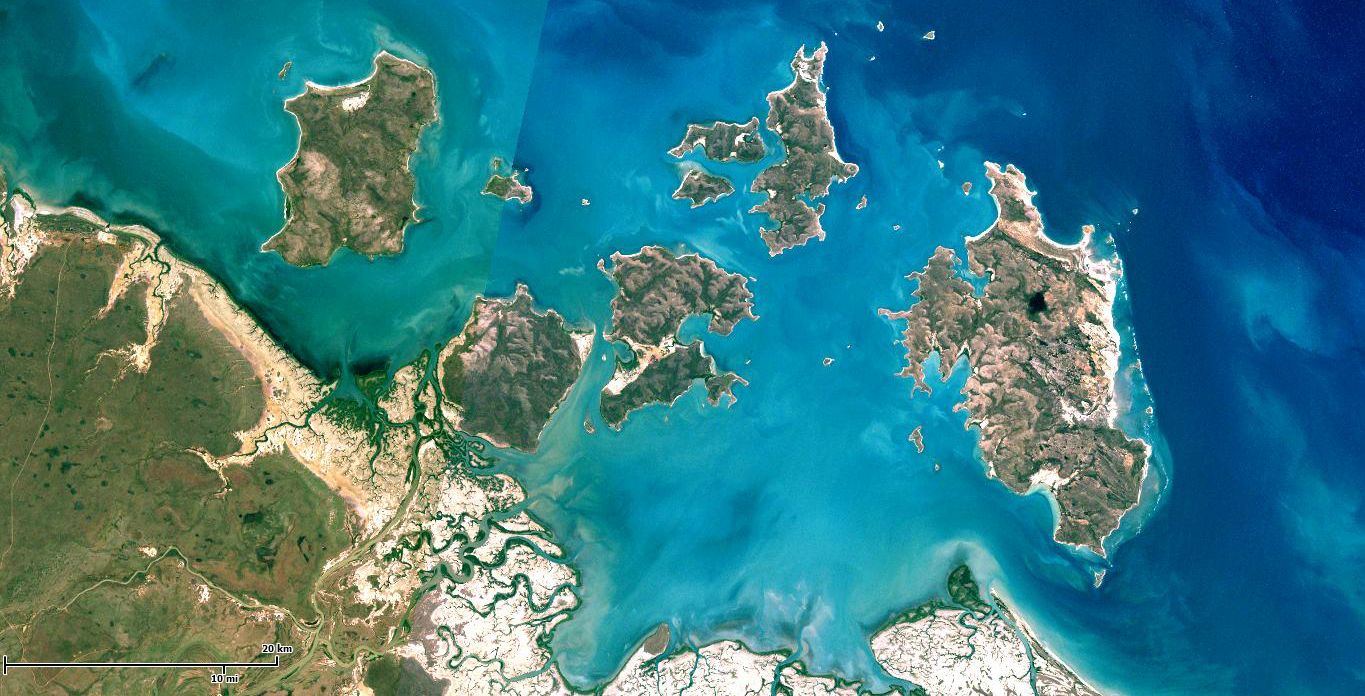
The Sir Edward Pellew Group of Islands is a remote archipelago of sandstone islands in the southwestern Gulf of Carpentaria, off the Northern Territory coast. The group includes Vanderlin, North, Centre, West, and South West Islands, with stunning turquoise bays, sandy beaches, and fringing reefs. The waters are rich with marine life, including sea turtles (green and flatback) that nest on the beaches. North Island is home to Barranyi (North Island) National Park, offering wilderness camping at Paradise Bay and Mud Bay. This is an untouched, wild destination for adventurous snorkelers seeking solitude and pristine coral habitats.
Sir Edward Pellew Group of Islands
AdvancedGO
GO
It's a go.
Showing last known conditions
Wave Height 0.1 mSwell Period 4.2 sWind Speed 5.9 knPrecipitation 2.1 mmTidal Phase ebb
Last evaluated
DANGER: Explicit Risks Present
Sir Edward Pellew Group of Islands has hazards marked as danger. Entering the water here means you may face serious risks to your personal safety.
- Saltwater crocodiles danger
Saltwater crocodiles inhabit the McArthur River estuary and may be encountered in coastal waters around the islands.
The spot
Community-maintained
Community contribution: submitted by Daniel
Know before you go
Logged by the community, confirmed by mods
High risk: Saltwater crocodiles
Saltwater crocodiles inhabit the McArthur River estuary and may be encountered in coastal waters around the islands.
Moderate risk: Remote boat access only
Accessible only by boat across open Gulf waters with strong tidal currents, winds, and large tidal ranges. A 35 km journey from the McArthur River mouth.
Moderate risk: Strong tidal currents
Strong tidal flows through the Carrington Channel and around the islands, particularly during spring tides.
Moderate risk: Box jellyfish (stinger season)
Box jellyfish (Chironex fleckeri) are present in Gulf waters during the warmer months.
Low risk: Extreme heat and isolation
Extreme heat and limited shade on the islands, plus no freshwater sources outside of campground supplies.
Wildlife Guide
No wildlife notes for this spot yet.
Gallery
1 photo from the community
Getting in
Boat
Entry
Access is by boat only, via a 35 km journey along the McArthur River and Carrington Channel from Borroloola to reach Gulf waters. The nearest town is Borroloola, approximately 700 km south-east of Darwin via the Carpentaria Highway.
Parking & facilities
No formal parking on the islands. Visitors launch from Borroloola or boat ramps along the McArthur River.
toiletsdrinking_waterpicnic_tables
Camping fees apply; permits must be booked online before visiting. Visits to Aboriginal land may require a negotiated fee with the Yanyuwa people.
Spot Map
Community
Gallery ┬╖ 1 photos
Trust
Is this spot real, accurate, still loved?
Spots near Northern Territory

No nearby spots yet.
Needs verification
Quick verify
One tap helps the community keep this spot honest.
About this data
- Conditions last evaluated
- Spot data last updated
- Data sources
- Open-Meteo (marine & weather conditions), tide predictions via UTide, community contributors (descriptions, hazards, marine life).
- License
- Spot content licensed under CC BY-SA 4.0. How's the Spot is open source.
Weather & swell ┬╖ Open-Meteo marine & weather APIs Tides ┬╖ UTide harmonic analysis Sea & safety ┬╖ community reports