Sheltered within the azure waters of Port Stephens and set against the dramatic backdrop of Tomaree Headland, Shoal Bay is a stunning 2.5 km crescent of calm, aquamarine water perfect for snorkelers of all levels. The extensive seagrass meadows near the shore teem with life — search for cuttlefish, pipefish, seahorses, and flathead hiding in the shallows. Snorkel around the historic jetty to see small schooling fish, or paddle further out for stingrays, dolphins, and the occasional resident fairy penguin. The calm conditions, gentle entry, and easy access from the sandy beach make this one of the most family-friendly snorkeling spots on the NSW Mid North Coast.
Shoal Bay
BeginnerMAYBE
MAYBE
Fair. Experienced snorkellers only.
Showing last known conditions
Wave Height 0.0 mSwell Period 0.0 sWind Speed 1.8 knPrecipitation 0.0 mmTidal Phase slack
Last evaluated
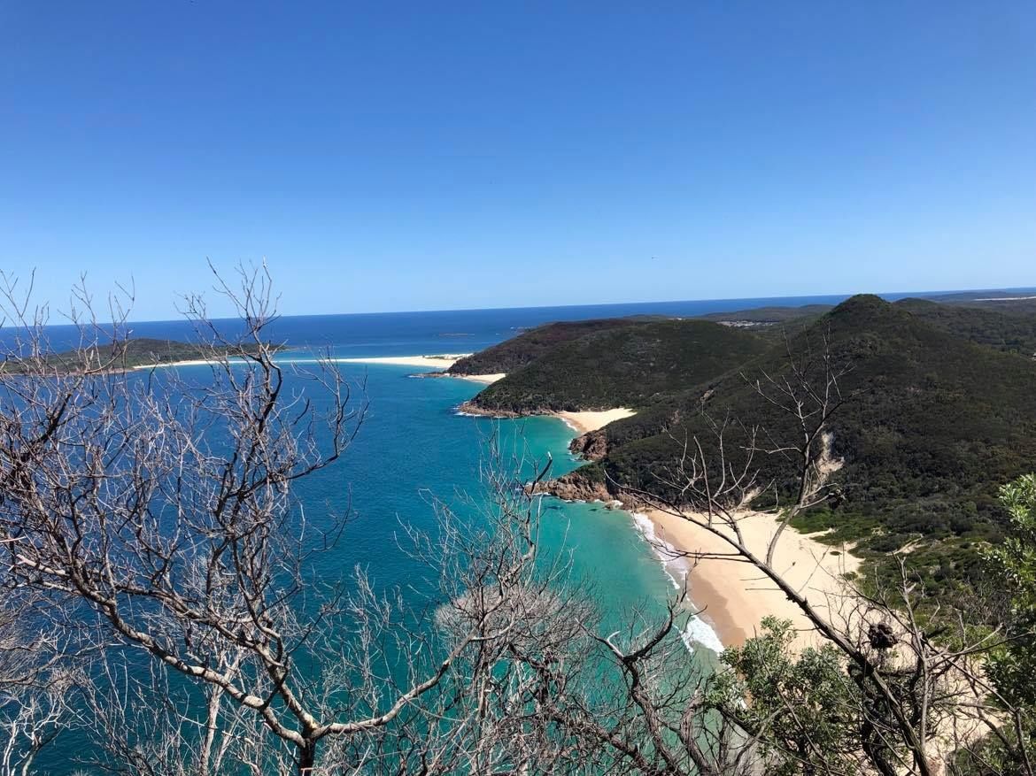 © Lkos8608
The spot
Community-maintained
Community contribution: submitted by Daniel
Know before you go
Logged by the community, confirmed by mods
Low risk: Boat traffic near jetty
The Shoal Bay jetty area sees regular boat and kayak traffic. Snorkelers should stay aware and avoid the immediate jetty approach zone.
Low risk: Shallow seagrass areas
Extensive seagrass meadows extend from the shore. Snorkelers can scrape knees or elbows on hidden sandbars and grass in very low tide.
Wildlife Guide
No wildlife notes for this spot yet.
Gallery
1 photo from the community
Getting in
Shore entry
Entry
Shoal Bay is a 2 hr 45 min drive north of Sydney via the M1 and Pacific Highway, then take the Nelson Bay Road. From Newcastle Airport, it's a 40-minute drive northeast. Public buses connect Shoal Bay with Nelson Bay and surrounding towns. The main beach stretches along Shoal Bay Road with multiple access points.
Parking & facilities
Street parking is available along Shoal Bay Road and nearby side streets. Several small public car parks are located near the beach reserve and the jetty area.
toiletsparkingpicnic_tablesdrinking_watershowers
Free entry. No fees for beach access.
Spot Map
Community
Gallery ┬╖ 1 photos
Trust
Is this spot real, accurate, still loved?
Spots near New South Wales

No nearby spots yet.
Needs verification
Quick verify
One tap helps the community keep this spot honest.
About this data
- Conditions last evaluated
- Spot data last updated
- Data sources
- Open-Meteo (marine & weather conditions), tide predictions via UTide, community contributors (descriptions, hazards, marine life).
- License
- Spot content licensed under CC BY-SA 4.0. How's the Spot is open source.
Weather & swell ┬╖ Open-Meteo marine & weather APIs Tides ┬╖ UTide harmonic analysis Sea & safety ┬╖ community reports