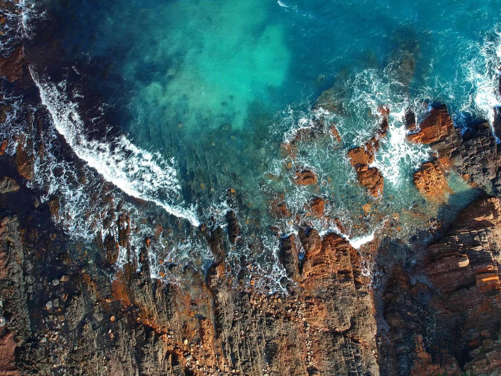
Tucked between rolling green hills and sheer cliff faces on the Fleurieu Peninsula, Second Valley is a stunning coastal gem about 90 minutes south of Adelaide. The sheltered sandy beach gives way to rocky headlands, a historic jetty, and dramatic underwater caves and swim-throughs. The main draw is Lasseter's Reef, a thriving bommie 400 m offshore teeming with fish. Closer in, the boulder-strewn western shoreline, seagrass meadows, and a large cave entrance offer endless exploration for confident snorkellers. Conditions here are exposed to wind and swell, so pick a calm day for the best visibility and safety.
Second Valley Beach / Second Valley Reef
IntermediateMAYBE
MAYBE
Fair. Experienced snorkellers only.
Showing last known conditions
Wave Height 0.1 mSwell Period 8.6 sWind Speed 1.6 knPrecipitation 35 mmTidal Phase ebb
Last evaluated
The spot
Community-maintained
Community contribution: submitted by Daniel
Know before you go
Logged by the community, confirmed by mods
Moderate risk: Strong currents around the point
Moderate to strong currents can develop around the rocky headland to the left of the jetty, especially on outgoing tides. Swim near the turn of tide for safest conditions.
Moderate risk: Swell and wind exposure
This is an exposed site; southerly and westerly winds produce dangerous conditions. Best snorkelled when wind is under 15 km/h from the east or north, with swell under 1 m.
Moderate risk: Long swim to Lasseter's Reef
The best reef is approximately 400 m offshore. Only strong, fit swimmers should attempt this swim. Fatigue can be a serious hazard on the return leg.
Moderate risk: Strong Currents
Tidal currents can be strong around the point and on the swim to Lasseter's Reef. Best snorkeled at slack tide or on minimal tidal movement.
Moderate risk: Swell and Exposed Conditions
Second Valley faces north and is exposed to wind and swell. Southerly or westerly winds create poor visibility and dangerous conditions. Best when wind is under 15 km/h and swell under 1 m.
Moderate risk: Strong tidal currents
Moderate to strong currents can develop around the rocky point and jetty, especially on outgoing tides.
Moderate risk: Fishing lines and hooks
The jetty is heavily used by anglers; submerged fishing line and hooks pose an entanglement risk.
Moderate risk: Southerly/westerly swell
Exposed to southerly and westerly winds which can quickly reduce visibility and create challenging conditions.
Low risk: Sharp rocks at entry points
The path over the rocks to the left of the jetty requires reef shoes. Bare feet risk cuts from sharp oyster-encrusted boulders.
Low risk: Cold water temperatures
Water temperature ranges only 17–22 °C year-round. Hypothermia risk without a wetsuit, even in summer.
Low risk: Fishing Lines at Jetty
The jetty is popular with fishers; submerged fishing lines and tackle pose entanglement hazards for snorkelers.
Low risk: Cold Water Temperature
Water temperatures range from 17–22°C year-round. Even in summer a wetsuit is recommended to avoid cold exposure.
Low risk: Rocky Entry Points
The path to the left of the jetty involves traversing jagged rocks to reach the water. Reef shoes essential.
Low risk: Sharp rocks
Entry from the rocky path left of the jetty requires reef shoes; rocks are sharp and slippery.
Wildlife Guide
No wildlife notes for this spot yet.
Gallery
6 photos from the community
Getting in
Shore entry
Entry
From Adelaide, drive south on the M1 to Yankalilla, then follow Second Valley Road to the coast (approx 90 minutes). The road ends at the jetty carpark. The beach is flanked on both sides of the jetty. A rocky path leads left of the jetty to access the caves and points.
Parking & facilities
Small car park at the end of the road near the jetty (fills early on summer weekends). Overflow parking along the road opposite the caravan park.
toiletspicnic_tablesparking
No entry fee. Parking is free.
Spot Map
Community
Gallery ┬╖ 6 photos
Trust
Is this spot real, accurate, still loved?
Spots near South Australia

No nearby spots yet.
Needs verification
Quick verify
One tap helps the community keep this spot honest.
About this data
- Conditions last evaluated
- Spot data last updated
- Data sources
- Open-Meteo (marine & weather conditions), tide predictions via UTide, community contributors (descriptions, hazards, marine life).
- License
- Spot content licensed under CC BY-SA 4.0. How's the Spot is open source.
Weather & swell ┬╖ Open-Meteo marine & weather APIs Tides ┬╖ UTide harmonic analysis Sea & safety ┬╖ community reports