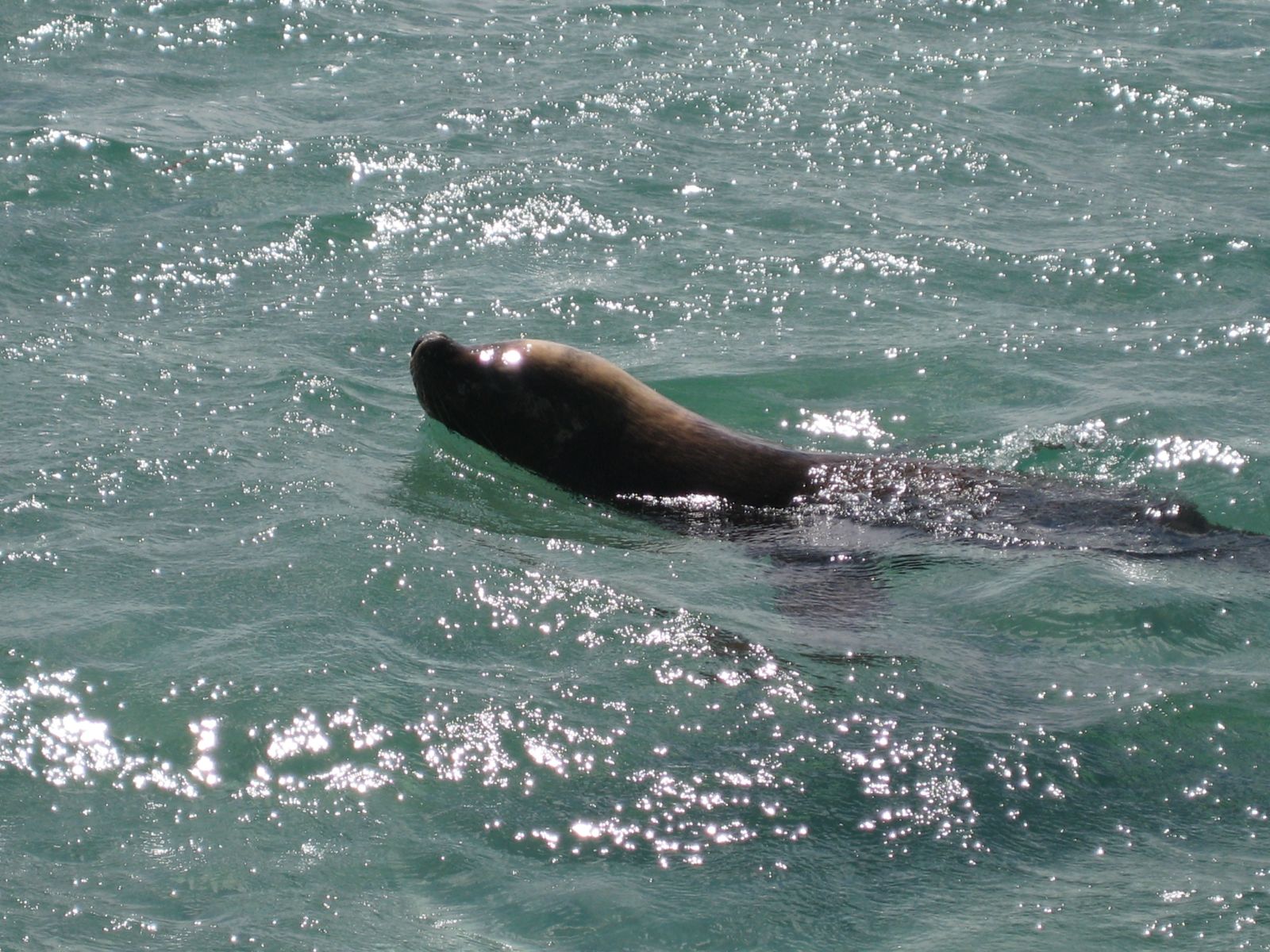
Seal Island, part of the Shoalwater Islands Marine Park 55 minutes south of Perth, is a premier snorkeling destination renowned for close encounters with wild Australian sea lions. This small limestone island sits 900 metres offshore, surrounded by clear waters 3–8 metres deep with gentle sandy-bottom terrain. The snorkeling itself is relaxed — you float near the sheltered eastern shore and wait for curious sea lions to swim right up to you. The real adventure is the crossing: kayak, boat, or a guided tour is required to reach the island. Along the way you may spot dolphins and, in season, migrating humpback whales. The experience is all about patient wildlife interaction rather than coral gardens, making it a truly unique Western Australian snorkel trip.
Seal Island Dive Sites
Fair. Experienced snorkellers only.
Showing last known conditions
Last evaluated
The spot
Community-maintained
Community contribution: submitted by Daniel
Know before you go
Logged by the community, confirmed by mods
Moderate risk: Open water crossing
Seal Island is 900 m offshore — kayakers and swimmers must be capable of crossing open water with variable conditions.
Moderate risk: Afternoon sea breeze
Westerly winds strengthen by midday, creating waves and chop that make the return crossing more challenging.
Moderate risk: Wildlife exclusion zone
Yellow buoys mark a 10 m exclusion zone around the island. Do not cross — sea lions are protected and can be unpredictable at close range.
Moderate risk: Afternoon sea breeze and chop
Westerly winds strengthen around midday, creating waves and reducing visibility. The return crossing to the mainland can become hazardous in a kayak.
Moderate risk: Summer sea breeze and chop
Strong afternoon westerlies are common from spring through summer, making the 900m return crossing challenging.
Low risk: Boat traffic
The area is used by tour boats, private vessels, and kayaks. Tour boats get priority at mooring points — stay vigilant near buoys.
Low risk: Boating traffic
Tour boats have priority at mooring points. Swimmers and kayakers must stay clear of approaching vessels.
Low risk: Wildlife protection buoys
Yellow buoys mark a 10-metre exclusion zone around the island. Entering this zone is prohibited to protect hauled-out sea lions.
Low risk: Tidal currents between islands
Strong tidal currents can flow between the islands and the mainland, particularly during outgoing tides. Paddlers and swimmers should plan trips around slack water.
Low risk: Boat traffic in crossing channel
Vessels, including kayak tour groups and private boats, operate in the channel between Seal Island and the mainland. Stay vigilant for boat traffic.
Low risk: Cold water temperature
Winter water temperatures can drop to 18°C, increasing the risk of cold-water shock or hypothermia during extended snorkels. A wetsuit (3 mm or thicker) is strongly recommended from June to September.
Low risk: Protective sea lions on beach
Australian sea lions, while generally docile, may become defensive if approached too closely or if their escape route to the beach is blocked. Maintain a minimum distance of 10 m and do not separate adults from pups.
Low risk: Southerly swell and wind exposure
The western side of the island is exposed to prevailing southerly winds and swells, creating rougher conditions.
Wildlife Guide
No wildlife notes for this spot yet.
Gallery
5 photos from the community
Getting in
Seal Island is 900 m offshore from Shoalwater, ~55–60 minutes south of Perth. The closest mainland launch point is Shoalwater Foreshore Reserve on Arcadia Drive. Alternatively, launch a private boat from Point Peron. There are no jetties at the island.
Car park available at Shoalwater Reserve on Arcadia Drive, near the closest mainland point to Seal Island.
Free if kayaking from the mainland. Guided tours and wildlife cruises from ~$80 per person; kayak tours $175–$200.
Spot Map
Community
Trust
Is this spot real, accurate, still loved?
Spots near Western Australia

No nearby spots yet.
Quick verify
One tap helps the community keep this spot honest.
About this data
- Conditions last evaluated
- Spot data last updated
- Data sources
- Open-Meteo (marine & weather conditions), tide predictions via UTide, community contributors (descriptions, hazards, marine life).
- License
- Spot content licensed under CC BY-SA 4.0. How's the Spot is open source.