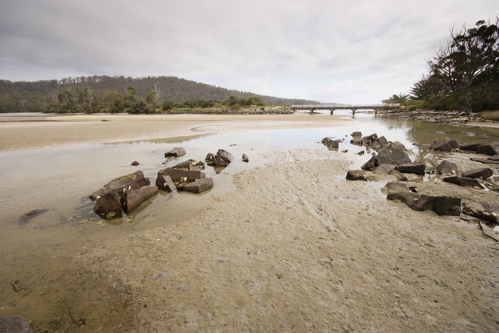
Sayers Beach is a remote, pristine sandy beach located within the Cockle Creek precinct at the southern end of the Recherche Bay Nature Recreation Area in far-south Tasmania. As one of Australia's southernmost accessible beaches, it offers a wild, temperate snorkeling experience amid clear, cool waters shaped by the Southern Ocean. The beach is bordered by low coastal vegetation and backed by eucalypt forest, creating a serene, off-grid atmosphere. Its sheltered position within Recherche Bay provides calm conditions ideal for shore-entry snorkeling when weather permits, with sandy-bottom flats giving way to seagrass beds and rocky reef edges where diverse temperate marine life congregates.
Sayers Beach
IntermediateMAYBE
MAYBE
Fair. Experienced snorkellers only.
Showing last known conditions
Wave Height 0.2 mSwell Period 13 sWind Speed 3.5 knPrecipitation 2.7 mmTidal Phase slack
Last evaluated
The spot
Community-maintained
Community contribution: submitted by Daniel
Know before you go
Logged by the community, confirmed by mods
Moderate risk: Weather changes
Southerly weather can arrive rapidly, bringing wind chop and reduced visibility.
Moderate risk: Remote location - limited services
Remote location with no mobile reception, shops, or services; injuries or emergencies require self-rescue or lengthy travel to Southport.
Moderate risk: Remote location
Limited mobile reception and very few services; medical emergencies require a long drive back to Hobart (2+ hours).
Low risk: Cold water temperature
Tasmanian waters are cold year-round; wetsuit (5mm+ recommended) is essential even in summer.
Low risk: No lifeguard patrol
There are no lifeguard services at Cockle Creek; swimmers snorkel at their own risk.
Low risk: Creek mouth tidal flow
Strong tidal movement in the channel near the creek mouth during outgoing tide, particularly on larger spring tides.
Low risk: Cold water temperatures
Cool temperate waters year-round; prolonged exposure can lead to cold shock without adequate wetsuit protection.
Low risk: Changing tides and currents
Recherche Bay experiences tidal flows that can shift when the tide turns, especially near the creek mouth.
Low risk: Strong Onshore Winds
Sudden westerly or southerly winds can whip up chop and reduce visibility in Recherche Bay.
Low risk: Strong ocean swells
Exposed to Southern Ocean swells, the beach can experience powerful surf and rip currents, particularly in windy conditions.
Low risk: Strong Southerly Winds
Sudden southerly wind changes can create choppy conditions and reduce visibility rapidly.
Low risk: Outgoing Tide Current
Flow from Cockle Creek can create a moderate outgoing current across the beach area during king tides.
Wildlife Guide
No wildlife notes for this spot yet.
Gallery
8 photos from the community
Getting in
Shore entry
Entry
From Hobart, drive south on the Huon Highway (A6) through Geeveston to the end of the road at Cockle Creek (approx. 2 hours). Cross the bridge over Cockle Creek; Sayers Beach is the first sandy beach on the left (east) side of the road, within the Recherche Bay Nature Recreation Area. The road is sealed to Cockle Creek, then gravel for the final short section.
Parking & facilities
Limited roadside parking is available adjacent to the beach along Cockle Creek Road. No dedicated car park. Spaces fill quickly during summer and holiday periods.
toilets
No entry fee. Camping fees apply if staying at designated sites within the Cockle Creek precinct (payable on-site).
Spot Map
Community
Gallery ┬╖ 8 photos
Trust
Is this spot real, accurate, still loved?
Spots near Tasmania

No nearby spots yet.
Needs verification
Quick verify
One tap helps the community keep this spot honest.
About this data
- Conditions last evaluated
- Spot data last updated
- Data sources
- Open-Meteo (marine & weather conditions), tide predictions via UTide, community contributors (descriptions, hazards, marine life).
- License
- Spot content licensed under CC BY-SA 4.0. How's the Spot is open source.
Weather & swell ┬╖ Open-Meteo marine & weather APIs Tides ┬╖ UTide harmonic analysis Sea & safety ┬╖ community reports