Sawtell Beach and its adjacent headland form a stunning snorkeling destination on the North Coast NSW, sheltered by a small offshore island and rocky reef. The calm, shallow waters of Sawtell Bay — the southern side of the island — are ideal for families and beginner snorkelers, offering clear conditions and gentle wave action. The headland features an ocean pool (Sawtell Memorial Pool) constantly refreshed by crashing waves, plus tidal rock pools teeming with small marine life. With a backdrop of lush headland walks and panoramic coastal views, this protected spot combines easy shore access with rich underwater exploration.
Sawtell Beach / Sawtell Headland
BeginnerGO
GO
It's a go.
Showing last known conditions
Wave Height 0.5 mSwell Period 6.3 sWind Speed 2.6 knPrecipitation 0.0 mmTidal Phase flood
Last evaluated
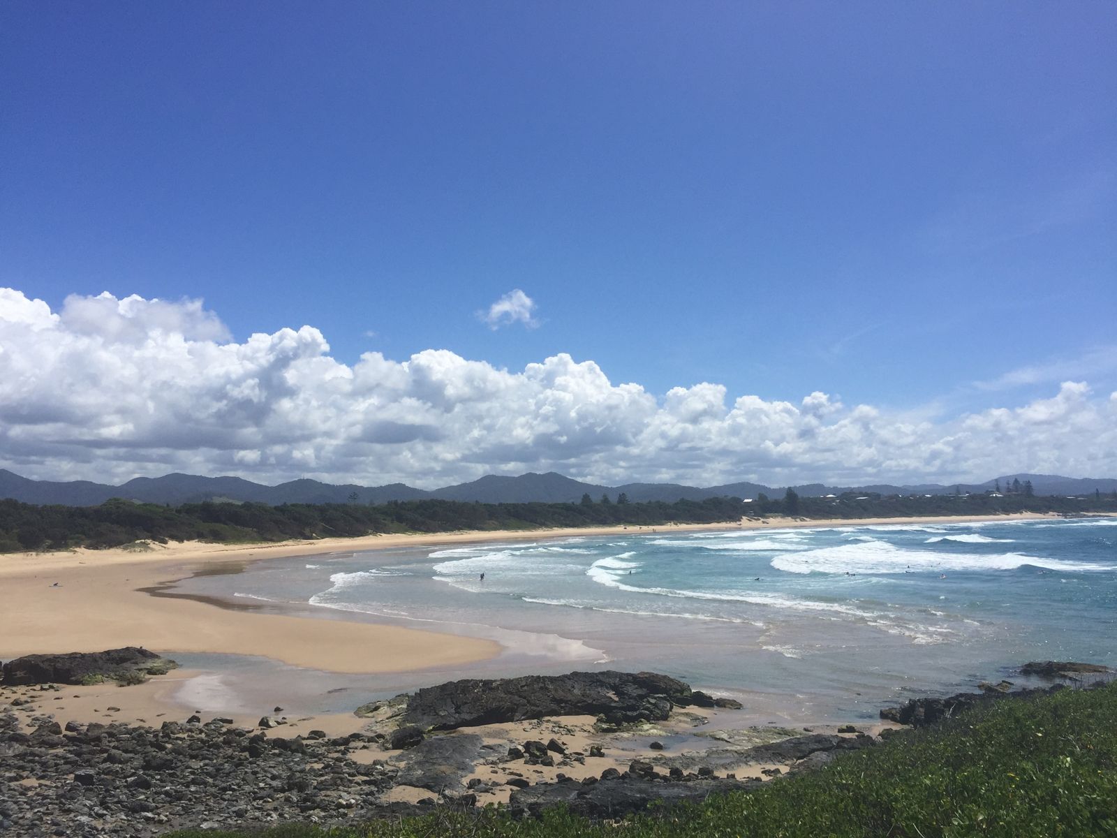 © Peter borley
The spot
Community-maintained
Community contribution: submitted by Daniel
Know before you go
Logged by the community, confirmed by mods
Moderate risk: Bluebottle Jellyfish
Bluebottle jellyfish (Physalia physalis) are common on north-coast NSW beaches during warmer months, particularly after onshore winds.
Moderate risk: Rip Currents
Unpatrolled sections of Sawtell Beach can experience rip currents; always swim between the flags during patrol hours (September–April).
Moderate risk: Unpatrolled beach
The Bay and Sawtell Island area are not patrolled by lifeguards — swim with caution and keep an eye on conditions.
Moderate risk: Outgoing tide current around Sawtell Island
Tidal flows can create strong currents around the island reef, especially on an outgoing tide. Swimmers and snorkelers should be aware of being swept around the island.
Moderate risk: Southerly swell waves
Sawtell Island and Main Beach can receive substantial south swells (2–11 ft), producing powerful surf and dumping waves that create hazardous conditions for snorkelers, particularly in winter.
Moderate risk: Unpatrolled area
Sailors Bay and Sawtell Island are not patrolled by lifeguards — no flags or supervision. Snorkelers are entirely responsible for their own safety.
Low risk: Tidal Currents Around Island
The sheltered area around Sawtell Island (Sailors Bay) is best accessed at low tide; outgoing tidal currents can create flow around the island channel.
Low risk: Surf Break
The main beach has a consistent surf break year-round with occasional strong shore dumps, especially at mid-to-high tide on the open beach.
Low risk: Swell waves at headland
The exposed headland and ocean pool can experience wave surge, especially on days with larger swells. Stick to the sheltered bay side of the island.
Low risk: Marine stingers
Bluebottles and other jellyfish can be present in warmer months, particularly after northerly winds.
Low risk: Boats in launching area
A boat ramp near the island means occasional boat traffic near the swimming/snorkeling zone. Stay clear of the ramp area.
Low risk: Sharp rocks at island entry
The jump-off rocks around the island are sharp, vertically-aligned strata — care needed when entering or exiting the water.
Low risk: Outgoing tide current
The bay can experience gentle current flow around the island during outgoing tides, especially near the channel between the island and shore.
Low risk: Sharp rock platform entry
The jump-off rocks around Sawtell Island are composed of sharp, vertically aligned strata. Care is needed when entering and exiting the water to avoid cuts.
Low risk: Unpatrolled snorkel zone
Sawtell Island and Bay are not patrolled by lifeguards. Snorkelers should exercise caution and check conditions before entering.
Low risk: Rocky reef / Sawtell Island
Sharp rocks and reef platforms around the island and at the jump-off points, especially hazardous when entering or exiting the water.
Wildlife Guide
No wildlife notes for this spot yet.
Gallery
2 photos from the community
Getting in
Shore entry
Entry
Sawtell is located 10 km south of Coffs Harbour on the Pacific Highway. Turn off at Sawtell Road and follow to the beach. The main beach access is via First Avenue, with additional access to the island and headland from Boronia Street at the base of Bonville Headland.
Parking & facilities
Formal parking available near the Sawtell Surf Life Saving Club on First Avenue (free/paid depending on season) and at the Boronia Street carpark near the island and headland. A reserve parking fee (approx. $8) applies in some lots during peak periods.
toiletsshowersparkingpicnic_tablesboat_ramp
Most parking is free outside peak season; paid parking (approx. $8/day) applies in the reserve lots during school holidays and summer.
Spot Map
Community
Gallery ┬╖ 2 photos
Trust
Is this spot real, accurate, still loved?
Spots near New South Wales

No nearby spots yet.
Needs verification
Quick verify
One tap helps the community keep this spot honest.
About this data
- Conditions last evaluated
- Spot data last updated
- Data sources
- Open-Meteo (marine & weather conditions), tide predictions via UTide, community contributors (descriptions, hazards, marine life).
- License
- Spot content licensed under CC BY-SA 4.0. How's the Spot is open source.
Weather & swell ┬╖ Open-Meteo marine & weather APIs Tides ┬╖ UTide harmonic analysis Sea & safety ┬╖ community reports