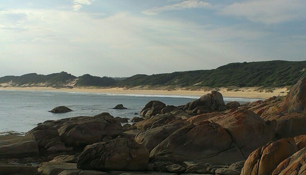
Nestled within Cape Conran Coastal Park on Victoria's stunning Wilderness Coast, Salmon Rocks Beach offers a small, 50-metre break in the rugged rock platform where the Southern Ocean crashes against exposed reef. This west-facing cove is prized for its clear waters, abundant rock pools to explore, and its position as the launching point for abalone divers. The dramatic contrast of granite boulders, sandy shore, and offshore reef creates a unique snorkeling environment that combines sheltered inshore pools with deeper water just beyond the break.
Salmon Rocks / Salmon Beach
IntermediateMAYBE
MAYBE
Fair. Experienced snorkellers only.
Showing last known conditions
Wave Height 0.2 mSwell Period 9.4 sWind Speed 9.9 knPrecipitation 43 mmTidal Phase flood
Last evaluated
 © ProfCockington
The spot
Community-maintained
Community contribution: submitted by Daniel
Know before you go
Logged by the community, confirmed by mods
Moderate risk: Swell waves breaking on reef
Exposed west-facing aspect means large swells can create dangerous breaking waves over the offshore reef.
Moderate risk: Strong inshore currents
Sweep along the exposed coastline and can be unpredictable around the rock break.
Low risk: Slippery rocks
Rock platform and boulders become extremely slippery when wet, particularly around the shoreline and pools.
Wildlife Guide
No wildlife notes for this spot yet.
Gallery
1 photo from the community
Getting in
Shore entry
Entry
Located within Cape Conran Coastal Park, approximately 12 km south of Marlo on the Princes Highway. Follow the signs to Cape Conran and the Salmon Rocks car park.
Parking & facilities
Car park available at Salmon Rocks within Cape Conran Coastal Park. A small parking fee applies (Parks Victoria vehicle entry fee).
parkingtoiletspicnic_tablesboat_ramp
Parks Victoria vehicle entry fee applies for Cape Conran Coastal Park.
Spot Map
Community
Gallery ┬╖ 1 photos
Trust
Is this spot real, accurate, still loved?
Spots near Victoria

No nearby spots yet.
Needs verification
Quick verify
One tap helps the community keep this spot honest.
About this data
- Conditions last evaluated
- Spot data last updated
- Data sources
- Open-Meteo (marine & weather conditions), tide predictions via UTide, community contributors (descriptions, hazards, marine life).
- License
- Spot content licensed under CC BY-SA 4.0. How's the Spot is open source.
Weather & swell ┬╖ Open-Meteo marine & weather APIs Tides ┬╖ UTide harmonic analysis Sea & safety ┬╖ community reports