Nestled within Cape Conran Coastal Park on Victoria's pristine Wilderness Coast, Salmon Rocks is a small, exposed 50 m cove tucked between rocky headlands. The real snorkeling magic lies just offshore where waves break over a sandstone reef system, carving out shallow slots and gutters between the rocks. On calm days, crystal-clear waters reveal intricate rock formations and sea caves teeming with fish. The site also hosts the area's only boat ramp and jetty, making it a launch point for exploring the broader marine park. Its west-facing aspect means conditions change quickly, rewarding those who pick a flat, still day.
Salmon Rocks
IntermediateSKIP
SKIP
Poor conditions. Stay out today.
Showing last known conditions
Wave Height 1.5 mSwell Period 7.2 sWind Speed 8.1 knPrecipitation 62 mmTidal Phase ebb
Last evaluated
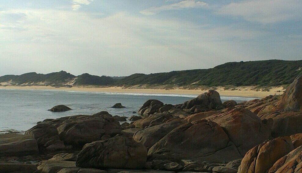 © ProfCockington
The spot
Community-maintained
Community contribution: submitted by Daniel
Know before you go
Logged by the community, confirmed by mods
Moderate risk: Swell and Surf Break
Exposed west-facing beach with waves breaking on an offshore reef, creating strong surf conditions and surge around the rocks.
Moderate risk: Rip Currents
Unpatrolled beach with no lifeguards; unpredictable rips can develop, especially around the rocky headland and boat ramp area.
Moderate risk: Rough surf & wind chop
Exposed west-facing aspect picks up prevailing winds and swells, creating rough waves and challenging conditions even on moderate days.
Moderate risk: Southern Ocean swell
Exposed to Southern Ocean swells that can create strong shore dumps and rip currents, especially during larger swell events.
Low risk: Rocky Shore and Reef
Snorkel entry is over uneven granite boulders and reef; sharp rocks and slippery surfaces present cutting and fall hazards.
Low risk: Remote Location
Isolated coastal park with limited mobile reception and no immediate emergency services; self-reliance is essential.
Low risk: Changing Weather Conditions
Bass Strait weather can shift rapidly with sudden wind changes, fog, and cold water temperatures even in summer.
Low risk: Reef & rock slots
Snorkelers can become trapped or scraped in narrow rock slots/gutters if swell picks up; entry and exit over rocks can be slippery.
Low risk: Strong outgoing tide
Tidal flow through the gutters and around the boat ramp jetty can create strong currents, especially on an outgoing tide.
Low risk: Cold water temperatures
The water in East Gippsland is cool year-round, typically 12–18°C, increasing risk of cold shock and hypothermia without proper wetsuit.
Wildlife Guide
No wildlife notes for this spot yet.
Gallery
1 photo from the community
Getting in
Shore entry
Entry
Located within Cape Conran Coastal Park, approximately 20 km south of Marlo on the Princes Highway (turn off at Cape Conran Road). Follow the signs to the Salmon Rocks day-use area and boat ramp.
Parking & facilities
Designated gravel carpark adjacent to the boat ramp and jetty at Salmon Rocks day-use area.
parkingboat_ramptoiletspicnic_tables
A Parks Victoria vehicle entry fee applies to Cape Conran Coastal Park (check current rates).
Spot Map
Community
Gallery ┬╖ 1 photos
Trust
Is this spot real, accurate, still loved?
Spots near Victoria

No nearby spots yet.
Needs verification
Quick verify
One tap helps the community keep this spot honest.
About this data
- Conditions last evaluated
- Spot data last updated
- Data sources
- Open-Meteo (marine & weather conditions), tide predictions via UTide, community contributors (descriptions, hazards, marine life).
- License
- Spot content licensed under CC BY-SA 4.0. How's the Spot is open source.
Weather & swell ┬╖ Open-Meteo marine & weather APIs Tides ┬╖ UTide harmonic analysis Sea & safety ┬╖ community reports