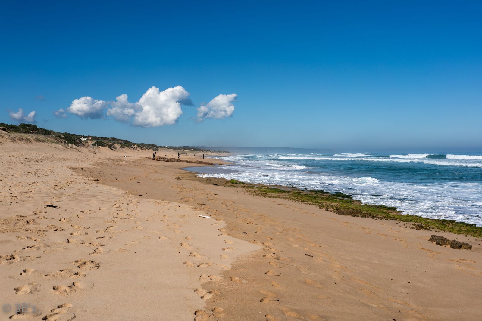
Stretching 4 km along the wild Bass Strait side of the Mornington Peninsula, Rye Ocean Beach sits within Mornington Peninsula National Park. Unlike the calm bay waters of nearby Rye Pier, this is an unpatrolled surf beach where powerful waves pound numerous reef breaks — a dramatic setting of natural sand dunes, coastal heath, and deep-blue swells. The exposed southern aspect means conditions are best in summer calm, though the raw beauty and solitude (even when the car park fills) make it a memorable spot for experienced snorkelers and body-surfers willing to read the conditions carefully.
Rye Ocean Beach
AdvancedSKIP
SKIP
Poor conditions. Stay out today.
Showing last known conditions
Wave Height 1.4 mSwell Period 12 sWind Speed 3.0 knPrecipitation 31 mmTidal Phase flood
Last evaluated
DANGER: Explicit Risks Present
Rye Ocean Beach has hazards marked as danger. Entering the water here means you may face serious risks to your personal safety.
- Powerful surf waves danger
Unpatrolled surf beach with strong swell and numerous reef breaks; only for confident swimmers.
- No lifeguard patrol danger
This beach is not patrolled — no lifesaving services available.
The spot
Community-maintained
Community contribution: submitted by Daniel
Know before you go
Logged by the community, confirmed by mods
High risk: Powerful surf waves
Unpatrolled surf beach with strong swell and numerous reef breaks; only for confident swimmers.
High risk: No lifeguard patrol
This beach is not patrolled — no lifesaving services available.
Moderate risk: Rip currents
Strong rip currents are common along this exposed coastline, especially near reef points.
Low risk: Cold water temperature
Bass Strait waters are cold year-round; wetsuit essential even in summer.
Wildlife Guide
No wildlife notes for this spot yet.
Gallery
1 photo from the community
Getting in
Shore entry
Entry
From Melbourne, take the M1/M3 to the Mornington Peninsula Freeway (M11) south through to Rye. Turn south onto Sandy Road and follow to the end where the large car park and toilet block are located.
Parking & facilities
Large formal car park at the end of Sandy Road (Sandy Beach Road). Additional smaller car park on Diamond Bay Road with walking track and staircase down to the beach. Eastern end accessible via dune walking tracks from Ocean Drive.
toiletsparkingpicnic_tables
Free entry (within Mornington Peninsula National Park)
Spot Map
Community
Gallery ┬╖ 1 photos
Trust
Is this spot real, accurate, still loved?
Spots near Victoria

No nearby spots yet.
Needs verification
Quick verify
One tap helps the community keep this spot honest.
About this data
- Conditions last evaluated
- Spot data last updated
- Data sources
- Open-Meteo (marine & weather conditions), tide predictions via UTide, community contributors (descriptions, hazards, marine life).
- License
- Spot content licensed under CC BY-SA 4.0. How's the Spot is open source.
Weather & swell ┬╖ Open-Meteo marine & weather APIs Tides ┬╖ UTide harmonic analysis Sea & safety ┬╖ community reports