Rocky Point is a striking granite headland on the Cape to Cape Track, near Eagle Bay in the Margaret River region of Western Australia's Southwest Capes. This exposed snorkeling spot features clear waters washing over a rocky reef platform with granite boulders, shallow pools, and gutters. Part of the Ngari Capes Marine Park, it offers a wild, off-the-beaten-path experience where oceanic swells surge around the point. Best on calm, low-swell days, the underwater terrain is a mosaic of boulders, sand patches, and kelp beds.
Rocky Point
IntermediateSKIP
SKIP
Poor conditions. Stay out today.
Showing last known conditions
Wave Height 1.3 mSwell Period 11 sWind Speed 2.5 knPrecipitation 1.1 mmTidal Phase ebb
Last evaluated
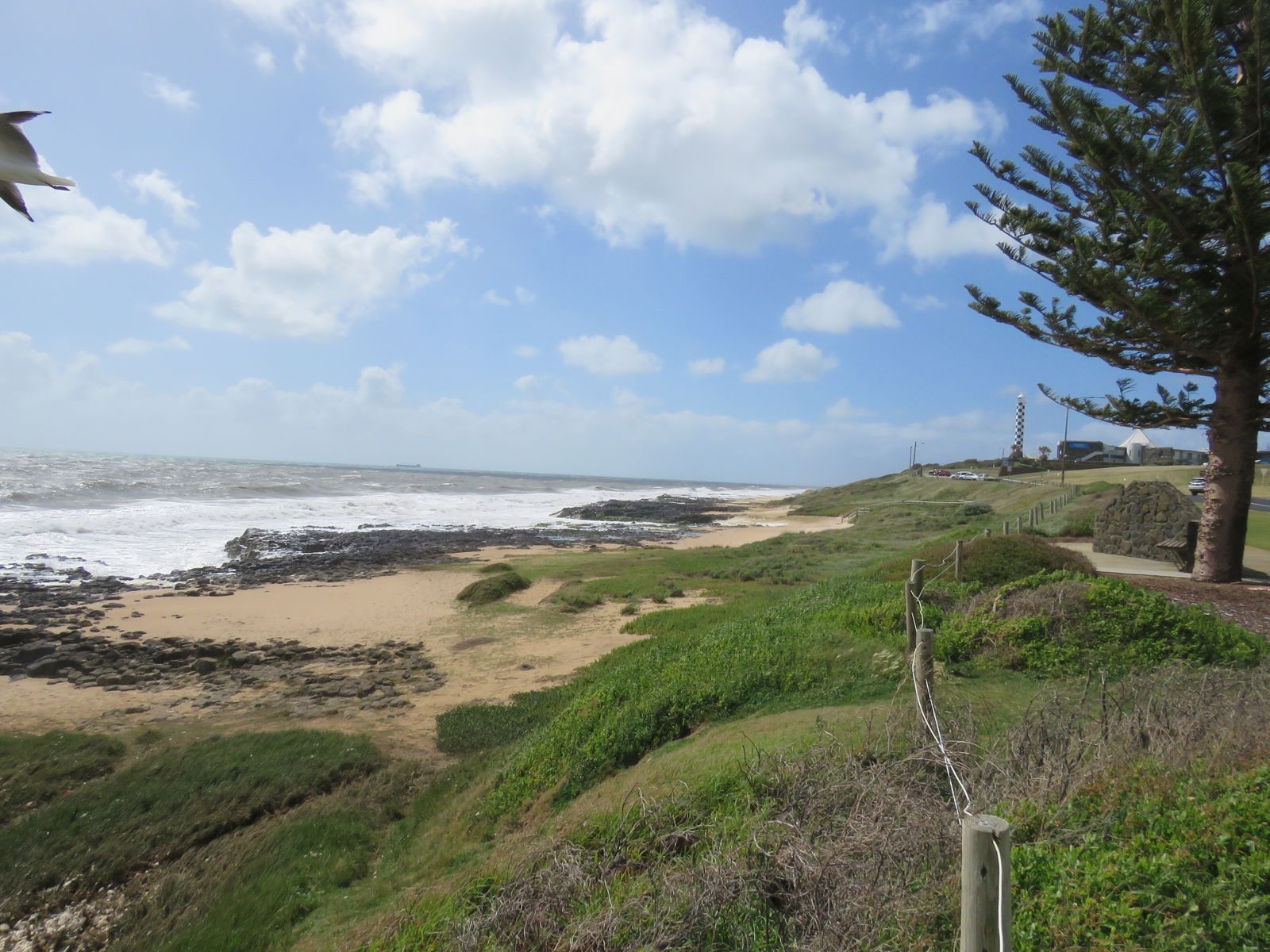 © Calistemon
The spot
Community-maintained
Community contribution: submitted by Daniel
Know before you go
Logged by the community, confirmed by mods
Moderate risk: Oceanic swell and surge
Exposed headland receives significant swell; surging waves around rocks can push snorkelers into granite boulders
Moderate risk: Strong currents
Tidal currents and rip-like flows can develop around the point, especially on outgoing tide
Low risk: Sharp reef and barnacles
Exposed granite and encrusted barnacles can cause cuts and abrasions on entry/exit
Low risk: Limited shore access
Rocky shoreline with no sandy beach; entry and exit require scrambling over boulders
Wildlife Guide
No wildlife notes for this spot yet.
Gallery
3 photos from the community
Getting in
Shore entry
Entry
Located along Eagle Bay Road (Meelup Reserve area) south of Dunsborough. The Cape to Cape Track passes directly by Rocky Point. Park at the Eagle Bay parking area and follow the coastal walking trail north approx. 500 m to the point.
Parking & facilities
Limited roadside parking at Eagle Bay near the Meelup Reserve trailhead. Can fill up quickly on weekends and summer holidays.
Free
Spot Map
Community
Gallery ┬╖ 3 photos
Trust
Is this spot real, accurate, still loved?
Spots near Western Australia

No nearby spots yet.
Needs verification
Quick verify
One tap helps the community keep this spot honest.
About this data
- Conditions last evaluated
- Spot data last updated
- Data sources
- Open-Meteo (marine & weather conditions), tide predictions via UTide, community contributors (descriptions, hazards, marine life).
- License
- Spot content licensed under CC BY-SA 4.0. How's the Spot is open source.
Weather & swell ┬╖ Open-Meteo marine & weather APIs Tides ┬╖ UTide harmonic analysis Sea & safety ┬╖ community reports