Nestled on the eastern side of Wilsons Promontory in Victoria, Refuge Cove is a remote, pristine beach accessible only by foot via a multi-day hike or by boat. This sheltered crescent of white sand is flanked by granite boulders and offers calm, clear waters perfect for snorkeling. The lack of road access keeps crowds minimal, rewarding those who make the journey with a wild, untouched coastal setting framed by tea-tree scrub and towering eucalypts. The cove's protected aspect means it often lies flat when other beaches are rough, making it a true hidden gem along the Prom's rugged coastline.
Refuge Cove
IntermediateSKIP
SKIP
Poor conditions. Stay out today.
Showing last known conditions
Wave Height 0.1 mSwell Period 14 sWind Speed 17 knPrecipitation 21 mmTidal Phase flood
Last evaluated
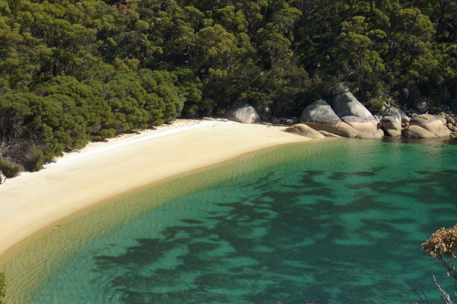 © Gburch
The spot
Community-maintained
Community contribution: submitted by Daniel
Know before you go
Logged by the community, confirmed by mods
Moderate risk: Remote location
Accessible only by boat or a long hike — no roads, no emergency services nearby. Carry adequate supplies and a first aid kit.
Moderate risk: Variable weather and swell
Exposed to Bass Strait weather; southerly swells can roll in quickly, creating strong shore breaks and making exit difficult.
Moderate risk: Limited mobile reception
No reliable phone coverage in the cove. Communication is difficult in an emergency.
Wildlife Guide
No wildlife notes for this spot yet.
Gallery
5 photos from the community
Getting in
Boat
Entry
Refuge Cove is located on the eastern side of Wilsons Promontory, about 30 km southeast of Tidal River. By sea, it is a popular stop for kayakers and boaters launching from Tidal River or Yanakie. By foot, it is reached via the 19 km徒步 from Tidal River along the Promontory Track (overnight hike required, with permits needed for camping). There is no vehicle access.
Parking & facilities
Park at the Tidal River visitor area or Yanakie boat ramp. No parking at the cove itself.
toilets
Parks Victoria entry fees apply to Wilsons Promontory National Park. Camping at Refuge Cove requires a permit and booking.
Spot Map
Community
Gallery ┬╖ 5 photos
Trust
Is this spot real, accurate, still loved?
Spots near Victoria

No nearby spots yet.
Needs verification
Quick verify
One tap helps the community keep this spot honest.
About this data
- Conditions last evaluated
- Spot data last updated
- Data sources
- Open-Meteo (marine & weather conditions), tide predictions via UTide, community contributors (descriptions, hazards, marine life).
- License
- Spot content licensed under CC BY-SA 4.0. How's the Spot is open source.
Weather & swell ┬╖ Open-Meteo marine & weather APIs Tides ┬╖ UTide harmonic analysis Sea & safety ┬╖ community reports