Ransons Beach is a pristine, sandy stretch within the Waterhouse Conservation Area on Tasmania's north-east coast, offering calm, sheltered temperate waters ideal for shore-entry snorkeling. The beach backs onto low coastal dunes and heathland, with the shallow nearshore waters revealing sandy patches interspersed with rocky reef habitat. Its remote, uncrowded setting means you can often have the whole bay to yourself, floating above views of seaweed gardens and the occasional stingray or flathead ghosting across the sand. The clear, cool waters here provide a glimpse into Tasmania's unique temperate marine environment without the crowds of more famous spots.
Ransons Beach
BeginnerGO
GO
It's a go.
Showing last known conditions
Wave Height 0.3 mSwell Period 4.2 sWind Speed 1.4 knPrecipitation 9.1 mmTidal Phase flood
Last evaluated
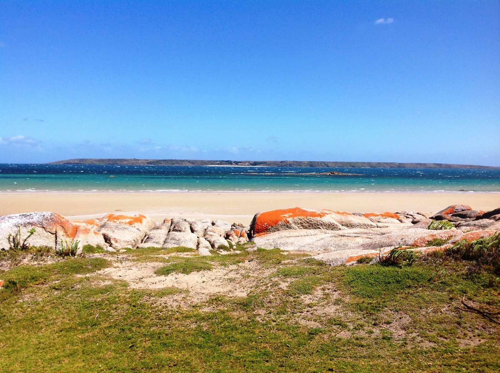 © ElPhantomero
The spot
Community-maintained
Community contribution: submitted by Daniel
Know before you go
Logged by the community, confirmed by mods
Moderate risk: Seasonal Road Closure
Access road to Ransons Beach is closed to all traffic from 1 December until after Easter each year.
Moderate risk: Variable weather and swell
Bass Strait conditions change rapidly; strong winds and sudden swells can create dangerous surf conditions, especially in winter and spring.
Moderate risk: Rip currents
Shallow beach with shifting sandbars can produce unpredictable rip currents, especially after swell events.
Low risk: Cold Water Temperatures
Tasmanian temperate waters are cold year-round (typically 12-18°C), requiring a wetsuit for comfort and safety.
Low risk: Limited Facilities
No drinking water, shops, or services on-site; visitors must be fully self-sufficient.
Low risk: Remote Location
Limited mobile phone reception and distance from emergency services; snorkel with a buddy.
Low risk: Rough access road
The unsealed road to Ransons Beach is rough and requires careful driving, especially in wet weather. Not suitable for low-clearance vehicles.
Low risk: Strong winds and choppy seas
The north-east coast is exposed to Bass Strait weather. Southerly and easterly winds can whip up waves and reduce visibility quickly.
Low risk: Snakes
Tiger snakes and copperheads are common in the coastal heath and dune vegetation behind the beach during warmer months (October to April).
Wildlife Guide
No wildlife notes for this spot yet.
Gallery
2 photos from the community
Getting in
Shore entry
Entry
From Launceston, head north-east on the Tasman Highway (A3) towards Scottsdale. Take the Bridport/Tomahawk Road (B82) north to Tomahawk, then follow Waterhouse Road into the Waterhouse Conservation Area. Ransons Beach is signposted off Homestead Road near the north end of the conservation area. The final section is unsealed but accessible to 2WD vehicles outside the closure period (closed 1 Dec–Easter).
Parking & facilities
Unsealed parking area near the beach. No designated marked bays but sufficient space for vehicles and campervans. First come, first served.
toiletsparking
No fees apply. Camping and day-use are free.
Spot Map
Community
Gallery ┬╖ 2 photos
Trust
Is this spot real, accurate, still loved?
Spots near Tasmania

No nearby spots yet.
Needs verification
Quick verify
One tap helps the community keep this spot honest.
About this data
- Conditions last evaluated
- Spot data last updated
- Data sources
- Open-Meteo (marine & weather conditions), tide predictions via UTide, community contributors (descriptions, hazards, marine life).
- License
- Spot content licensed under CC BY-SA 4.0. How's the Spot is open source.
Weather & swell ┬╖ Open-Meteo marine & weather APIs Tides ┬╖ UTide harmonic analysis Sea & safety ┬╖ community reports