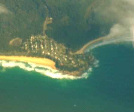
Potato Point, 9 km east of Bodalla on the NSW South Coast, is a wild and exposed headland where snorkellers can suddenly find themselves enveloped in swirling schools of kingfish or salmon. The rocky shoreline and offshore reefs offer thrilling encounters with wobbegongs, stingrays, and Port Jackson sharks. The nearby boat ramp provides easy shore entry, but this is a spot reserved for confident swimmers — when the swell is up, the ocean here demands respect.
Potato Point
IntermediateGO
GO
It's a go.
Showing last known conditions
Wave Height 0.5 mSwell Period 6.5 sWind Speed 7.5 knPrecipitation 14 mmTidal Phase flood
Last evaluated
 © Graeme Bartlett
DANGER: Explicit Risks Present
Potato Point has hazards marked as danger. Entering the water here means you may face serious risks to your personal safety.
- Rip currents danger
Rocky headland with strong rips forming around the point, especially on an outgoing tide.
The spot
Community-maintained
Community contribution: submitted by Daniel
Know before you go
Logged by the community, confirmed by mods
High risk: Rip currents
Rocky headland with strong rips forming around the point, especially on an outgoing tide.
Moderate risk: Ocean swell
Potato Point is fairly exposed; not suitable for snorkelling when swell exceeds 1 metre.
Moderate risk: North / north-east wind
Wind from the north or north-east creates choppy, unsafe conditions at the Point.
Moderate risk: North / north-east wind (continued)
Wind from the north or north-east creates choppy, unsafe conditions (Jan-Mar).
Low risk: Sharp reef and rock shelves
Submerged rocky ledges and gutters near the shoreline can cause cuts and injuries.
Wildlife Guide
No wildlife notes for this spot yet.
Gallery
2 photos from the community
Getting in
Shore entry
Entry
Potato Point is 9 km east of Bodalla via Potato Point Road. Turn off the Princes Highway at Bodalla and follow the signs east to the coast. The boat ramp is at the end of Long Point Street.
Parking & facilities
Limited roadside parking available near the boat ramp at the end of Long Point Street.
parkingboat_ramp
No fees for access.
Spot Map
Community
Gallery ┬╖ 2 photos
Trust
Is this spot real, accurate, still loved?
Spots near Victoria

No nearby spots yet.
Needs verification
Quick verify
One tap helps the community keep this spot honest.
About this data
- Conditions last evaluated
- Spot data last updated
- Data sources
- Open-Meteo (marine & weather conditions), tide predictions via UTide, community contributors (descriptions, hazards, marine life).
- License
- Spot content licensed under CC BY-SA 4.0. How's the Spot is open source.
Weather & swell ┬╖ Open-Meteo marine & weather APIs Tides ┬╖ UTide harmonic analysis Sea & safety ┬╖ community reports