Port Noarlunga Reef is a 1.5 km-long temperate reef sanctuary lying parallel to the shore, just 300 m offshore from the historic Port Noarlunga Jetty. Part of the Encounter Marine Park, this protected marine reserve is home to over 200 species of marine plants and animals and 50+ fish species — from leafy sea dragons and giant cuttlefish to schools of silver drummer, sweep, and old wives. A 12-marker underwater dive trail guides snorkellers through the sheltered inner lagoon, the natural 'Gap' in the reef, and the exposed outer edge. The 300 m jetty delivers you to the reef's doorstep, making this one of the most accessible and rewarding snorkel sites in South Australia.
Port Noarlunga Reef (Noarlunga Reef)
BeginnerGO
GO
It's a go.
Showing last known conditions
Wave Height 0.4 mSwell Period 8.9 sWind Speed 2.9 knPrecipitation 15 mmTidal Phase ebb
Last evaluated
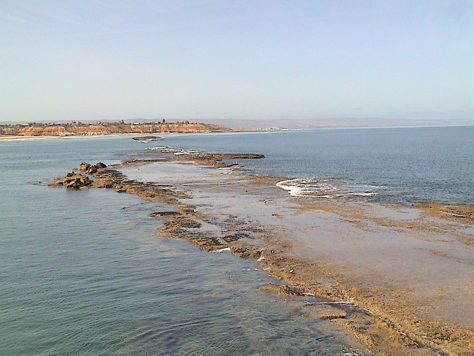
The spot
Community-maintained
Community contribution: submitted by Daniel
Know before you go
Logged by the community, confirmed by mods
Moderate risk: Strong currents at 'The Gap'
The natural break in the reef can produce strong tidal currents, especially on outgoing tides. Snorkellers should exercise caution when swimming through this area.
Moderate risk: Tidal Current Through The Gap
Strong tidal flows can rush through the natural break ('The Gap') in the reef, especially on outgoing tides, creating dangerous conditions for weaker swimmers.
Moderate risk: Outgoing tide current in the 'Gap'
A strong current can flow through the natural break ('Gap') in the reef on an outgoing tide, which can sweep snorkellers out to sea.
Low risk: Boat traffic near jetty
Boats and jetty users share the area near the jetty structure. Snorkellers should stay aware of vessel movements and avoid the jetty's boating lanes.
Low risk: Variable water visibility
Visibility can shift quickly due to wind, swell, and runoff. Best conditions are typically in calm summer months (December to March).
Low risk: Cool water temperatures
Temperate South Australian waters are cool year-round (12-20°C). Snorkellers should wear a wetsuit (3-5mm recommended) to prevent cold shock or hypothermia.
Low risk: Tidal current at The Gap
Strong tidal flows can develop through The Gap (natural break in the reef). Snorkelers should time their visit with slack tide.
Low risk: Boat traffic
Boat traffic in the channel near the jetty. Snorkelers should stay within the marked reef sanctuary zone.
Low risk: Cold water temperatures (winter)
Water temperatures in winter can drop below 13°C, increasing risk of cold shock and hypothermia for extended snorkels.
Low risk: Bluebottle jellyfish
Bluebottle jellyfish can be present during northerly winds, typically in warmer months.
Low risk: Sharp Reef Rock
The reef features sharp limestone and rocky outcrops that can cause cuts and abrasions. Reef shoes are recommended.
Low risk: Summer low visibility after storms
Following rain or swell, sediment can reduce visibility in the shallow lagoon, particularly in winter and after storms.
Low risk: Fishing lines from jetty
Active fishing occurs along the jetty; snorkellers entering from the beach or walking the jetty should watch for discarded lines and hooks.
Low risk: Current at the Gap
The natural break in the reef ('The Gap') can channel surge and current, especially on the outer reef side. Best snorkelled on calm days with low swell.
Low risk: Cold water temperatures
Water temperatures range from 14°C in winter to low 20s°C in summer. Wetsuit recommended year-round; cold water can increase fatigue risk.
Wildlife Guide
No wildlife notes for this spot yet.
Gallery
7 photos from the community
Getting in
Shore entry
Entry
35-40 minutes south of Adelaide via Southern Expressway; take Beach Road exit to Murray Road towards the coast. The reef is 300 m offshore, accessed via the 300 m-long Port Noarlunga Jetty which has a stair platform at its end for easy water entry.
Parking & facilities
Large free carpark adjacent to Noarlunga Jetty; additional street parking available along the foreshore. Can be busy in summer.
toiletsshowersparkingpicnic_tablesdrinking_water
Free entry. No fees for snorkelling or accessing the jetty.
Spot Map
Community
Gallery ┬╖ 7 photos
Trust
Is this spot real, accurate, still loved?
Spots near South Australia

No nearby spots yet.
Needs verification
Quick verify
One tap helps the community keep this spot honest.
About this data
- Conditions last evaluated
- Spot data last updated
- Data sources
- Open-Meteo (marine & weather conditions), tide predictions via UTide, community contributors (descriptions, hazards, marine life).
- License
- Spot content licensed under CC BY-SA 4.0. How's the Spot is open source.
Weather & swell ┬╖ Open-Meteo marine & weather APIs Tides ┬╖ UTide harmonic analysis Sea & safety ┬╖ community reports