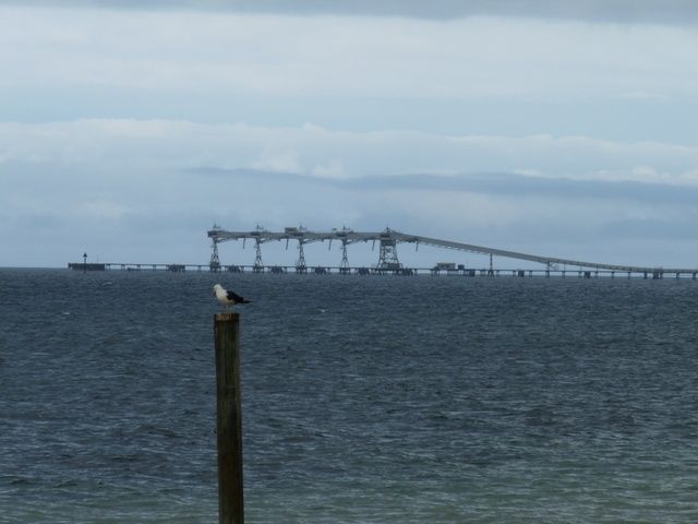
Port Giles Jetty is a 600-metre-long industrial jetty backed by towering white wheat silos on the eastern Yorke Peninsula coast. Its deep pylons — averaging 8 m and reaching 14 m — are encrusted with colourful sponges and soft corals, attracting conger eels, nudibranchs, spider crabs, blue swimmer crabs, and long-finned pike. The site is prized for its clear waters and abundant marine life, though active shipping prohibits diving when vessels are berthed.
Port Giles Jetty
IntermediateGO
GO
It's a go.
Showing last known conditions
Wave Height 0.1 mSwell Period 11 sWind Speed 2.1 knPrecipitation 15 mmTidal Phase ebb
Last evaluated
DANGER: Explicit Risks Present
Port Giles Jetty has hazards marked as danger. Entering the water here means you may face serious risks to your personal safety.
- Shipping traffic danger
Active bulk cargo shipping uses this jetty; diving or snorkeling is strictly prohibited when ships are berthed.
The spot
Community-maintained
Community contribution: submitted by Daniel
Know before you go
Logged by the community, confirmed by mods
High risk: Shipping traffic
Active bulk cargo shipping uses this jetty; diving or snorkeling is strictly prohibited when ships are berthed.
Low risk: Tidal current
Moderate current can develop along the long jetty structure, especially during tidal exchanges.
Low risk: Depth (14 m max)
Depth drops to 14 m at the jetty end; snorkelers should stay within comfortable depth limits.
Low risk: Fishing line entanglement
Fishing activity from the jetty may create entanglement hazards from loose line and tackle.
Wildlife Guide
No wildlife notes for this spot yet.
Gallery
1 photo from the community
Getting in
Shore entry
Entry
Port Giles Jetty is located on the eastern coast of Yorke Peninsula, off Hickeys Drive near Coobowie. From Adelaide, take the Port Wakefield Road and follow the Copper Coast Highway to the Yorke Peninsula, then turn off towards Coobowie/Port Giles.
Parking & facilities
Unsealed parking area available near the jetty approach.
parking
Free access
Spot Map
Community
Gallery ┬╖ 1 photos
Trust
Is this spot real, accurate, still loved?
Spots near South Australia

No nearby spots yet.
Needs verification
Quick verify
One tap helps the community keep this spot honest.
About this data
- Conditions last evaluated
- Spot data last updated
- Data sources
- Open-Meteo (marine & weather conditions), tide predictions via UTide, community contributors (descriptions, hazards, marine life).
- License
- Spot content licensed under CC BY-SA 4.0. How's the Spot is open source.
Weather & swell ┬╖ Open-Meteo marine & weather APIs Tides ┬╖ UTide harmonic analysis Sea & safety ┬╖ community reports