Porpoise Bay Caves sit along the south-facing coast of Rottnest Island, offering a unique snorkeling experience where limestone reef formations create a series of underwater caverns and swim-throughs. The bay shelters a 1 km stretch of white sandy beach between Henrietta Rocks (home to the famous Shark shipwreck) and scenic Parker Point. Snorkelers can explore the cave systems teeming with fish, with depths ranging from 8 m to 18 m, and occasional sightings of sea turtles and leafy sea dragons in the clear, calm waters.
Porpoise Bay Caves (Rottnest Island)
IntermediateGO
GO
It's a go.
Showing last known conditions
Wave Height 0.3 mSwell Period 12 sWind Speed 0.7 knPrecipitation 0.5 mmTidal Phase ebb
Last evaluated
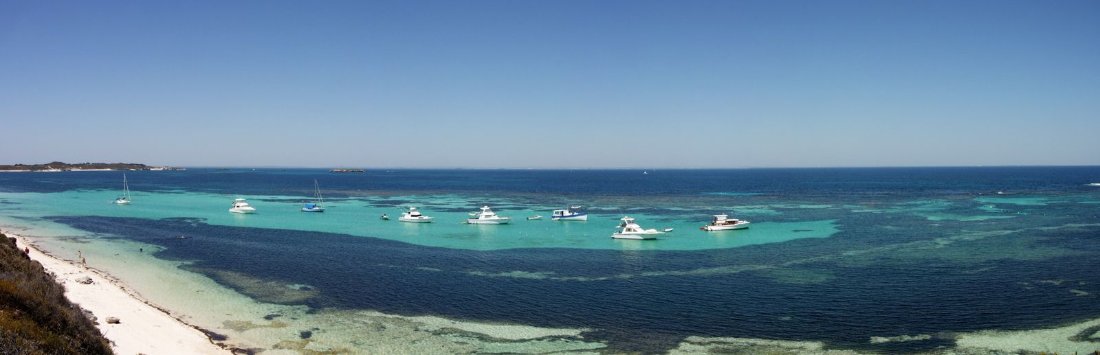
The spot
Community-maintained
Community contribution: submitted by Daniel
Know before you go
Logged by the community, confirmed by mods
Low risk: Underwater cave navigation
The limestone caves and swim-throughs can be disorienting; limited overhead clearance and light reduction inside caverns require good buoyancy control.
Low risk: Boat traffic
Porpoise Bay is accessible to moored boats, and vessels may transit through the bay, especially near Henrietta Rocks.
Low risk: Depth variation
Depth ranges from shallow shoreline to around 18 m at the outer cave entrances, which may surprise less experienced snorkelers.
Low risk: Swell exposure
As a south-facing bay, Porpoise Bay can be affected by southern ocean swells and winter storms, reducing visibility.
Wildlife Guide
No wildlife notes for this spot yet.
Gallery
1 photo from the community
Getting in
Shore entry
Entry
Porpoise Bay is on the southern side of Rottnest Island, easily reached by bicycle or the island bus service from the main settlement at Thomson Bay. Follow the South Perimeter road towards Parker Point — the bay is the first large beach east of Parker Point.
Parking & facilities
No car parking on Rottnest Island (cars are prohibited). Bicycle racks are available near the beach access points. Mooring buoys are available in the bay for boats.
toilets
No additional fee for the beach, but visitors must pay the Rottnest Island Admission Fee (ferry ticket included for day-trippers) and a ferry fare from Perth/Fremantle.
Spot Map
Community
Gallery ┬╖ 1 photos
Trust
Is this spot real, accurate, still loved?
Spots near Western Australia

No nearby spots yet.
Needs verification
Quick verify
One tap helps the community keep this spot honest.
About this data
- Conditions last evaluated
- Spot data last updated
- Data sources
- Open-Meteo (marine & weather conditions), tide predictions via UTide, community contributors (descriptions, hazards, marine life).
- License
- Spot content licensed under CC BY-SA 4.0. How's the Spot is open source.
Weather & swell ┬╖ Open-Meteo marine & weather APIs Tides ┬╖ UTide harmonic analysis Sea & safety ┬╖ community reports