Point Danger Marine Sanctuary hugs the limestone headland between Torquay and Jan Juc on Victoria's Surf Coast. This 21.7-hectare reserve protects shallow reefs (mostly under 7m deep), intertidal rock platforms, and kelp forests that teem with life. The sanctuary is renowned for its extraordinary diversity of sea slugs (96 species recorded), while Eagle Rays glide over sandy patches, and Neptune's Necklace algae carpets the intertidal zone. A sandy channel often separates the reef from the beach, with the reef fully exposed only on the lowest summer tides — an underwater wonderland for snorkelers when conditions are calm.
Point Danger Marine Sanctuary
IntermediateMAYBE
MAYBE
Fair. Experienced snorkellers only.
Showing last known conditions
Wave Height 0.1 mSwell Period 8.7 sWind Speed 19 knPrecipitation 46 mmTidal Phase flood
Last evaluated
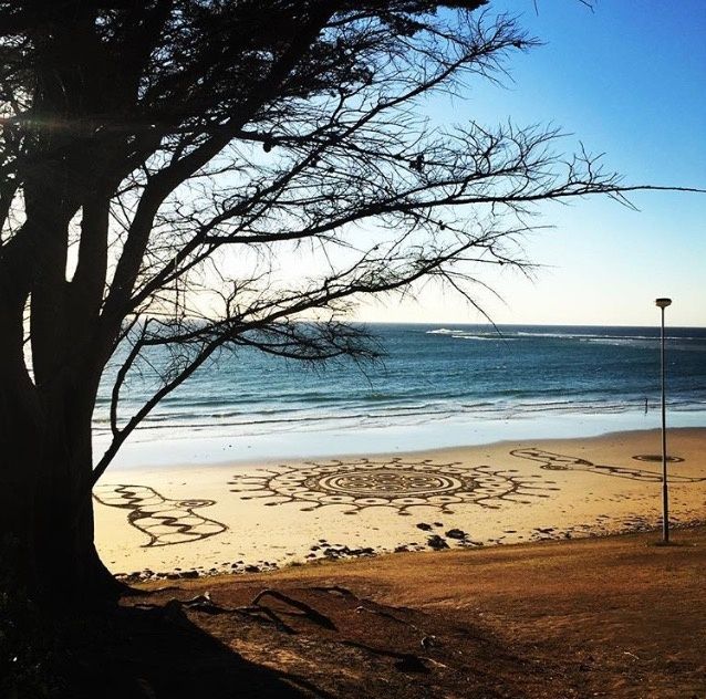 © Oompieindieruimte
DANGER: Explicit Risks Present
Point Danger Marine Sanctuary has hazards marked as danger. Entering the water here means you may face serious risks to your personal safety.
- Strong surf & swell danger
Point Danger is exposed to Bass Strait swells, producing powerful surf and rip currents that can be hazardous for snorkelers.
The spot
Community-maintained
Community contribution: submitted by Daniel
Know before you go
Logged by the community, confirmed by mods
High risk: Strong surf & swell
Point Danger is exposed to Bass Strait swells, producing powerful surf and rip currents that can be hazardous for snorkelers.
Moderate risk: Rip currents
Strong rip currents form along the headland and reef edges, particularly during southerly swells.
Moderate risk: Sharp reef & rock platforms
The bommie (bombora) reef features sharp limestone and volcanic rock that can cause cuts and abrasions.
Moderate risk: Strong currents and undertows
Sudden changes in tide can create dangerous currents and undertows, especially near the point.
Moderate risk: Large unexpected waves
Exposed to southern ocean swell; rogue waves can sweep across the rock platform without warning.
Moderate risk: Variable weather conditions
Strong south-westerly winds can change rapidly, making the water unsafe for snorkelling.
Low risk: Variable visibility
Swell and wind can quickly stir up sediment, reducing underwater visibility to near zero.
Low risk: Cold water temperatures
Bass Strait waters are cold year-round, typically 12–16°C, posing hypothermia risk without adequate wetsuit.
Low risk: Slippery rock platform
The intertidal limestone reef is very slippery when wet; sturdy footwear with good grip is essential.
Low risk: Sandy channel separation
A sandy channel often isolates the main reef from the beach; swimmers must cross open water.
Wildlife Guide
No wildlife notes for this spot yet.
Gallery
3 photos from the community
Getting in
Shore entry
Entry
Located at Point Danger, Torquay, on the Great Ocean Road, roughly 1.5 km south of the Torquay town centre. Access is from the Point Danger car park off Point Danger Road, then a short walk to the beach and rock platform.
Parking & facilities
Designated car park at Point Danger Road, Torquay. Parking is free but fills quickly on summer weekends and public holidays.
parkingpicnic_tables
Free entry; no fees required.
Spot Map
Community
Gallery ┬╖ 3 photos
Trust
Is this spot real, accurate, still loved?
Spots near Victoria

No nearby spots yet.
Needs verification
Quick verify
One tap helps the community keep this spot honest.
About this data
- Conditions last evaluated
- Spot data last updated
- Data sources
- Open-Meteo (marine & weather conditions), tide predictions via UTide, community contributors (descriptions, hazards, marine life).
- License
- Spot content licensed under CC BY-SA 4.0. How's the Spot is open source.
Weather & swell ┬╖ Open-Meteo marine & weather APIs Tides ┬╖ UTide harmonic analysis Sea & safety ┬╖ community reports