Nelson Bay is the heart of Port Stephens' snorkeling scene, anchored by the Fly Point – Halifax Park Aquatic Reserve. This protected sanctuary boasts one of the most extensive sponge gardens on the NSW east coast, alongside soft corals, kelp forests, and seagrass beds teeming with fish. Snorkelers enter via a staircase at Neil Carroll Park on Victoria Parade, entering calm, sheltered waters between Nelson Bay and Little Beach. The rocky reef shelves offer easy shore access, rewarding visitors with frequent sightings of wobbegong sharks, seahorses, and rays amid crystal-clear conditions.
Pipeline (Nelson Bay)
BeginnerGO
GO
It's a go.
Showing last known conditions
Wave Height 0.1 mSwell Period 10 sWind Speed 1.0 knPrecipitation 0.5 mmTidal Phase flood
Last evaluated
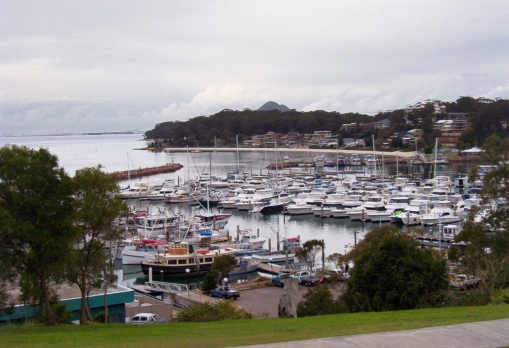
The spot
Community-maintained
Community contribution: submitted by Daniel
Know before you go
Logged by the community, confirmed by mods
Moderate risk: Slack water required
This is a slack-water dive site; strong currents can develop outside of slack tide, especially around tide changes.
Moderate risk: Boat traffic near marina
The site is adjacent to the marina breakwall. Boats and jet skis operate in the vicinity — stay aware and close to the marked dive area.
Low risk: Boat traffic in channel
Fly Point is adjacent to the Port Stephens shipping channel; boat traffic can be present, especially near the boundary of the aquatic reserve.
Low risk: Strong tidal currents
Tidal flows through the Port Stephens estuary can create moderate currents around the point, particularly on outgoing tides.
Low risk: Bluebottles
Bluebottles (Physalia physalis) can drift into the bay during onshore winds, typically in warmer months.
Low risk: Slippery entry rocks
The rock stairs and submerged rocks at the entry point are notoriously slippery and require careful footing when entering or exiting.
Low risk: Low tide restriction
Diving on low tide is not recommended due to very shallow water reducing clearance over the reef and increasing the risk of contact with hazards.
Low risk: Rocky shoreline entry
The entry point has a rocky bottom and shoreline — water shoes or booties recommended for safe footing.
Low risk: Boat traffic
The bay is busy with recreational and tour boats, especially during summer weekends and holidays. Use caution and stay within the aquatic reserve boundary.
Low risk: Boat traffic near breakwall
The breakwall is adjacent to the Nelson Bay marina and boat channel; stay vigilant for vessel traffic entering and leaving the harbour.
Low risk: Sharp rocks and barnacles
The breakwall structure is covered in sharp barnacles and rock oysters; sturdy footwear or booties recommended for entry and exit.
Wildlife Guide
No wildlife notes for this spot yet.
Gallery
3 photos from the community
Getting in
Shore entry
Entry
From Nelson Bay town centre, head towards d'Albora Marina and drive to the end of the marina road. Park in the car park near the breakwall. Walk past the fish co-op building and follow the path down to a set of rock stairs leading into the water. A small breakwall at the water's edge serves as a handy platform to sit on while putting on fins.
Parking & facilities
Car park available at the end of d'Albora Marina near the breakwall. Can fill up quickly on weekends and holidays — arrive early.
parkingtoilets
Free public access. No entry fee.
Spot Map
Community
Gallery ┬╖ 3 photos
Trust
Is this spot real, accurate, still loved?
Spots near New South Wales

No nearby spots yet.
Needs verification
Quick verify
One tap helps the community keep this spot honest.
About this data
- Conditions last evaluated
- Spot data last updated
- Data sources
- Open-Meteo (marine & weather conditions), tide predictions via UTide, community contributors (descriptions, hazards, marine life).
- License
- Spot content licensed under CC BY-SA 4.0. How's the Spot is open source.
Weather & swell ┬╖ Open-Meteo marine & weather APIs Tides ┬╖ UTide harmonic analysis Sea & safety ┬╖ community reports