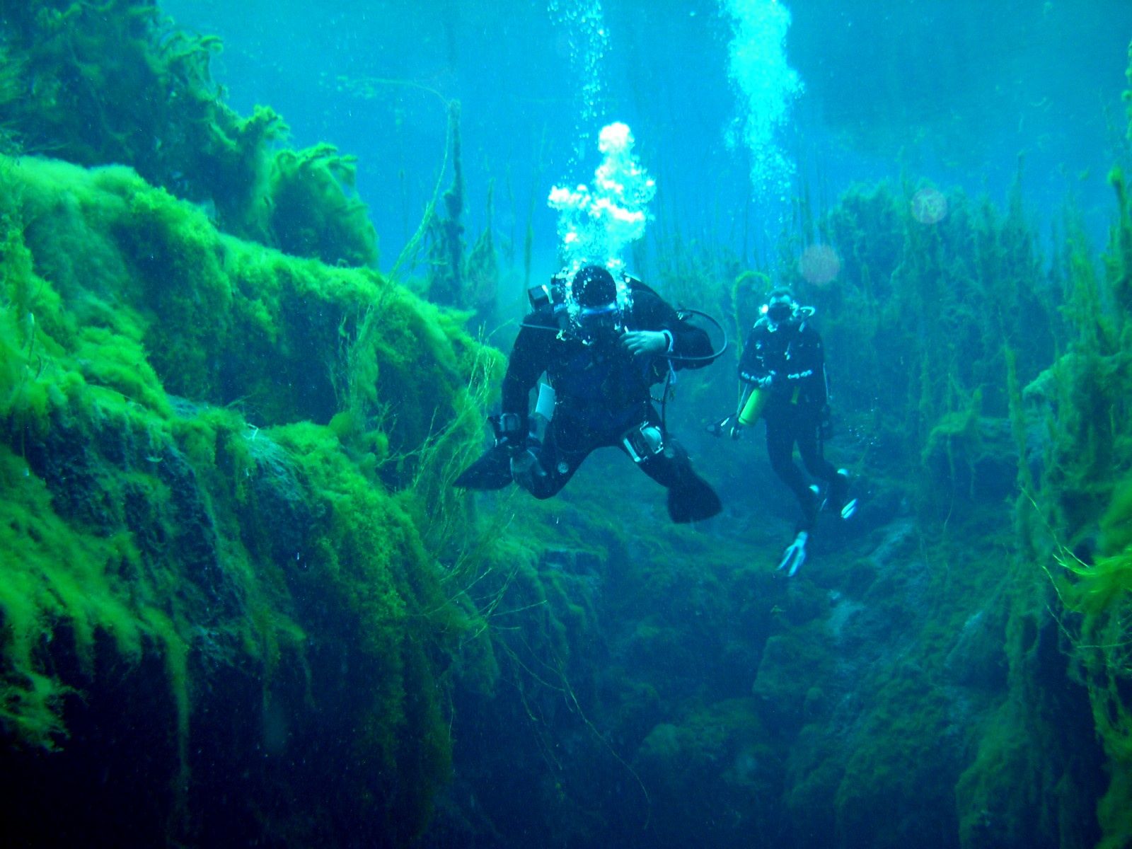
Piccaninnie Ponds Conservation Park protects a globally significant freshwater wetland on South Australia's Limestone Coast. The star attractions are two unique underwater formations formed by spring-fed freshwater rising through limestone: The Chasm (a vertical shaft plunging into darkness) and The Cathedral (a vast underwater cavern with luminous white scalloped limestone walls). Crystal-clear 14°C waters (issued via permit) have historically drawn divers and snorkelers from across Australia. The park also features a coastal walking trail, boardwalk overlook, and interpretive displays. Note: snorkeling/diving is currently suspended due to an algae outbreak recovery program.
Piccaninnie Ponds Conservation Park (Piccaninnie Ponds)
IntermediateSKIP
SKIP
Poor conditions. Stay out today.
Showing last known conditions
Wave Height 2.2 mSwell Period 11 sWind Speed 17 knPrecipitation 7.9 mmTidal Phase slack
Last evaluated
The spot
Community-maintained
Community contribution: submitted by Daniel
Know before you go
Logged by the community, confirmed by mods
Moderate risk: Limited visibility in caverns
Silt and fine sediment can be stirred up inside The Cathedral and The Chasm, reducing visibility to near-zero and disorienting snorkelers.
Moderate risk: Filamentous algae outbreak
Park is currently closed for snorkeling/diving to allow regeneration of aquatic vegetation following an outbreak of filamentous algae.
Low risk: Cold water temperature
Spring-fed ponds maintain a constant 14°C (57°F) year-round, creating risk of hypothermia without adequate thermal protection.
Low risk: Strong freshwater currents at springs
Pressurised freshwater rising through submerged limestone conduits can create unexpected upwelling currents near fissures and cavern entrances.
Wildlife Guide
No wildlife notes for this spot yet.
Gallery
1 photo from the community
Getting in
Shore entry
Entry
Located 32 km south-east of Mount Gambier on the Limestone Coast of South Australia (482 km south-east of Adelaide). Access via Piccaninnie Ponds Road off the Riddoch Highway.
Parking & facilities
Car parking available at the park entrance near the picnic area.
toiletsparkingpicnic_tablesdrinking_watershowers
Snorkeling/diving requires a permit (currently not being issued). Park entry is free. Bookings: [email protected]
Spot Map
Community
Gallery ┬╖ 1 photos
Trust
Is this spot real, accurate, still loved?
Spots near Victoria

No nearby spots yet.
Needs verification
Quick verify
One tap helps the community keep this spot honest.
About this data
- Conditions last evaluated
- Spot data last updated
- Data sources
- Open-Meteo (marine & weather conditions), tide predictions via UTide, community contributors (descriptions, hazards, marine life).
- License
- Spot content licensed under CC BY-SA 4.0. How's the Spot is open source.
Weather & swell ┬╖ Open-Meteo marine & weather APIs Tides ┬╖ UTide harmonic analysis Sea & safety ┬╖ community reports