A Ramsar-listed wetland fed by crystal-clear karst freshwater springs, Piccaninnie Ponds offers extraordinary underwater visibility often exceeding 40 metres. Snorkelers explore iconic limestone formations including The Chasm and The Cathedral — deep, spring-fed pools carved into the ancient karst landscape. The ponds merge into coastal wetlands and sit just back from Discovery Bay on South Australia's Limestone Coast, creating a unique freshwater snorkeling experience amid lush aquatic vegetation and bird-filled wetlands.
Piccaninnie Ponds Conservation Park
IntermediateSKIP
SKIP
Poor conditions. Stay out today.
Showing last known conditions
Wave Height 2.2 mSwell Period 11 sWind Speed 17 knPrecipitation 7.9 mmTidal Phase slack
Last evaluated
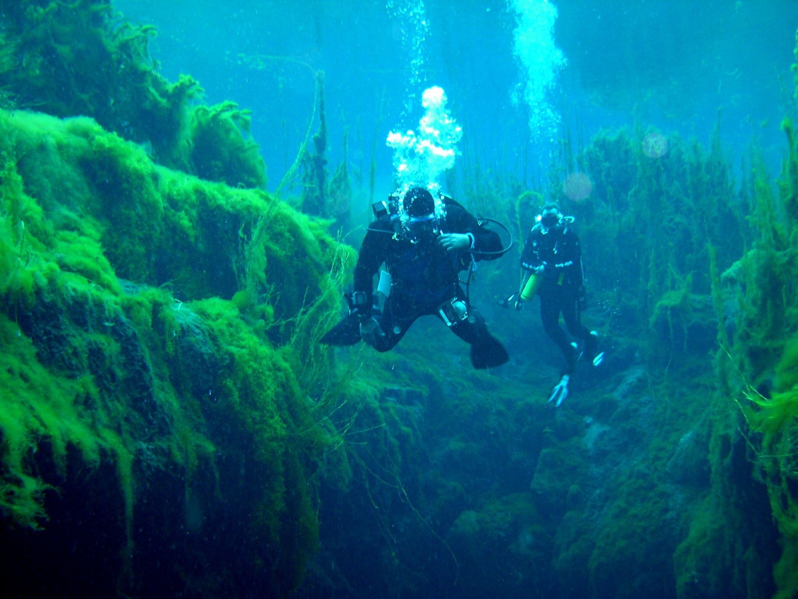
The spot
Community-maintained
Community contribution: submitted by Daniel
Know before you go
Logged by the community, confirmed by mods
Moderate risk: Deep sinkholes and sudden depth changes
The Chasm drops abruptly to great depth; strong swimming ability required near the deep sinkholes.
Low risk: Permit-only access with time limit
Snorkel sessions are limited to 1 hour and access is strictly by permit to protect the fragile aquatic ecosystem.
Low risk: Cold spring water (approx. 14b0C / 57b0F year-round)
Freshwater springs maintain a constant cool temperature year-round; exposure can cause rapid heat loss.
Wildlife Guide
No wildlife notes for this spot yet.
Gallery
1 photo from the community
Getting in
Snorkel tour
Entry
Located 30 km southeast of Mount Gambier, South Australia, near the town of Wye off Piccaninnie Ponds Road, just inland from Discovery Bay.
Parking & facilities
Car parking available at the conservation park entrance.
parkingtoilets
Permit required; book a 1-hour snorkel session online via National Parks SA.
Spot Map
Community
Gallery ┬╖ 1 photos
Trust
Is this spot real, accurate, still loved?
Spots near Victoria

No nearby spots yet.
Needs verification
Quick verify
One tap helps the community keep this spot honest.
About this data
- Conditions last evaluated
- Spot data last updated
- Data sources
- Open-Meteo (marine & weather conditions), tide predictions via UTide, community contributors (descriptions, hazards, marine life).
- License
- Spot content licensed under CC BY-SA 4.0. How's the Spot is open source.
Weather & swell ┬╖ Open-Meteo marine & weather APIs Tides ┬╖ UTide harmonic analysis Sea & safety ┬╖ community reports