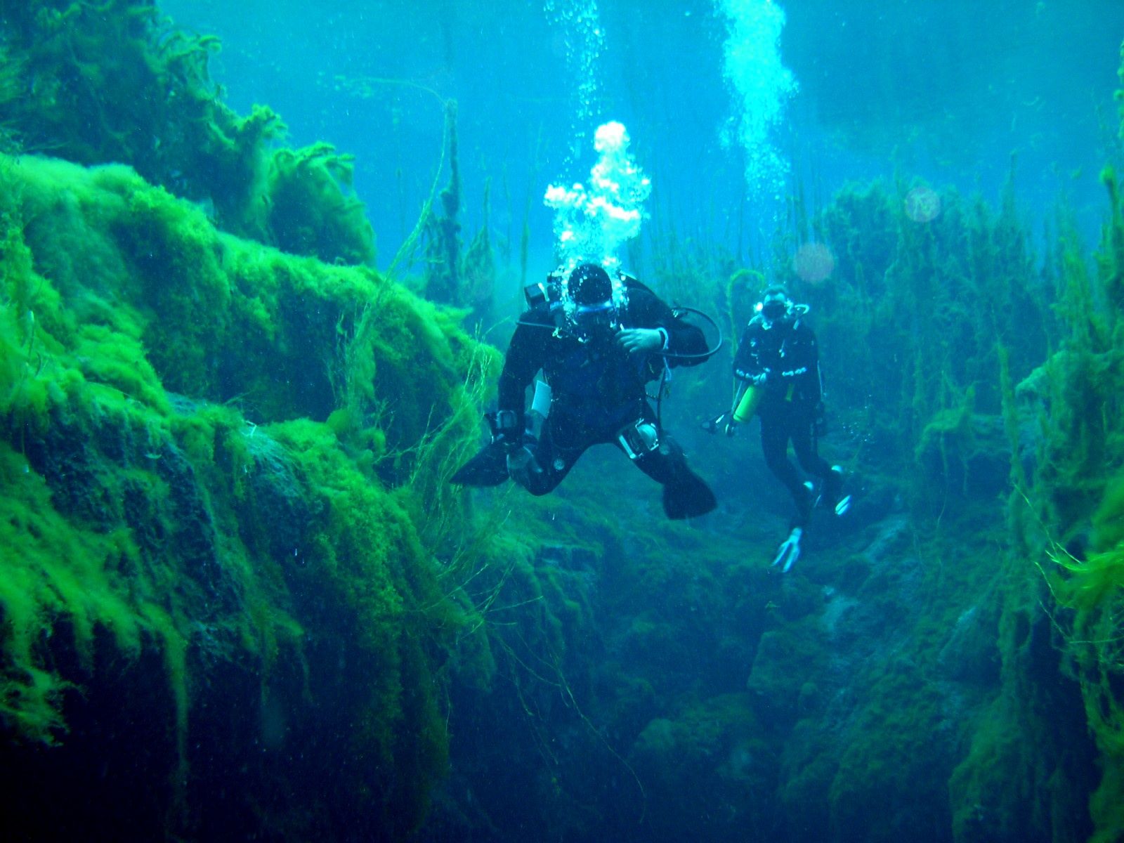
Piccaninnie Ponds is a spring-fed limestone sinkhole on South Australia's Limestone Coast, recognised as a wetland of international importance. Crystal-clear freshwater rises under pressure through the limestone, carving dramatic underwater features including The Chasm and an immense white-walled cavern known as The Cathedral. The ponds are surrounded by coastal wattles, beard heath, and boardwalk trails, with reeds encircling the water. This iconic freshwater snorkeling destination offers an eery, ethereal underwater landscape of tall swaying vegetation and sculpted limestone walls. Note: currently closed for water activities due to a filamentous algal bloom (permits not being issued).
Piccaninnie Ponds
IntermediateSKIP
SKIP
Poor conditions. Stay out today.
Showing last known conditions
Wave Height 2.2 mSwell Period 11 sWind Speed 17 knPrecipitation 7.9 mmTidal Phase slack
Last evaluated
The spot
Community-maintained
Community contribution: submitted by Daniel
Know before you go
Logged by the community, confirmed by mods
Moderate risk: Cold water temperature (<15°C)
Water temperature remains below 15°C year-round, requiring a full-length wetsuit even in summer to prevent hypothermia.
Moderate risk: Permit requirement and current closure
A permit is mandatory for all snorkeling and diving; currently no permits are being issued due to an algal bloom closure.
Moderate risk: Bushfire danger closure
Park is closed on days of Catastrophic Fire Danger and may close on Extreme Fire Danger days during summer.
Moderate risk: Deep Cave Drop-off
The main cave plunges to 110 metres just metres from the surface entry — disorientation or panic near this drop-off is a serious risk for inexperienced swimmers.
Moderate risk: Underwater limestone formations
Submerged limestone caverns and crevasses can be disorienting and pose entrapment risk if explored beyond the snorkeling zone.
Low risk: Afternoon coastal winds
Ponds are exposed to coastal winds, especially in the afternoon, reducing surface visibility and comfort.
Low risk: Reduced visibility from filamentous algae
Dislodged filamentous algae reduces underwater visibility, particularly after recent disturbance.
Low risk: Cold Water Temperature
Water sits at a constant 15°C year-round, requiring a proper wetsuit (at least 3mm) to avoid cold shock and hypothermia.
Low risk: Slippery Floating Jetty Entry
Entry via a small floating jetty can be slippery and unstable, especially when wet.
Low risk: Limited Visibility in Blue Lake Section
The deep 'Blue Lake' section is the coldest and darkest part of the pond, reducing visibility for snorkelers compared to shallower areas.
Wildlife Guide
No wildlife notes for this spot yet.
Gallery
2 photos from the community
Getting in
Snorkel tour
Entry
32 km south-east of Mount Gambier, via Piccaninnie Ponds Road, Wye SA. Approximately 482 km south-east of Adelaide.
Parking & facilities
Car park available at the conservation park.
toiletsparking
Free park entry. Snorkeling/diving permits required — book online via National Parks SA. Permits currently not being issued due to park closure for water activities.
Spot Map
Community
Gallery ┬╖ 2 photos
Trust
Is this spot real, accurate, still loved?
Spots near Victoria

No nearby spots yet.
Needs verification
Quick verify
One tap helps the community keep this spot honest.
About this data
- Conditions last evaluated
- Spot data last updated
- Data sources
- Open-Meteo (marine & weather conditions), tide predictions via UTide, community contributors (descriptions, hazards, marine life).
- License
- Spot content licensed under CC BY-SA 4.0. How's the Spot is open source.
Weather & swell ┬╖ Open-Meteo marine & weather APIs Tides ┬╖ UTide harmonic analysis Sea & safety ┬╖ community reports