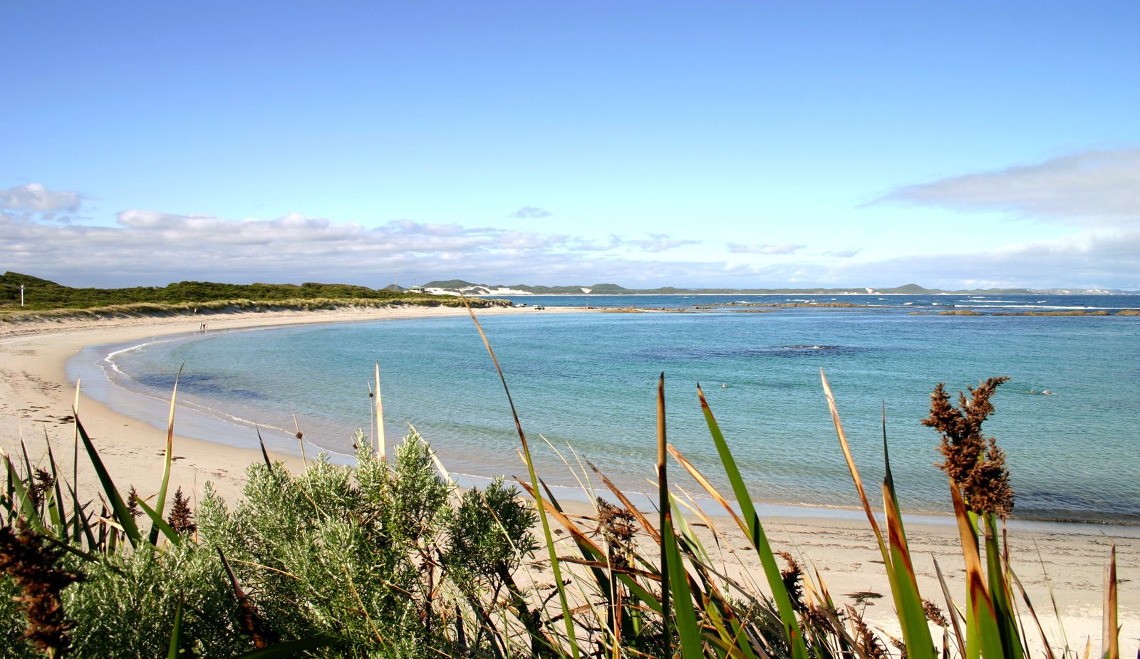
Nestled between towering karri forests and the Southern Ocean, Peaceful Bay lives up to its name with sheltered turquoise waters protected from harsh southern swells. This wide white-sand beach on Western Australia's Rainbow Coast wraps around a headland, offering calm, clear conditions ideal for snorkeling. Part of the Bibbulmun Track runs through the bay, and the nearby Walpole-Nornalup National Park frames the coastline. The bay's gentle conditions make it a welcoming spot for families, while the clear shallows reveal local marine life just metres from shore.
Peaceful Bay
BeginnerSKIP
SKIP
Poor conditions. Stay out today.
Showing last known conditions
Wave Height 1.9 mSwell Period 12 sWind Speed 1.5 knPrecipitation 2.6 mmTidal Phase ebb
Last evaluated
The spot
Community-maintained
Community contribution: submitted by Daniel
Know before you go
Logged by the community, confirmed by mods
Moderate risk: Rip currents during storms
Although generally sheltered, strong rip currents can develop during winter storms or after heavy weather.
Low risk: Seasonal whale migration traffic
Humpback and southern right whales migrate past the bay from June to October, creating potential vessel conflicts for boat-based snorkelers.
Low risk: 4WD vehicle traffic on beach
Beach driving is permitted, so swimmers and snorkelers must stay vigilant for vehicles using the shoreline.
Wildlife Guide
No wildlife notes for this spot yet.
Gallery
1 photo from the community
Getting in
Shore entry
Entry
Peaceful Bay is 33 km east of Walpole and 45 km west of Denmark on the South Coast Highway. Turn off the highway onto Peaceful Bay Road and follow it approximately 10 km to the beach. It's about a 5-hour drive south of Perth.
Parking & facilities
Carpark available at the beach, plus additional parking near the caravan park. 4WD vehicles can also drive onto the beach via designated access points.
toiletsparkingpicnic_tablesboat_ramp
No entry fee for the beach. Camping fees apply at Peaceful Bay Caravan Park.
Spot Map
Community
Gallery ┬╖ 1 photos
Trust
Is this spot real, accurate, still loved?
Spots near Western Australia

No nearby spots yet.
Needs verification
Quick verify
One tap helps the community keep this spot honest.
About this data
- Conditions last evaluated
- Spot data last updated
- Data sources
- Open-Meteo (marine & weather conditions), tide predictions via UTide, community contributors (descriptions, hazards, marine life).
- License
- Spot content licensed under CC BY-SA 4.0. How's the Spot is open source.
Weather & swell ┬╖ Open-Meteo marine & weather APIs Tides ┬╖ UTide harmonic analysis Sea & safety ┬╖ community reports