Nestled on the north coast of Rottnest Island, Parakeet Bay is a serene, sheltered cove with calm, crystal-clear waters that offer excellent snorkelling conditions. The sandy beach gives way to a shallow limestone reef system with depths of just 1–5 metres, making it ideal for exploring colourful coral gardens and the rocky outcrops at either end of the bay. Protected from prevailing winds, the water stays placid here, revealing a glittering underwater world just metres from shore.
Parakeet Bay
BeginnerGO
GO
It's a go.
Showing last known conditions
Wave Height 0.4 mSwell Period 12 sWind Speed 0.6 knPrecipitation 0.8 mmTidal Phase ebb
Last evaluated
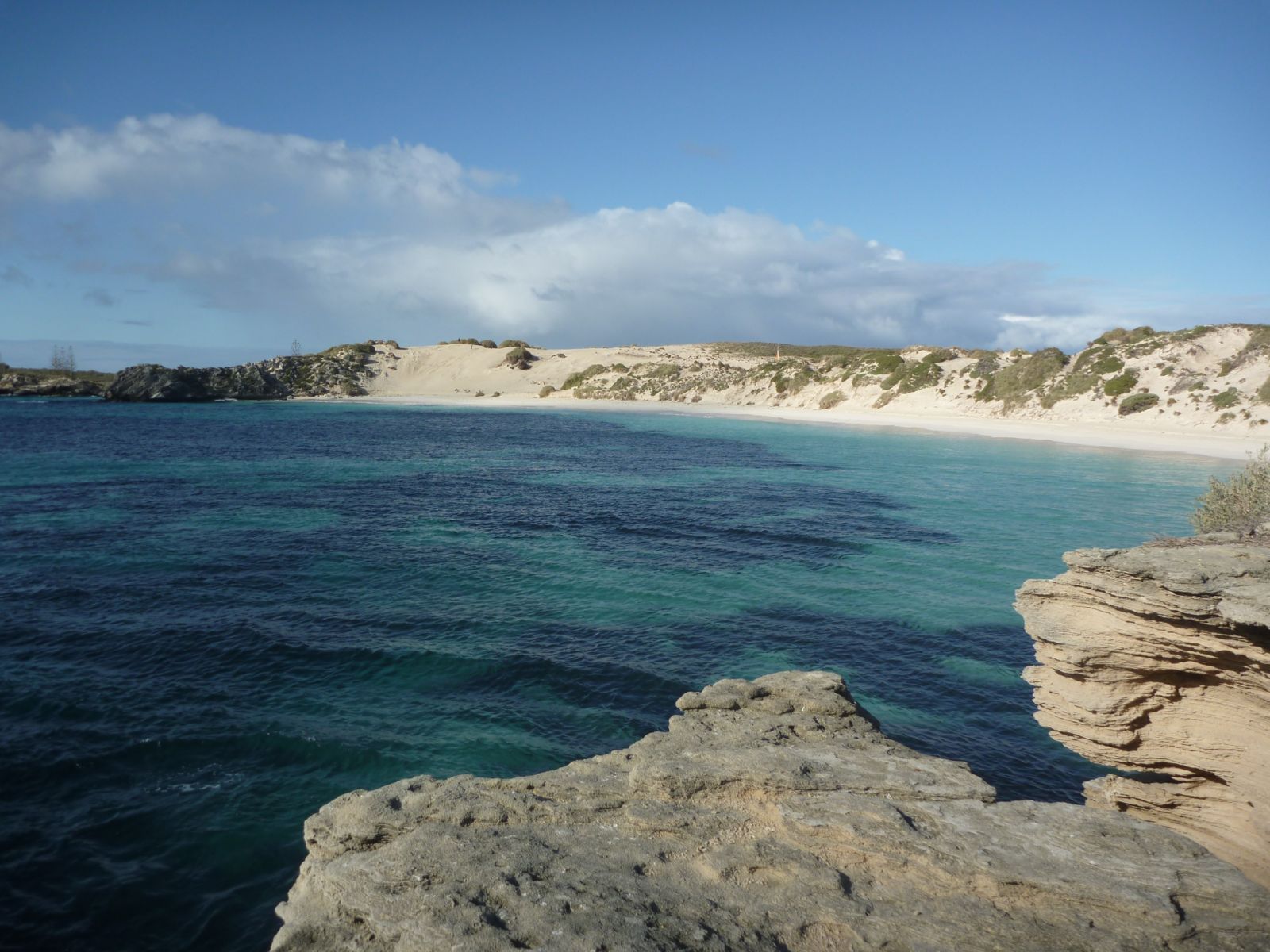 © Sam Wilson
The spot
Community-maintained
Community contribution: submitted by Daniel
Know before you go
Logged by the community, confirmed by mods
Low risk: Sharp limestone reef
The shallow limestone reef can be sharp; wear reef shoes or fins to avoid cuts when entering or exiting the water.
Low risk: Boat traffic
Parakeet Bay is accessible by boat, and vessels may anchor in the bay during peak season (summer months). Be alert for boat activity near the surface.
Wildlife Guide
No wildlife notes for this spot yet.
Gallery
4 photos from the community
Getting in
Shore entry
Entry
From the main settlement at Thomson Bay, cycle or walk north along Parakeet Road for approximately 3 km to reach Parakeet Bay. It is also accessible by boat and is a popular stop on snorkel tours around the island.
Parking & facilities
No dedicated car park. Visitors typically park bicycles at the trailhead near the beach access path, or moor boats offshore.
toilets
No fee for beach access. Rottnest Island entry fee applies (purchased with ferry ticket).
Spot Map
Community
Gallery ┬╖ 4 photos
Trust
Is this spot real, accurate, still loved?
Spots near Western Australia

No nearby spots yet.
Needs verification
Quick verify
One tap helps the community keep this spot honest.
About this data
- Conditions last evaluated
- Spot data last updated
- Data sources
- Open-Meteo (marine & weather conditions), tide predictions via UTide, community contributors (descriptions, hazards, marine life).
- License
- Spot content licensed under CC BY-SA 4.0. How's the Spot is open source.
Weather & swell ┬╖ Open-Meteo marine & weather APIs Tides ┬╖ UTide harmonic analysis Sea & safety ┬╖ community reports