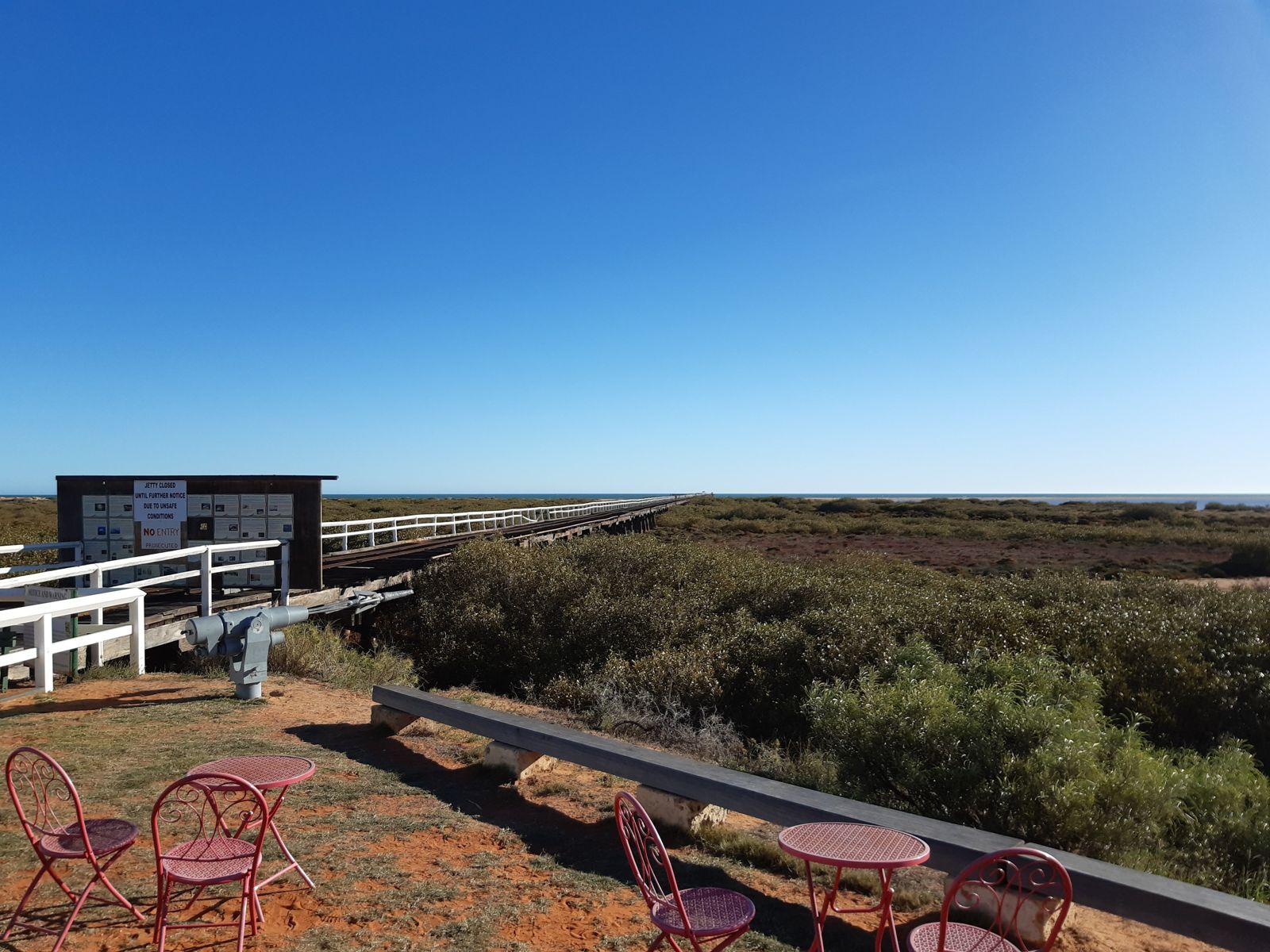
One Mile Jetty on Babbage Island at the mouth of the Gascoyne River is a historic 1898 jetty offering a unique snorkeling experience where river meets sea. The surrounding waters mix fresh and saltwater environments, supporting diverse marine habitats near seagrass meadows and mangroves. Snorkelers can explore around the jetty piles which attract fish seeking shelter, while the nearby Whitlock Island area is known for macro photography opportunities. Part of the broader Shark Bay World Heritage region, this spot provides calm, protected waters ideal for a relaxed snorkel.
One Mile Jetty
BeginnerGO
GO
It's a go.
Showing last known conditions
Wave Height 0.3 mSwell Period 7.6 sWind Speed 1.2 knPrecipitation 0.1 mmTidal Phase flood
Last evaluated
 © Calistemon
The spot
Community-maintained
Community contribution: submitted by Daniel
Know before you go
Logged by the community, confirmed by mods
Moderate risk: Jetty restoration works
The jetty and walk trail are currently closed for restoration work — check local access status before planning a visit.
Moderate risk: Marine stingers (Nov-Apr)
Box jellyfish and other marine stingers may be present in warmer months (November to April) in these north-west WA waters.
Low risk: Tidal currents at river mouth
The Gascoyne River mouth near the jetty can produce shifting tidal currents, especially during outgoing tides near the river channel.
Wildlife Guide
No wildlife notes for this spot yet.
Gallery
2 photos from the community
Getting in
Shore entry
Entry
Located on Babbage Island, Carnarvon, approximately 2.5km walk from the Fascine Town Beach footbridge. The site is off Annear Place, Carnarvon, Western Australia. Follow signage from Carnarvon town centre toward Babbage Island.
Parking & facilities
Parking available near the Carnarvon Heritage Precinct on Babbage Island, at the jetty end of the walk trail.
toiletsparkingpicnic_tables
Check with Carnarvon Visitor Centre for current access fees — the jetty precinct may have entry fees during operational periods.
Spot Map
Community
Gallery ┬╖ 2 photos
Trust
Is this spot real, accurate, still loved?
Spots near Western Australia

No nearby spots yet.
Needs verification
Quick verify
One tap helps the community keep this spot honest.
About this data
- Conditions last evaluated
- Spot data last updated
- Data sources
- Open-Meteo (marine & weather conditions), tide predictions via UTide, community contributors (descriptions, hazards, marine life).
- License
- Spot content licensed under CC BY-SA 4.0. How's the Spot is open source.
Weather & swell ┬╖ Open-Meteo marine & weather APIs Tides ┬╖ UTide harmonic analysis Sea & safety ┬╖ community reports