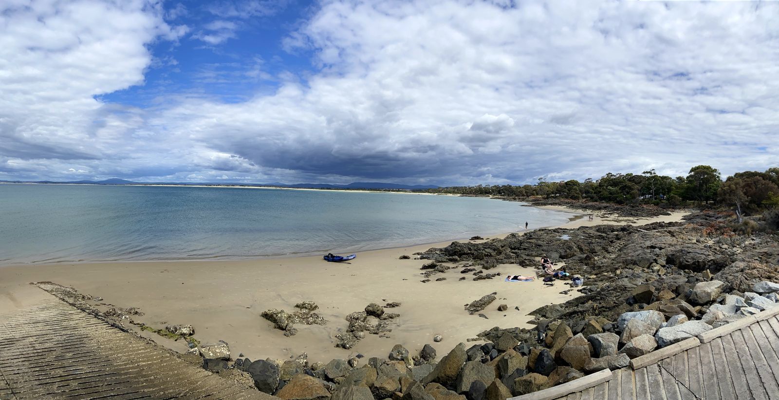
Old Pier Beach in Bridport, Tasmania, is a sheltered 200-metre east-facing sandy beach with the haunting remains of an old pier extending 500 metres offshore — the ghostly timber stumps create an underwater structure that attracts fish and provides wonderful snorkelling terrain. Nestled along Bridport's protected foreshore between granite outcrops, the crystal-clear waters of Anderson Bay offer calm conditions ideal for exploring the pier ruins and spotting marine life around the submerged pylons. This family-friendly beach is part of a chain of secluded coves along the Bridport foreshore walking track.
Old Pier (Bridport)
BeginnerGO
GO
It's a go.
Showing last known conditions
Wave Height 0.2 mSwell Period 4.2 sWind Speed 6.9 knPrecipitation 9.1 mmTidal Phase flood
Last evaluated
 © jacobharrisau
The spot
Community-maintained
Community contribution: submitted by Daniel
Know before you go
Logged by the community, confirmed by mods
Moderate risk: Sharp submerged pier debris
Remains of the old pier include potentially sharp metal and wooden debris underwater near the structure.
Low risk: Pier debris
Submerged remains of the old pier structure include exposed pylons, rotting timbers and metal fittings that can cause cuts or entanglement. Snorkel carefully around the ruins.
Low risk: Boat traffic
The old pier area and adjacent boat ramp see regular vessel traffic, especially on weekends and in summer. Snorkelers should be vigilant and stay clear of the ramp channel.
Low risk: Tidal currents
Moderate currents can develop around the pier ruins during tide changes, particularly on an outgoing tide. Best snorkeled during slack tide or incoming tide for calm conditions.
Low risk: Outgoing tide current
Tidal currents can develop around the old pier stumps, particularly on an outgoing tide, which may drift swimmers away from the beach.
Low risk: Submerged pier stumps
Remnants of the old pier are submerged and can be sharp or snagging; care needed when entering and exiting the water around the structure.
Low risk: Tidal current around pier structure
When the tide changes, currents can strengthen near the old pier piles. Best snorkeled at slack tide.
Low risk: Cold water temperatures
Tasmanian waters are cool year-round. Temperate waters typically range 12-18°C. A wetsuit is recommended.
Low risk: Old pier structure debris
Submerged and exposed remnants of the old pier piles, with potential sharp edges and tripping hazards in and out of the water.
Low risk: Variable tidal currents
Moderate tidal flows can develop around the pier structure, especially during outgoing tides in Bass Strait.
Low risk: Old pier remains
Submerged sections of the old pier structure can be present below the surface near the southern end of the beach.
Low risk: Tidal changes
Water depth and conditions vary significantly with tide; the area is best snorkeled at high tide when Mermaids Pool fills and the pier remains are less exposed.
Wildlife Guide
No wildlife notes for this spot yet.
Gallery
5 photos from the community
Getting in
Shore entry
Entry
From Bridport town centre, head east along the foreshore. Old Pier Beach is accessible via the Bridport Foreshore Walking Track, approximately 1.5 km from the town centre. Public access is via Beach Road and the foreshore reserve.
Parking & facilities
Limited street parking available along Beach Road near the foreshore. Additional parking can be found at the Bridport town centre car parks (a short walk away).
toiletsparkingpicnic_tables
Free entry — no fees required.
Spot Map
Community
Gallery ┬╖ 5 photos
Trust
Is this spot real, accurate, still loved?
Spots near Tasmania

No nearby spots yet.
Needs verification
Quick verify
One tap helps the community keep this spot honest.
About this data
- Conditions last evaluated
- Spot data last updated
- Data sources
- Open-Meteo (marine & weather conditions), tide predictions via UTide, community contributors (descriptions, hazards, marine life).
- License
- Spot content licensed under CC BY-SA 4.0. How's the Spot is open source.
Weather & swell ┬╖ Open-Meteo marine & weather APIs Tides ┬╖ UTide harmonic analysis Sea & safety ┬╖ community reports