Tucked beneath the towering limestone cliffs of Cape Dombey on Robe's rugged coastline, the Obelisk Cliff coves are a series of hidden sandy pockets accessible via the scenic coastal walking track. Named for the iconic red-and-white 1852 Robe Obelisk perched above, these sheltered coves feature turquoise water protected by rocky reefs, making them a favourite local spot for snorkelling. The limestone formations host tide pools teeming with life, while the dramatic backdrop of weathered cliffs and crashing Southern Ocean swells creates an unforgettable setting. Access is by foot down steep cliff paths — reward comes in the form of clear, calm waters and a sense of seclusion.
Obelisk Cliff coves
IntermediateSKIP
SKIP
Poor conditions. Stay out today.
Showing last known conditions
Wave Height 2.1 mSwell Period 10 sWind Speed 2.0 knPrecipitation 12 mmTidal Phase slack
Last evaluated
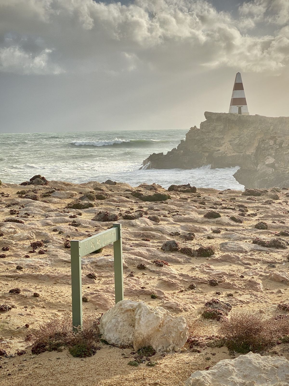 © -viklink21-
The spot
Community-maintained
Community contribution: submitted by Daniel
Know before you go
Logged by the community, confirmed by mods
Moderate risk: Unstable cliff edges
Limestone cliffs along the Obelisk track are actively eroding; cliff collapses have occurred. Stay well back from cliff edges and heed warning signs.
Moderate risk: Southern Ocean swells
Powerful swells can sweep into the coves during rough weather, making entry and exit dangerous.
Low risk: Slippery rock paths
The steep, unsealed paths down to the coves can be slippery, especially after rain or sea spray.
Low risk: Outgoing tide current
Tidal currents can be strong around the rocky reef entrances to the coves on an outgoing tide.
Wildlife Guide
No wildlife notes for this spot yet.
Gallery
1 photo from the community
Getting in
Shore entry
Entry
From Robe town centre, follow Obelisk Road (past the old Robe Gaol ruins) to a gravel parking area on Cape Dombey. From there, the Obelisk Cliff coastal walking track leads south — the hidden coves are accessed via short, steep unsealed paths branching off the main track. Alternatively, walk from town along the coastal trail starting near the Lake Butler Marina.
Parking & facilities
Free gravel parking lot at the end of Obelisk Road on Cape Dombey, near the Obelisk itself.
parking
Free
Spot Map
Community
Gallery ┬╖ 1 photos
Trust
Is this spot real, accurate, still loved?
Spots near South Australia

No nearby spots yet.
Needs verification
Quick verify
One tap helps the community keep this spot honest.
About this data
- Conditions last evaluated
- Spot data last updated
- Data sources
- Open-Meteo (marine & weather conditions), tide predictions via UTide, community contributors (descriptions, hazards, marine life).
- License
- Spot content licensed under CC BY-SA 4.0. How's the Spot is open source.
Weather & swell ┬╖ Open-Meteo marine & weather APIs Tides ┬╖ UTide harmonic analysis Sea & safety ┬╖ community reports