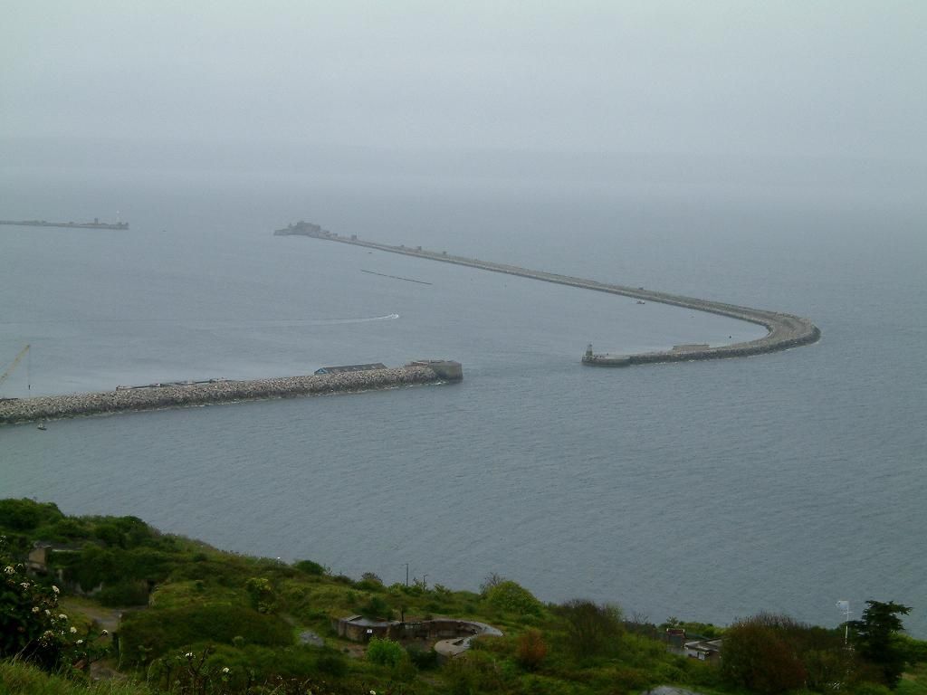
Nunn's Beach (officially Nuns Beach) is a sheltered, artificial sandy beach lying immediately north of Portland Harbour in Western Victoria. Backed by a grassy foreshore and car park, this calm, protected bay offers easy shore-entry snorkeling over a shallow sandy bottom that transitions into rocky reef. The adjacent Lee Breakwater is a popular entry point, where snorkelers can explore clear, shallow waters around the breakwater rocks, home to stingrays, penguins, eels, and occasional seals. The beach is also the launch point for exploring Lighthouse Reef to the north — a shallow reef site where the wreck of the New Zealander (a coal ship set alight in 1953) lies scattered, attracting diverse marine life.
Nunn's Beach (Portland)
BeginnerGO
GO
It's a go.
Showing last known conditions
Wave Height 0.3 mSwell Period 11 sWind Speed 12 knPrecipitation 16 mmTidal Phase slack
Last evaluated
The spot
Community-maintained
Community contribution: submitted by Daniel
Know before you go
Logged by the community, confirmed by mods
Moderate risk: Boat traffic
The harbour is a working port with vessel movements inside the breakwater; snorkelers should stay aware of approaching boats.
Moderate risk: Boat traffic near harbour entrance
Proximity to Portland Harbour means recreational and commercial vessels transit nearby; a dive float and flag are recommended.
Low risk: Fishing line entanglement
The breakwater is a popular fishing spot; active lines, discarded hooks, and broken monofilament pose snag and cut hazards.
Low risk: Sharp underwater debris
Wreck remnants and rubble from the breakwater structure can include rusted metal, concrete edges, and exposed rebar.
Low risk: Slippery rock entry
Some shore entries (particularly over the breakwater rock wall) are steep, slippery, and may require ladders or ropes.
Low risk: Easterly swell
Easterly winds create unfavourable conditions and stir up sediment, reducing visibility at Lee Breakwater.
Low risk: Fishing lines and hooks
The breakwater is popular with anglers; active and discarded fishing lines pose entanglement and laceration hazards.
Low risk: Open ocean swell exposure
Nunn's Beach opens to the ocean; larger swells can reduce visibility and create surge near the reef.
Low risk: Variable visibility
Visibility drops significantly after northerly or easterly winds; best after westerly or southerly winds with low swell.
Low risk: Kelp in shallows
Thick kelp growth can occur in shallow areas, making entry and exit slightly more challenging.
Low risk: Kelp entanglement
Large amounts of kelp can accumulate in shallows near the reef sections, potentially causing entanglement for swimmers.
Low risk: Artificial beach structure
The beach is heavily modified and artificial — submerged rock or concrete structures may be present beneath the surface near the breakwater.
Low risk: Boating traffic adjacent to harbour
The beach lies immediately north of Portland Harbour; boat traffic and occasional wash may occur near the breakwater end.
Low risk: Occasional strong southerly winds
Southerly winds can create choppy surface conditions, reducing visibility and making entry more difficult.
Low risk: Boat traffic near breakwater
The beach lies adjacent to Portland Harbour and the Lee Breakwater, where recreational and commercial boat traffic may be present.
Low risk: Ship traffic
The outer reef edges are near Portland Harbour shipping channels; check for planned ship movements before snorkeling the outer reef.
Low risk: Kelp overgrowth
Large amounts of kelp can accumulate in the shallows, making entry and navigation difficult at times.
Wildlife Guide
No wildlife notes for this spot yet.
Gallery
1 photo from the community
Getting in
Shore entry
Entry
Located north of Portland Harbour, off Lee Breakwater Road. From Portland town centre, head east along Bentinck Street towards the harbour, then turn onto Lee Breakwater Road. The beach and car park are immediately north of the breakwater.
Parking & facilities
Large car park directly behind the beach on the grassy foreshore, off Lee Breakwater Road.
parkingpicnic_tables
Free
Spot Map
Community
Gallery ┬╖ 1 photos
Trust
Is this spot real, accurate, still loved?
Spots near Victoria

No nearby spots yet.
Needs verification
Quick verify
One tap helps the community keep this spot honest.
About this data
- Conditions last evaluated
- Spot data last updated
- Data sources
- Open-Meteo (marine & weather conditions), tide predictions via UTide, community contributors (descriptions, hazards, marine life).
- License
- Spot content licensed under CC BY-SA 4.0. How's the Spot is open source.
Weather & swell ┬╖ Open-Meteo marine & weather APIs Tides ┬╖ UTide harmonic analysis Sea & safety ┬╖ community reports