The North Solitary Islands, part of the Solitary Islands Marine Park, are a stunning snorkeling destination 7 nautical miles offshore from Wooli on the NSW Mid North Coast. This is where the warm tropical currents of the Great Barrier Reef meet cooler southern waters, creating a unique biodiversity hotspot. Sheltered bays and coves around the islands offer crystal-clear waters teeming with subtropical marine life, hard and soft corals, and abundant tropical fish. It's considered some of the best snorkelling in NSW — accessible by boat tour from Wooli or Coffs Harbour, with protected conditions ideal for families and beginners, while also rewarding for experienced snorkelers.
North Solitary Island - Bubble Cave
IntermediateGO
GO
It's a go.
Showing last known conditions
Wave Height 0.1 mSwell Period 6.8 sWind Speed 1.7 knPrecipitation 0.0 mmTidal Phase slack
Last evaluated
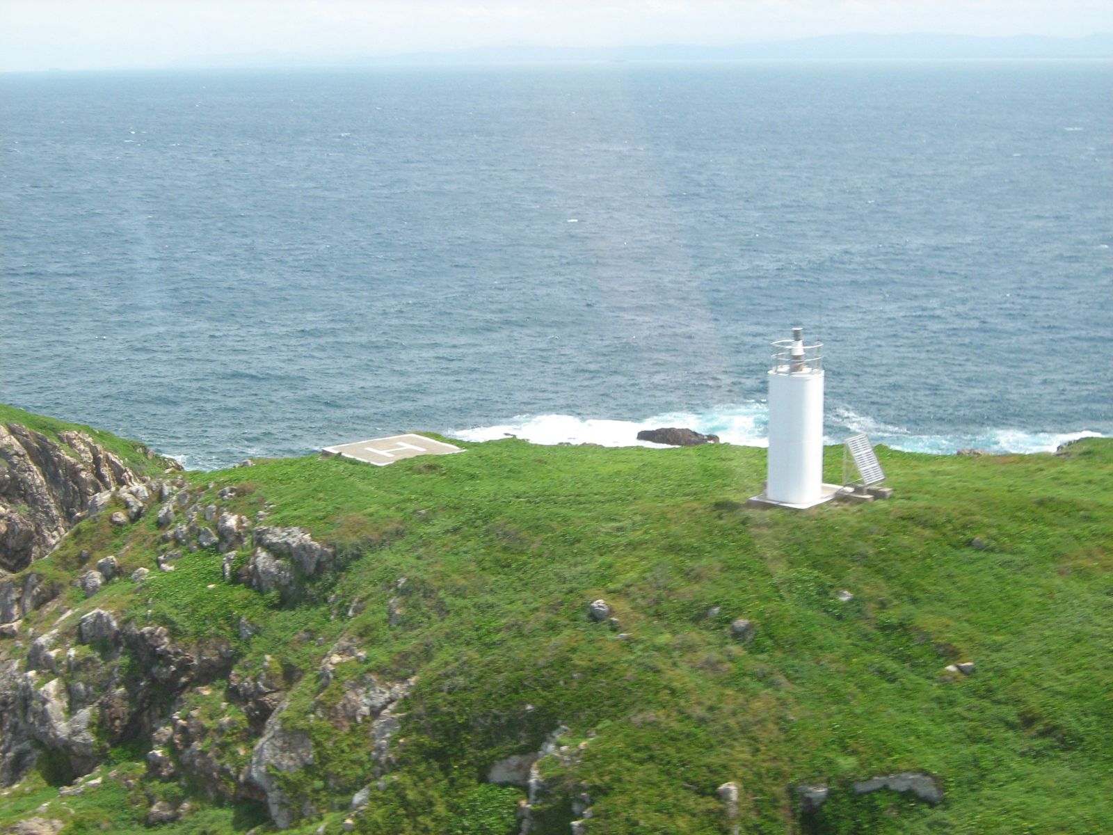 © JWarnes
DANGER: Explicit Risks Present
North Solitary Island - Bubble Cave has hazards marked as danger. Entering the water here means you may face serious risks to your personal safety.
- Cave entrapment danger
The Bubble Cave has a single entrance and overhead environment; snorkelers entering the cave risk disorientation or becoming trapped inside the air pocket.
The spot
Community-maintained
Community contribution: submitted by Daniel
Know before you go
Logged by the community, confirmed by mods
High risk: Cave entrapment
The Bubble Cave has a single entrance and overhead environment; snorkelers entering the cave risk disorientation or becoming trapped inside the air pocket.
Moderate risk: Strong currents at NW point
Strong currents can develop around the north-western point of the island; snorkellers should avoid going around the corner.
Moderate risk: Remote island access
Anemone Bay is 14 km (25 min boat ride) offshore — no shore-based facilities, emergency services, or shelter beyond the boat.
Moderate risk: Strong North-South Current
The East Australian Current sweeps strongly from north to south around the island, especially on the eastern side. Can make swimming back to the mooring difficult and may cause unplanned drift dives.
Moderate risk: Swell and Surge in Channel
The narrow split between the two rocks concentrates swell energy, creating surge conditions that can push snorkelers against the rocks. Requires calm seas to safely navigate the gap.
Moderate risk: Strong ocean currents
The East Australian Current can create strong north-to-south currents around the island, making swimming back to the mooring challenging.
Moderate risk: Cave entanglement risk
The cave entrance can be tight and dark; snorkelers entering the cave risk disorientation and entanglement.
Moderate risk: Ocean swell and choppy surface conditions
Even in the shelter of the islands, wave action is common. Snorkel trips are often cancelled when swell makes conditions unsafe or visibility drops below 15m.
Moderate risk: Offshore current (East Australian Current influence)
The meeting of northern and southern currents creates rips and variable currents around the island. Snorkelers must stay aware of drift.
Moderate risk: Ocean swell and choppy conditions
Surface conditions can become rough and choppy, especially outside the protected coves. Snorkel trips are frequently postponed due to unfavourable sea states.
Moderate risk: Deep water snorkelling (5-20m)
Snorkelling sites are in depths of 5 to 20 metres with no shallow standing areas — snorkelers must be competent swimmers with no option to touch the bottom.
Moderate risk: Depth Hazard
Snorkelling sites range from 5m to 20m depth with no shallow standing points — snorkelers must be confident swimmers as there is no bottom to touch.
Moderate risk: East Australian Current
The East Australian Current can create strong sweeping currents around the islands, especially at northern and eastern points, which can make swimming difficult for inexperienced snorkelers.
Moderate risk: Boat-only access
The site is offshore with no shore entry; requires boat transport and a mooring pickup. Challenging in rough seas.
Moderate risk: Strong currents and surge
Exposed western side of the island can experience ocean swell, surge in gullies, and tidal currents that can push snorkelers away from the mooring.
Low risk: Deep drop-offs
The bay floor drops sharply from 15 m to 25–30 m at the outer edge; less experienced snorkellers should stay inside the bay.
Low risk: Cold water (winter)
Winter water temperatures drop to 19°C, increasing hypothermia risk for extended snorkel sessions without a wetsuit.
Low risk: Boat traffic at moorings
Several moorings in the bay are used by dive boats; surface awareness required to avoid boat traffic.
Low risk: Boat Traffic
Access is by boat only from Coffs Harbour or Wooli. The site is a popular charter destination with dive boats mooring at the western side. Be aware of mooring lines and vessel traffic.
Low risk: Limited visibility variation
Visibility ranges from 5 metres on poor days to 30 metres on good days; sudden changes can disorient swimmers.
Low risk: Depth variability
Bottom depth ranges from 5 metres at the cave entrance to 15 metres at the sandy base; strong buoyancy control needed.
Low risk: Deep water snorkelling (5-20m depth)
There is no shallow standing bottom — snorkellers are over 5-20m depths at all sites. Competent swimming and snorkel skills are mandatory.
Low risk: Marine stingers (seasonal jellyfish)
Box jellyfish and other marine stingers can be present in warmer months, typical for northern NSW coastal waters.
Low risk: Boat traffic in marine park channels
Access is by boat only. Snorkelers share waters with dive charter and fishing vessels transiting sanctuary zones.
Low risk: Strong currents at convergence zone
The island sits where northern tropical currents meet southern temperate currents, creating unpredictable currents around the island's exposed sides.
Low risk: Swell and Wave Action
Even in the shelter of the islands there is always some wave action; surface conditions can become choppy or rough, requiring competent snorkelling skills.
Low risk: Variable Water Visibility
Visibility must exceed 15m for safe enjoyable snorkelling; poor conditions frequently cause trip postponements or cancellations.
Low risk: Strong Currents
Where northern tropical currents meet southern temperate currents, rips and tidal flow can develop around the island channel.
Low risk: Marine Stingers
Box jellyfish and other stingers may be present during warmer months in northern NSW waters.
Low risk: Grey nurse sharks
Grey nurse sharks (protected species) are commonly sighted in the Shark Gutters area during winter, and year-round. Generally docile but require respectful distancing.
Low risk: Boat traffic
Access is solely by boat/charter. Mooring buoys are used but divers/snorkellers must be aware of vessel movements during entry and exit.
Low risk: Swell and Sea Conditions
Exposed outer edges of the islands can experience ocean swells and choppy conditions. Snorkeling is best in the sheltered bays and coves on calm days.
Low risk: Exposed Rocky Outcrop
Fish Soup is located at a group of wave-washed rocks (North West Rock) with no shelter, meaning surface conditions can be rough with surging swell.
Low risk: Depth Variation
Depth ranges from 5 to 24 metres with sudden drop-offs and gutters, requiring good buoyancy control and awareness of depth limits.
Wildlife Guide
No wildlife notes for this spot yet.
Gallery
4 photos from the community
Getting in
Snorkel tour
Entry
Bubble Cave is located off North Solitary Island, approximately 45 km south-west of Coffs Harbour, NSW. Access is exclusively by boat via charter operators such as Wooli Dive Centre or Jetty Dive Centre, which run snorkel and dive tours from Coffs Harbour marina or Wooli. The site is within the Solitary Islands Marine Park, about a 35–45 minute boat ride offshore.
Parking & facilities
Parking is available at the Coffs Harbour marina precinct (paid parking) or at the Wooli boat ramp area (free street parking nearby).
parkingtoiletsshowersdrinking_waterpicnic_tablesboat_ramp
Charter tour fees apply — approximately $120–$180 per person depending on group size and inclusions. There is no direct entry fee for the marine park.
Spot Map
Community
Gallery ┬╖ 4 photos
Trust
Is this spot real, accurate, still loved?
Spots near New South Wales

No nearby spots yet.
Needs verification
Quick verify
One tap helps the community keep this spot honest.
About this data
- Conditions last evaluated
- Spot data last updated
- Data sources
- Open-Meteo (marine & weather conditions), tide predictions via UTide, community contributors (descriptions, hazards, marine life).
- License
- Spot content licensed under CC BY-SA 4.0. How's the Spot is open source.
Weather & swell ┬╖ Open-Meteo marine & weather APIs Tides ┬╖ UTide harmonic analysis Sea & safety ┬╖ community reports